world.wikisort.org - India
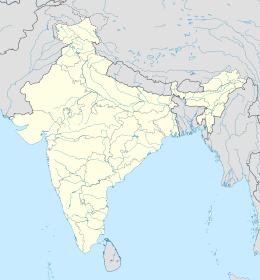
Koloriang è un villaggio dell'India, capoluogo del distretto di Kurung Kumey, nello stato federato dell'Arunachal Pradesh.
| Koloriang tehsil | |
|---|---|
| Localizzazione | |
| Stato | |
| Stato federato | Arunachal Pradesh |
| Divisione | Non presente |
| Distretto | Kurung Kumey |
| Territorio | |
| Coordinate | 27°55′N 93°21′E |
| Altitudine | 1 000 m s.l.m. |
| Abitanti | 2 345[1] (2011) |
| Altre informazioni | |
| Lingue | lingue tibetane, inglese |
| Cod. postale | 791118 |
| Prefisso | 3788 |
| Fuso orario | UTC+5:30 |
| Cartografia | |
Geografia fisica
Il villaggio è situato a 27° 54' 11 N e 93° 20' 59 E[2].
Società
Evoluzione demografica
Al censimento del 2011 la popolazione di Koloriang assommava a 2 345 persone, delle quali 1.246 maschi e 1.099 femmine[1].
Note
- Koloriang Population Census 2011, su census2011.co.in. URL consultato il 9 luglio 2017.
- (EN) Google Maps, Koloriang, Arunachal Pradesh, India, su maps.google.com. URL consultato il 12-08-2008.
На других языках
[en] Koloriang
Koloriang is a hilly district headquarters town of Kurung Kumey district in Arunachal Pradesh, India, bordering Tibet. It has an altitude of 1,000 metres (3,300 ft)[1] and is surrounded by high mountains all around[2] and is located in the right bank of river Kurung, one of the major tributaries of Subansiri river. The climate is rainy and hot during summer and very cold in winter. Located at an altitude of 1,040 metres above sea level, this town is also an old administrative centre. It is about 257 km from state capital, Itanagar.- [it] Koloriang
Текст в блоке "Читать" взят с сайта "Википедия" и доступен по лицензии Creative Commons Attribution-ShareAlike; в отдельных случаях могут действовать дополнительные условия.
Другой контент может иметь иную лицензию. Перед использованием материалов сайта WikiSort.org внимательно изучите правила лицензирования конкретных элементов наполнения сайта.
Другой контент может иметь иную лицензию. Перед использованием материалов сайта WikiSort.org внимательно изучите правила лицензирования конкретных элементов наполнения сайта.
2019-2025
WikiSort.org - проект по пересортировке и дополнению контента Википедии
WikiSort.org - проект по пересортировке и дополнению контента Википедии
