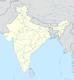
world.wikisort.org - India
Il distretto di Kannur (o anche di Cannanore; malayalam: കണ്ണൂര്) è uno dei 14 distretti dello stato indiano del Kerala; il capoluogo è la città di Kannur, da cui il distretto prende il nome. Si tratta del secondo distretto che si incontra procedendo in Kerala in direzione nord-sud, dopo quello di Kasaragod; a sud si ritrovano i distretti di Kozhikode, sulla costa, e di Wayanad, nell'entroterra.
|
Questa voce o sezione sull'argomento India non cita le fonti necessarie o quelle presenti sono insufficienti.
|
| Kannur distretto | |
|---|---|
| Kannur | |
| Localizzazione | |
| Stato | |
| Stato federato | Kerala |
| Divisione | Non presente |
| Amministrazione | |
| Capoluogo | Kannur |
| Territorio | |
| Coordinate del capoluogo | 11°52′42.21″N 75°22′26.69″E |
| Superficie | 2 966 km² |
| Abitanti | 2 412 365 (2001) |
| Densità | 813,34 ab./km² |
| Altre informazioni | |
| Fuso orario | UTC+5:30 |
| Cartografia | |
 | |
| Sito istituzionale | |
Origine del nome
Ci sono molti miti e leggende associate a Kannur. Secondo la teoria più consolidata, il nome Kannur deriverebbe dalla fusione ovvia delle due parole malayalam Kannan (riferito a Krishna) e Ur (luogo). In India è piuttosto frequente associare i nomi dei villaggi alla mitologia indiana, tuttavia, nella storia di Krishna, mai ci si riferisce a questo luogo. Un'altra versione indica in Kanathur l'antico nome di Kannur, come è testimoniato pure da un antico documento custodito nel municipio.
Altri progetti
 Wikimedia Commons contiene immagini o altri file su distretto di Kannur
Collegamenti esterni
- Sito ufficiale, su kannur.nic.in.
| Controllo di autorità | VIAF (EN) 236534733 · LCCN (EN) n82103542 · GND (DE) 4300804-5 |
|---|
На других языках
[de] Kannur (Distrikt)
Der Distrikt Kannur (Malayalam: കണ്ണൂർ ജില്ല, früher Cannanore) ist ein Distrikt im südindischen Bundesstaat Kerala. Verwaltungssitz ist die namensgebende Stadt Kannur.[en] Kannur district
Kannur (pronounced [kɐɳːuːr] (listen)), is one of the 14 districts along the west coast in the state of Kerala, India. The city of Kannur is the district headquarters and gives the district its name. The old name, Cannanore, is the anglicized form of the Malayalam name "Kannur". Kannur district is bounded by Kasaragod District to the north, Kozhikode district to the south, Mahé district to the southwest and Wayanad District to the southeast. To the east, the district is bounded by the Western Ghats, which forms the border with the state of Karnataka (Kodagu district). The Arabian Sea lies to the west. Paithalmala is the highest point in Kannur District (1,372m). Enclosed within the southern part of the district is the Mahé district of the Union Territory of Puducherry. The district was established in 1957.- [it] Distretto di Kannur
[ru] Каннур (округ)
Каннур (малаял. കണ്ണൂര് ജില്ല; англ. Kannur) — округ в индийском штате Керала. Образован 1 января 1957 года. Административный центр — город Каннур. Площадь округа — 2966 км².Другой контент может иметь иную лицензию. Перед использованием материалов сайта WikiSort.org внимательно изучите правила лицензирования конкретных элементов наполнения сайта.
WikiSort.org - проект по пересортировке и дополнению контента Википедии
