world.wikisort.org - India
Satautha is a village in Harpalpur block of Hardoi district, Uttar Pradesh, India.[2] The main staple crops here are wheat and rice.[3][4] As of 2011, the population of Satathua is 3,992, in 727 households.[2] The village lands cover an area of 797.6 hectares.[2]
Satautha | |
|---|---|
Populated place | |
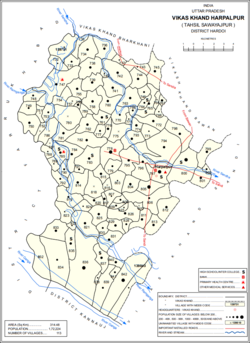 Map showing Satautha (#794) in Harpalpur CD block | |
 Satautha Location in Uttar Pradesh, India  Satautha Satautha (India) | |
| Coordinates: 27.343737°N 79.838808°E[1] | |
| Country | |
| State | Uttar Pradesh |
| District | Hardoi |
| Area | |
| • Total | 7.976 km2 (3.080 sq mi) |
| Population (2011)[2] | |
| • Total | 3,992 |
| • Density | 500/km2 (1,300/sq mi) |
| Languages | |
| • Official | Hindi |
| Time zone | UTC+5:30 (IST) |
The 1961 census recorded Satathua as comprising 4 hamlets, with a total population of 1,524 (792 male and 732 female), in 281 households and 224 physical houses.[5] The area of the village was given as 2,020 acres.[5]
References
- Search for "Satautha" here https://geonames.nga.mil/namesgaz/.
{{cite web}}: Missing or empty|title=(help) - "Census of India 2011: Uttar Pradesh District Census Handbook - Hardoi, Part A (Village and Town Directory)" (PDF). Census 2011 India. pp. 206–30. Retrieved 29 May 2021.
- Census 1971 Uttar Pradesh: District Census Handbook Part X-A: Village & Town Directory, District Hardoi (PDF). 1972. pp. 128–9. Retrieved 29 May 2021.
- Census 1981 Uttar Pradesh: District Census Handbook Part XIII-A: Village & Town Directory, District Hardoi (PDF). 1982. pp. 172–3. Retrieved 29 May 2021.
- Census 1961: District Census Handbook, Uttar Pradesh (36 - Hardoi District) (PDF). Lucknow. 1965. pp. 158, xciv-xcv of section "Bilgram Tahsil". Retrieved 29 May 2021.
This Hardoi district location article is a stub. You can help Wikipedia by expanding it. |
Текст в блоке "Читать" взят с сайта "Википедия" и доступен по лицензии Creative Commons Attribution-ShareAlike; в отдельных случаях могут действовать дополнительные условия.
Другой контент может иметь иную лицензию. Перед использованием материалов сайта WikiSort.org внимательно изучите правила лицензирования конкретных элементов наполнения сайта.
Другой контент может иметь иную лицензию. Перед использованием материалов сайта WikiSort.org внимательно изучите правила лицензирования конкретных элементов наполнения сайта.
2019-2026
WikiSort.org - проект по пересортировке и дополнению контента Википедии
WikiSort.org - проект по пересортировке и дополнению контента Википедии