world.wikisort.org - India
Rammanahalli is a Town and a suburb of Mysore in the Mysuru metropolitan area of Karnataka, India.[1][2] It is located in the Mysore taluk of Mysore district. In November 2020, Kadakola was upgraded from a Gram Panchayat to a Town Panchayat and a gazetted notification was passed on November 26th 2020.[3][4] The notification combines Rammanahalli GP villages, Nadanahalli and Alanahalli (outside of Ring Road) of Alanahalli GP, Hanchya and Sathagalli villages of Hanchya GP, covering a total area of 22.81 sq. km.[3] The combined population of the town according to 2011 census was 20,804.[5]
Rammanahalli | |
|---|---|
Town | |
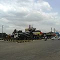
 Sathgalli KSRTC Bus Station | |
| Coordinates: 12°11′32″N 76°39′55″E | |
| Country | |
| State | Karnataka |
| District | Mysore |
| Talukas | Mysore |
| Government | |
| • Body | Town Panchayat |
| Area | |
| • Total | 22.81 km2 (8.81 sq mi) |
| Population (2011) | |
| • Total | 20,804 |
| • Density | 910/km2 (2,400/sq mi) |
| Languages | |
| • Official | Kannada |
| Time zone | UTC+5:30 (IST) |
| ISO 3166 code | IN-KA |
| Vehicle registration | KA |
| Nearest city | Mysore |
Demographics
According to census 2011, combined population of the town according to 2011 census was 20,804.[5] Population breakdown is given below.
| Area Name | Population According to Census 2011 |
| Rammanahalli | 9584 |
| Nadanahalli | 2808 |
| Alanahalli | 6779 |
| Hanchya | 4743 |
| Sathgalli | 819 |
Localities
- Rammanahalli
- Sathgalli
- Nadanahalli
- Hanchya
- Alanahalli
- KBL Layout
- Nandini Layout
- Buguthagalli
Landmarks
- Sathgalli Bus Station
- VTU Regional Center
- Vidya Vikas Engineering College
- Jalmahal Resort
- Jnanasarovara International School
- Alanahalli Police Station
- Sathgalli Police Station
Gallery
See also
- Districts of Karnataka
References
- Village code= 2819700 "Census of India : Villages with population 5000 & above". Registrar General & Census Commissioner, India. Retrieved 18 December 2008.
- "Yahoomaps India :". Archived from the original on 18 December 2008. Retrieved 18 December 2008. Kadakola, Mysore, Karnataka
- "Hootagalli CMC and four Town Panchayats formed: Govt. issues Gazette notification". Star of Mysore. 26 November 2020. Retrieved 6 December 2020.
- "Gazette Notification" (PDF).
{{cite web}}: CS1 maint: url-status (link) - "Census 2011 Handbook Mysore" (PDF).
{{cite web}}: CS1 maint: url-status (link)
External links
- "Mysuru District Information". Mysore.nic.in. Retrieved 1 May 2016.
Текст в блоке "Читать" взят с сайта "Википедия" и доступен по лицензии Creative Commons Attribution-ShareAlike; в отдельных случаях могут действовать дополнительные условия.
Другой контент может иметь иную лицензию. Перед использованием материалов сайта WikiSort.org внимательно изучите правила лицензирования конкретных элементов наполнения сайта.
Другой контент может иметь иную лицензию. Перед использованием материалов сайта WikiSort.org внимательно изучите правила лицензирования конкретных элементов наполнения сайта.
2019-2025
WikiSort.org - проект по пересортировке и дополнению контента Википедии
WikiSort.org - проект по пересортировке и дополнению контента Википедии


