world.wikisort.org - India
Niwari is a town and a nagar panchayat in Niwari district in Indian state of Madhya Pradesh. It is administrative headquarter of Niwari district. It is adjacent to the Jhansi and Mahoba districts of Uttar Pradesh.
Niwari | |
|---|---|
Town | |
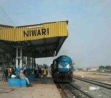 Niwari Railway Station in Niwari, M.P | |
 Niwari Location in Madhya Pradesh, India  Niwari Niwari (India) | |
| Coordinates: 25.43°N 79.71°E | |
| Country | |
| State | Madhya Pradesh |
| District | Niwari |
| Government | |
| • Type | Municipal Council |
| • Body | Niwari Municipal Council |
| Population (2001) | |
| • Total | 20,711 |
| Languages | |
| • Official | Hindi, Bundeli |
| Time zone | UTC+5:30 (IST) |
| PIN | 472442 |
| Telephone code | 91-7680 |
| ISO 3166 code | IN-MP |
| Vehicle registration | MP-36 |
| Distance from New Delhi | 434 kilometres (270 mi) SE |
| Website | www |
Demographics
As of the 2001 Census of India,[1] Niwari had a population of 20,711 with the 606,00 km2 area. Males constitute 53% of the population and females 47%. Niwari has an average literacy rate of 60%, higher than the national average of 59.5%: male literacy is 69%, and female literacy is 50%. In Niwari, 7% of the population is under 6 years of age.
References
- "Census of India 2001: Data from the 2001 Census, including cities, villages and towns (Provisional)". Census Commission of India. Archived from the original on 16 June 2004. Retrieved 1 November 2008.
This article related to a location in Madhya Pradesh is a stub. You can help Wikipedia by expanding it. |
Текст в блоке "Читать" взят с сайта "Википедия" и доступен по лицензии Creative Commons Attribution-ShareAlike; в отдельных случаях могут действовать дополнительные условия.
Другой контент может иметь иную лицензию. Перед использованием материалов сайта WikiSort.org внимательно изучите правила лицензирования конкретных элементов наполнения сайта.
Другой контент может иметь иную лицензию. Перед использованием материалов сайта WikiSort.org внимательно изучите правила лицензирования конкретных элементов наполнения сайта.
2019-2026
WikiSort.org - проект по пересортировке и дополнению контента Википедии
WikiSort.org - проект по пересортировке и дополнению контента Википедии