world.wikisort.org - India
Nighoj is a village in Ahmednagar District, Maharashtra, India. It is about 90 kilometres away from Pune and had naturally created potholes (tinajas) on the riverbed of the Kukadi River.[1]
This article needs additional citations for verification. (September 2012) |
Nighoj | |
|---|---|
village | |
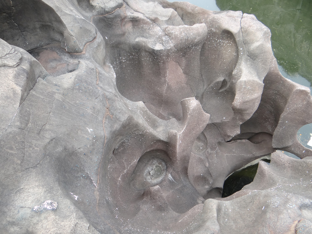 Potholes at Nighoj river | |
 Nighoj Location in Maharashtra, India  Nighoj Nighoj (India) | |
| Coordinates: 18°57′35″N 074°16′37″E | |
| Country | |
| State | Maharashtra |
| District | Ahmadnagar |
| Taluka | Parner |
| Government | |
| • Body | Village panchayat |
| Population (2011) | |
| • Total | 13,600 |
| Languages | |
| • Official | Marathi |
| Time zone | UTC+5:30 (IST) |
| PIN | 414 306 |
| Telephone code | 02488 |
| Vehicle registration | MH-16, MH-17 |
| Lok Sabha constituency | Ahmednagar |
| Vidhan Sabha constituency | Parner |
| Nearest towns | Parner, Shirur, Alkuti |

Geologists indicate that formerly there was greater rainfall in the area and that the Kukadi River flowed out from the highlands, scouring the bedrock and forming the potholes and the gorge.[2]
Education
Schools
- Shree Malganga Public School Ghodobaphata, Patharwadi, Nighoj
- Jilha Parishad Prathamik Shala, Nighoj
- New English Medium School, Nighoj
- Shri Mulika Devi Vidya Mandir, Nighoj
- Shri Mulika Devi Science & Art Junior College, Nighoj
- Malaganga Vidyalay, Nighoj
- Shri Mulikadevi Arts & Science Senior College, Nighoj
- Zilha Parishad Primary School, Lamkhade Vasti, Nighoj
- Zilha Parishad Primary School, Tanpure wadi, Lalage mala, Nighoj
- Zilha Parishad Prarthmik Shala, Kund Vasti
- Zilha Parishad Prathmik Shala, Kale Wasti Nighoj
- zilla parishad prathmik shall ,Tukaivasti
Religion
This section may require cleanup to meet Wikipedia's quality standards. The specific problem is: Poor grammar and undefined terminology. (May 2021) |
The majority of the population in Nighoj is Hindu, but there are also Muslims. There are several temples in the village, one of which, the Malaganga temple, is located on the bank of the gorge on the old river-bed itself[1]
Temples
- Malaganga Temple
- Kapileshwar Temple
- Waghajai mata Temple, Lalagemala
- Ram Mandir
- Shambhu Temple
- Vardvinayak Temple, Tanpurevasti
- Savta mali Temple, Bhukanvasti
- Datta Mandir, Lalagemala, Nighoj
- Khandoba Mandir, Lalagemala, Nighoj
Places of interest
- Pot Holes, Malaganga Temple
- Morachi Chincholi
- Natural pot holes
See also
- Parner tehsil
- List of Villages in Parner Tehsil
- ahemadnagar
- malaganga mata
References
- Gunaji, Milind (2010). Offbeat Tracks in Maharashtra (second ed.). Mumbai, India: Popular Prakashan. p. 231. ISBN 978-81-7991-578-3.
- Babar, Md. (2005). "8. Hydrogeomorphology of Landforms". Hydrogeomorphology: Fundamentals, Applications and Techniques. New Delhi: New India Publishing Agency. pp. 149–150. ISBN 978-81-89422-01-1.
External links
Wikimedia Commons has media related to Nighoj.

Текст в блоке "Читать" взят с сайта "Википедия" и доступен по лицензии Creative Commons Attribution-ShareAlike; в отдельных случаях могут действовать дополнительные условия.
Другой контент может иметь иную лицензию. Перед использованием материалов сайта WikiSort.org внимательно изучите правила лицензирования конкретных элементов наполнения сайта.
Другой контент может иметь иную лицензию. Перед использованием материалов сайта WikiSort.org внимательно изучите правила лицензирования конкретных элементов наполнения сайта.
2019-2026
WikiSort.org - проект по пересортировке и дополнению контента Википедии
WikiSort.org - проект по пересортировке и дополнению контента Википедии