world.wikisort.org - IndiaMangali, near Badya Jattan, is a village of more than 10,000 population with 5 gram panchayat (Mangali Aklan, Mangali Surtiya, Mangali Mohabbat, Mangali Dhani and Mangali Jhara) in it, the only village in Haryana having 5 panchayat in single village, of Hisar-1 Rural Development Block,[2] Nalwa Chaudhry (Vidhan Sabha constituency)[3] and Hisar (Lok Sabha constituency)[4] of Hisar District of Hisar Division in the Haryana state of India.
Village in Haryana, India
Mangali, Hisar district, Haryana, India |
|---|
|
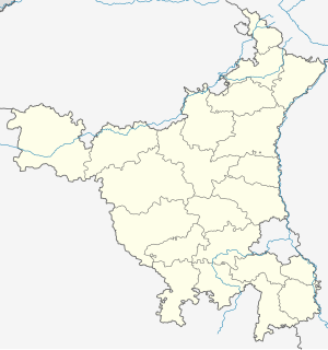 Mangali, Hisar district, Haryana, India Location in Haryana, India Show map of Haryana Mangali, Hisar district, Haryana, India Mangali, Hisar district, Haryana, India (India) Show map of India |
| Coordinates: 29°02′28″N 75°44′04″E |
| Country |  India India |
|---|
| State | Haryana |
|---|
| District | Hisar |
|---|
|
| • Type | Local government |
|---|
| • Body | Panchayat |
|---|
| Elevation | 215 m (705 ft) |
|---|
|
| • Official | Hindi |
|---|
| Time zone | UTC+5:30 (IST) |
|---|
| PIN | |
|---|
| Vehicle registration | HR |
|---|
| Website | haryana.gov.in |
|---|
It is situated 166 kilometres (103 mi) from the national capital Delhi and 14 kilometres (8.7 mi) from the district headquarters Hisar on the Hisar-Tosham road.
History
During British Raj
Main article: Thikanas of Shekhawati
Rao Shekha, a Shekhawat rajput (sub-branch of Kachwaha or Kushwaha), was the founder of Shekhawati, who originally divided Shekhawati into 33 Thikana (also called a Pargana). After him, additional thikanas were granted to the descendants of subsequent generations.
[5][6] Tosham Thikana was granted as a thikana by Shekhawati ruler Maharaja Mukund Singh in 1870 to Kunwar Abhaya Singh, the son of Maharaja Raj Singh II. During the Indian Rebellion of 1857, Hindu Shekhawat rajput officials of British Raj based at Tosham killed the Bhati and Ranghar Muslim Rajputs of Jamalpur and Mangali. These Hindu thakurs (Shekhawat) were granted the Thikana of Tosham as a Pargana under Shekhawati in 1870 by the British raj and Maharaja Mukund Singh for their services.
Post-independence
After Independence of India in 1947, it became part of Punjab. Once Haryana was formed as a separate state in 1966, it became part of the Hisar district, state of Haryana State.
Transportation
Mangali is connected by road with Hisar, 10 km (6.2 mi) distant.[7] The nearest major train stations are at Hisar, Hansi, which is 14 km (8.7 mi) away, and at Bhiwani city (60 km (37 mi)).
Hisar Airport, the nearest functional airport and flying training club is 14 km (8.7 mi) away. Currently no commercial domestic or international flights from this airport. The nearest domestic and international airports are 185 km (115 mi) at Indira Gandhi International Airport at Delhi and 235 km (146 mi) at Chandigarh International Airport.
Revenue, Agriculture, Health and Other Services
There is a Patwari (Government Land Records Officer), an Agriculture Development Officer (ADO),[8] a Rural Health Officer (RHO), and an Anganwadi (Community Childcare) worker based at village.
See also
References
- "Pin codes of Hisar district, Hisar pincodes, Haryana zip code". Whereincity.com. Retrieved 22 September 2010.
- Hisar-1 Rural Development Block
- Assembly Constituency
- Hisar (Lok Sabha constituency
- Loharu State The Imperial Gazetteer of India, 1909, v. 16, p. 169.
- The State of Loharu Indian States: A Biographical, Historical, and Administrative Survey, by Somerset Playne, R. V. Solomon, J. W. Bond, Arnold Wright. Asian Educational Services, 2006. ISBN 81-206-1965-X.Page 691
- "Haryana Road Network" (PDF). Archived from the original (PDF) on 1 July 2014. Retrieved 24 May 2016.
- "Source: O/o Agriculture, Hisar". Hisar.nic.in. Retrieved 22 September 2010.[permanent dead link]
External links
 State of Haryana |
|---|
Capital: Chandigarh |
| Topics |
- Divisions of Haryana
- Outline
- History
- Tourism
- Geography
- Politics
- Government
- Governors
- Economy
- Sports
|
|---|
| Districts and divisions | |
|---|
| Major cities | |
|---|
| Culture | |
|---|
| Economy |
- Power stations and power organisations
|
|---|
Places of interest |
|---|
| Sarasvati civilization (Indus Valley civilization – IVC) | |
|---|
| Archaeological |
- National monuments
- State monuments
|
|---|
| Baoli (Stepwells)s | |
|---|
| Buddhist and HIndu Sites |
- Buddhist mounds (Agroha Mound, Sugh Ancient Mound)
- Buddhist stupas ([Adi Badri, Haryana
|
|---|
| Haveli |
- Nangal Sirohi
- Hemu Ki Haveli in Rewari
- Noor Mahal in Karnal
- Gurugram: (Sikanderpur, Mohammadpur Jharsa, 12 Biswa haveli in Gurgaon gaon, Mahalwala haveli in 8 Biswa of Gurgaon gaon)
|
|---|
| Forts | |
|---|
| Hills | |
|---|
| Caves | |
|---|
| Historical |
- Bhima Devi Temple Complex at Pinjore
- Dhosi Hill
- Farrukhnagar
- Kalayat Ancient Bricks Temple Complex
- Mughal Bridge at Kernal
- Harsh ka Tilla at Kurukshetra
- Nahar Singh Mahal
- Narnaul
- Pataudi Palace
- Pinjore Gardens
- Sthaneshwar Mahadev Temple
- Surajkund
- Tomb of Saikh Taiyab at Kaithal
- Tosham rock inscription
- State Protected Monuments
- Monuments of National Importance
|
|---|
| National Parks & Wildlife Sanctuaries of Haryana | |
|---|
| Endangered Wildlife Breeding | |
|---|
| Zoos in Haryana | |
|---|
| Herbal Parks |
- Shatavar Vatika Herbal Park, Hisar
- Ch. Surender Singh Memorial Herbal Park, Tosham
- Ch. Surender Singh Memorial Herbal Park, Kairu
- Ch. Devi Lal Herbal Nature Park
|
|---|
| Lakes | |
|---|
| Dams | |
|---|
| Rivers | |
|---|
| Religious |
- Adi Badri (Haryana) Sarsvati udgam sthal
- Agroha Dham
- Baba Thakur
- Banbhori Devi
- Brahma Sarovar
- Bhuteshwar Temple
- Jayanti Devi Temple
- Jyotisar
- Kartikeya Temple
- Markandeshwar
- Mata Mansa Devi Mandir
- Nada Sahib
- Naugaja Peer
- Pindara Temple
- Sannihit Sarovar
- Sita Mai Temple
- Sthaneshwar Mahadev Temple
- Sheetla Mata Mandir Gurgaon
- St. Thomas' Church at Hisar
|
|---|
| Offices |
- High Court
- Legislative Assembly
- Raj Bhavan
|
|---|
| Public places |
- Kingdom of Dreams
- Mall of India
- The Oberoi
|
|---|
| Extreme Corners of Haryana |
- Eastern-most point: Kalesar village Yamuna riverbank in Yamuna Nagar District
- Western-most point: Chautala-Sangari border road crossing in Sirsa district
- Southern-most point: Kol Gaon hill in Ferozepur Jhirka tehsil of Gurgaon district
- Northern-most point: Khokhra village riverbank north of Chandigarh-Baddi river bridge in Panchkula district
|
|---|
| Highest-lowest of Haryana |
- Highest point: Karoh Peak in Shivalik Hills of Panchkula district
- Lowest natural Surface elevation point:
- Deepest Underground Cave:
- Coldest avg temp: Karoh Peak in Shivalik Hills of Panchkula district
- Hottest avg temp: Hisar
- Wettest avg rainfall: Morni hills in Shivalik Hills of Panchkula district
- Driest avg rainfall: Bhiwani
|
|---|
| Oldest of Haryana |
- Oldest archaeological site: Rakhigarhi 4700 BC or 6700 years old Indus Valley civilization in Hisar district
- Oldest archaeological mine site: Kaliyana hill Indus Valley civilization stone mine (3000 BC or 5000 years old) west of Charkhi Dadri
|
|---|
|
Government and Politics |
|---|
| Elections |
- Elections in Haryana
- 1991
- 1996
- 1998
- 1999
- 2004
- 2009
- 2014
- 2019
|
|---|
| Chief Ministers |
- Banarsi Das Gupta
- Rao Birender Singh
- Bansi Lal
- Bhagwat Dayal Sharma
- Bhajan Lal
- Devi Lal
- Om Prakash Chautala
- Hukam Singh
- Bhupinder Singh Hooda
- Manohar Lal Khattar
|
|---|
| Governors |
- Dharma Vira
- Birendra Narayan Chakraborty
- Ranjit Singh Narula
- Jaisukh Lal Hathi
- Harcharan Singh Brar
- Surjit Singh Sandhawalia
- Ganpatrao Devji Tapase
- Saiyid Muzaffar Husain Burney
- Hari Anand Barari
- Dhanik Lal Mandal
- Mahaveer Prasad
- Babu Parmanand
- Om Prakash Verma
- Akhlaqur Rahman Kidwai
- Jagannath Pahadia
- Kaptan Singh Solanki
|
|---|
| State agencies |
- Dakshin Haryana Bijli Vitran Nigam
- Debt Conciliation Board
- Doordarshan Haryana
- Foreign Investment and NRI Cell
- Forests Department, Haryana
- Department of Economic and Statistical Analysis, Haryana
- Department of Environment, Haryana
- Department of Excise & Taxation, Haryana
- Department of Finance, Haryana
- Department of Industries & Commerce, Haryana
- Department of Industrial Training & Vocational Education, Haryana
- Department of Institutional Finance & Credit Control, Haryana
- Department of Labour & Employment, Haryana
- Department of Land records & Consolidation, Haryana
- Department of Revenue and Disaster Management, Haryana
- Department of Rehabilitation, Haryana
- Department of Higher Education, Haryana
- Department of School Education, Haryana
- Department of Elementary Education, Haryana
- Haryana Board of School Education
- Haryana Civil Medical Services
- Haryana Environment Protection Council
- Haryana Land Record Information System
- Haryana Power Generation Corporation Limited
- Haryana Police
- Haryana Roadways
- Haryana Seeds Development Corporation
- Haryana State Directorate of Archaeology & Museums
- Haryana State Legal Services Authority, Haryana
- Haryana Tourism Corporation Limited
- Haryana Urban Development Authority
- Haryana Waqf Board
- State Counselling Board, Haryana
- Uttar Haryana Bijli Vitran Nigam
|
|---|
|
Sports |
|---|
| Venues | |
|---|
| Associations |
- Haryana Archery Association
- Haryana Cricket Association
|
|---|
| Teams | |
|---|
|
 Portal:India Portal:India Category: Haryana Category: Haryana Wikiproject: Haryana Wikiproject: Haryana
|
Текст в блоке "Читать" взят с сайта "Википедия" и доступен по лицензии Creative Commons Attribution-ShareAlike; в отдельных случаях могут действовать дополнительные условия.
Другой контент может иметь иную лицензию. Перед использованием материалов сайта WikiSort.org внимательно изучите правила лицензирования конкретных элементов наполнения сайта.
2019-2026
WikiSort.org - проект по пересортировке и дополнению контента Википедии

