world.wikisort.org - India
Madhubani is a City Municipal Corporation and headquarter of Madhubani district. Madhubani is situated in the Indian state of Bihar. It comes under Darbhanga Division. It is situated at 26 km northeast of Darbhanga City.The Madhuban Raj in Madhubani was created as a consequence.[2] The word "Madhuban" means "forest of honey" from which Madhubani is derived, but sometimes it is also known as "madhu"+"vaani" meaning "sweet" "voice/language".[3]
Madhubani | |
|---|---|
City | |
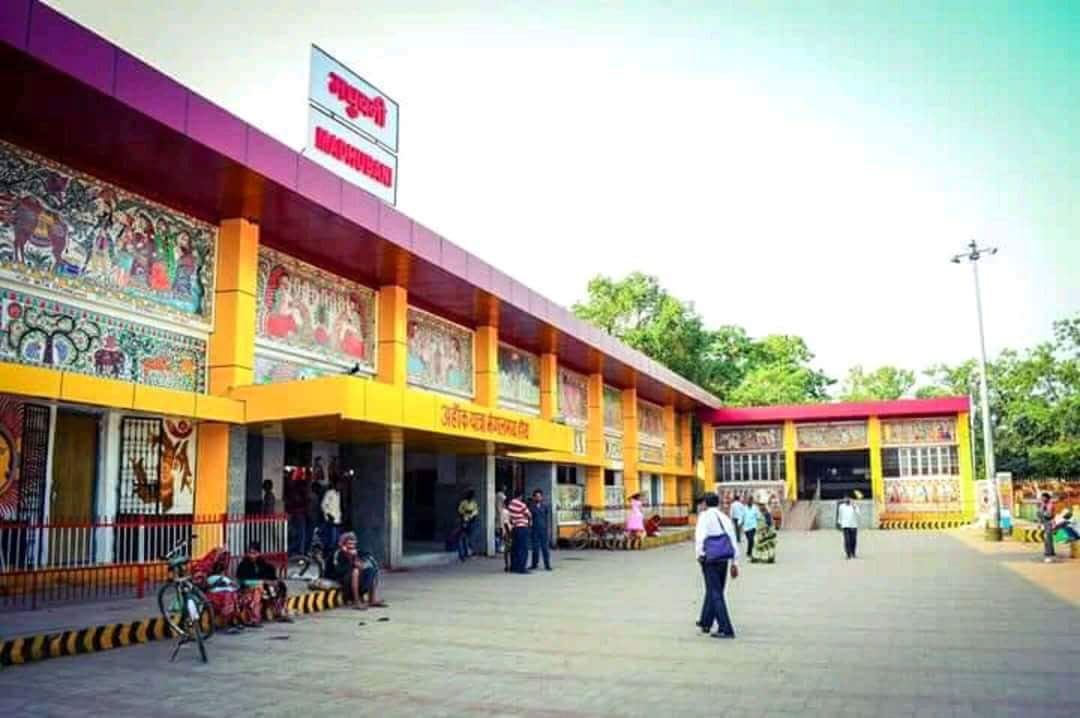     Clockwise from top: Madhubani City skyline, Madhubani railway station ,Kali Mandir, Police Line mandir, Hanuman Mandir, School Student. | |
 Madhubani Location in Bihar, India  Madhubani Madhubani (India) | |
| Coordinates: 26.37°N 86.08°E | |
| Country | |
| State | Bihar |
| Region | Mithila |
| District | Madhubani |
| Government | |
| • Type | Madhubani Municipal Corporation |
| Elevation | 56 m (184 ft) |
| Population (2011) | |
| • Total | 75,736 |
| Languages | |
| • Official | Maithili |
| • Additional official | Hindi, English |
| • Regional Language | Maithili |
| Time zone | UTC+5:30 (IST) |
| PIN | |
| Telephone code | 06276 |
| ISO 3166 code | IN-BR |
| Vehicle registration | BR-32 |
| Sex ratio | 1000/926 ♂/♀ |
| Lok Sabha constituency | Madhubani |
| Vidhan Sabha constituency | Madhubani, Bisfi |
| Website | madhubani |

Area
- Madhubani occupies a total of 3501 km2.
- Main Rivers are Kamla, Kareh, Balan, Bhutahi Balan, Gehuan, Supen, Trishula, Jeevachh, Koshi and Adhwara Group.
- High Flood Level is 54.017 m.
- Whole District is under Earthquake Zone 5.
- Total Cropped Area – 218381 Hect.
- Barren /Uncultivable Land – 1456.5 Hect
- Land under Non-agricultural use – 51273.24 Hect
- Cultivable Barren Land – 333.32 Hect
- Permanent Pasture – 1372.71 Hect
- Miscellaneous Trees – 8835.90 Hect
- Cultivable Land – 232724 Hect
- Cropping Intensity – 134.23%[4]
Geography
Madhubani Town is located at 26.37°N 86.08°E.[5] It has an average elevation of 56 metres.
Madhubani painting
Madhubani is also famous for its world class paintings popularly called as Mithila paintings. These paintings are created mostly by women. Natural colours are used and paintings are done on canvases, walls, floors of sacred places, etc. The painting is brightly coloured with a mix of several hues, along with a white border to all lines which is a major technique used. This art form originated when Lord Janak asked the villagers to decorate the village to celebrate the wedding of Rama Ji and Sita Ji. The art usually consists of scenes from the Ramayana or depicts Lord Krishan with Gopis. Famous artists include Ms Bharti Dayal from Mithila. Many books and picture books have been made on this artform, such as the one available online.[6]
Demographics
As of 2011[update] India census,[7] Madhubani Town had a population of 166,285. Males constitute 53% of the population and females 47%. Madhubani Town has an average literacy rate of 71.06%, just above the national average of 62.39%: male literacy is 78.81%, and female literacy is 53%. In Madhubani Town, 16% of the population is under 6 years of age.
Trade
Laukaha is a nearby town close to the border of Nepalese town of Thadi. Laukaha in India and Thadi in Nepal are a part of one of the agreed route for Mutual Trade between India and Nepal and import and export to Nepal happen via Laukaha.[8] Government of Nepal has set up a dedicated customs office in the town.[9] and Government of India has set up a Land Customs Station with a Superintendent level officer.[10]
Education
List of colleges offer Higher Education in Madhubani
- Ram Krishna College
- Madhubani Medical College and Hospital
- J N College
- Mithila Chitrakala Sansthan[11]
- D N Y College[12]
Notable people
- Dhirendra Brahmachari
- Arknath Chaudhary
- Chandramani Datta
- Mahasundari Devi
- Ashish Jha
- Ganganath Jha
- Narendra Jha
- Sriram Jha
- Mangani Lal Mandal
- Ramprit Mandal
- Ramprit Paswan
- Chaturanan Mishra
- Mohan Mishra
- Prem Chandra Mishra
- Maṇḍana Miśra
- Amrish Ranjan Pandey
- Mohammad Shams Aalam Shaikh
- Gajendra Thakur
- Maithili Thakur
- Vidyapati
- Devendra Prasad Yadav
{{div col end}—}
References
- Madhubani
- Ram, Bindeshwar (1998). Land and society in India: agrarian relations in colonial North Bihar. Orient Blackswan. ISBN 978-81-250-0643-5.
- "Madhubani | India | Britannica.com". Encyclopædia Britannica. Retrieved 12 November 2016.
- "MADHUBANI Pincode". citypincode.in. Retrieved 19 May 2014.
- "Maps, Weather, and Airports for Madhubani, India". fallingrain.com. Retrieved 12 November 2016.
- "Warli and Madhubani Picture book | informative video" – via YouTube.
- "Census of India 2001: Data from the 2001 Census, including cities, villages and towns (Provisional)". Census Commission of India. Archived from the original on 16 June 2004. Retrieved 1 November 2008.
- "India Nepal Trade Agreement. India-Nepal Foreign Treaty of Trade Agreement". eximguru.com. Retrieved 12 September 2019.
- "Department of Customs, Nepal – Custom Contact Offices". customs.gov.np. Retrieved 12 September 2019.
- "No. |".
- "Advertisement of Mithila Chitrakala sansthan, Madhubani for Certificate Cours (Session – January – 2021) | District Madhubani, Government of Bihar | India". Madhubani district official Website.
{{cite web}}: CS1 maint: url-status (link) - "Dev Narayan Yadav College Madhubani,Bihar". dnycollege.in. Retrieved 26 December 2021.
External links
Authority control | |
|---|---|
| General | |
| National libraries | |
На других языках
[de] Madhubani (Stadt)
Madhubani ist eine Stadt im Bundesstaat Bihar im Osten Indiens. Sie ist der Hauptsitz des gleichnamigen Distrikt Madhubani. Madhubani hat den Status eines City Council (Nagar parishad). Die Stadt ist in 30 Wards gegliedert. Sie ist ungefähr 172 km von Bihars Hauptstadt Patna entfernt. In Madhubani sind die Sprachen Hindi, Maithili und Urdu vorherrschend.- [en] Madhubani, India
[ru] Мадхубани
Мадхубани (англ. Madhubani) — город в северной части штата Бихар, Индия. Административный центр округа Мадхубани (округ)Мадхубани.Другой контент может иметь иную лицензию. Перед использованием материалов сайта WikiSort.org внимательно изучите правила лицензирования конкретных элементов наполнения сайта.
WikiSort.org - проект по пересортировке и дополнению контента Википедии