world.wikisort.org - India
Ladhoo[3] or Ladhu is a village in Pulwama district of Jammu and Kashmir, India. It is situated on the Jhelum River and of all villages in Pampore Constituency is one of the largest village. It is 18 km (11 mi) from Srinagar and 4 km (2.5 mi) from NH44 via Lethpora. It is spread over an area of 9 km2 (3.5 sq mi) including a long stretch of very famous trekking spot known as Wasturwan. This hill is also referred as 'Veshrivan' by some scholars and is said to be a store house of many myths and truths for the people living in its vicinity.


Ladhoo
Ladhu Loduv | |
|---|---|
Village | |
 | |
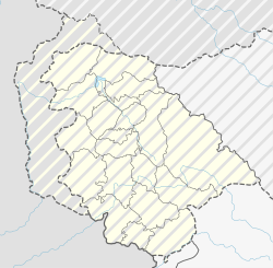 Ladhoo Location in Jammu and Kashmir, India  Ladhoo Ladhoo (India) | |
| Coordinates: 34.00°N 75.00°E | |
| Country | |
| State | Jammu and Kashmir |
| District | Pulwama district |
| Area | |
| • Total | 9 km2 (3 sq mi) |
| Elevation | 1,592 m (5,223 ft) |
| Population (2011) | |
| • Total | 4,602 |
| Languages | |
| • Official | Kashmiri, Urdu, English[1][2] |
| Time zone | UTC+5:30 (IST) |
| PIN | 191103 |
| Telephone code | 01933 |
| Vehicle registration | JK 13 |
| Literacy | 65.33% |
| Website | www |

As per the census of 2011,[4] the household capacity is 823 and the total population is 4604. The male-to-female ratio is 1000:973.
Quarrying and farming provide employment for most of the residents, either directly or indirectly. Products include saffron,[5] almonds, walnuts, pears, paddy, and maize.[6]
Literacy
The literacy rate of Ladhoo is 65.33%. Male literacy is at 77.83% while female literacy stands at 52.8%. There are three private schools (up to primary level), five government schools (up to primary level) and a government higher secondary school and the names are given in the table below.[citation needed]
| 1 | Government Higher Secondary School, Ladhoo |
| 2 | Government Middle School, Herpora |
| 3 | Sheikh Ul Alam Public Middle Model School, Nagbal |
| 4 | Government Residential School, Nagbal |
| 5 | Government Primary School, Gousen nar |
| 6 | Musa Educational Institute, Banpora |
| 7 | Government Primary School, Banpora |
| 8 | Government middle school, Batpora |
| 9 | Dawah Public School, Banpora |
Religion


The majority of the population is Muslim, with a Hindu minority. [7] They all live together in peace and harmony, they also take part in one another's festivals. There are around 15 mosques and four temples built in the village and among them is the Ancient Temple which is included in the list of Historical monuments of India and is under the care of archaeological survey of India (ASI), circle srinagar. The other notable religious sites of the village include Sheikh-ul-Alam shrine and Samadhi Of Jeevan Sahib.
Important locations


The Ancient Temple is located by a pond named Sanz Har Nag and dates back to the 8th century AD. The temple is externally square but circular internally. The southwest entrance has an arch surmounted by a pediment. Considering the topology, nature has designed this village so adequate that it had remained the seat of learning for many saints and Sufis and get spiritual enlightenment, one among them is one of the valleys highly praised Sufi saint popularly known as Alamdare Kashmir Sheikh-ul-Aalam also known as Nund Rishi has spent an ample amount of time here (12 years), other saints visited here include Mir Syed Ali Hamadani, Baba Raqam ud din and Jeevan Sahib[8] and all of them have chosen different residing sites in the village which are worth to mention as Lopan pal, bank of sanz haer nag, ghope bal and Gousen nar respectively.
Ladhoo is also near a hiking spot known as Wasturwan.[9]
References
- "The Jammu and Kashmir Official Languages Act, 2020" (PDF). The Gazette of India. 27 September 2020. Retrieved 27 September 2020.
- "Parliament passes JK Official Languages Bill, 2020". Rising Kashmir. 23 September 2020. Retrieved 30 May 2021.
- Bhat, Chander. "LADOV- A village of my dreams". Kashmir News Network.
{{cite news}}: CS1 maint: url-status (link) - "Census of India 2001: Data from the 2001 Census, including cities, villages and towns (Provisional)". Census Commission of India. Archived from the original on 16 June 2004. Retrieved 1 November 2008.
- Yasmin, Salwee (14 March 2015). "Saffron - The aroma unforgettable". The Greater Kashmir.
- "Saffron heritage of Kashmir".
{{cite web}}: CS1 maint: url-status (link) - Rashid, Afsana (3 July 2010). "Wasturwan area blessed with Hindi, Muslim shrines". J&K Plus Online Edition. 1: 5.
- "Nirwan Diwas of Swami Jeevan Sahib observed". The Daily Excelsior. 28 February 2013.
- Farooq, Aadil (March 2018). "Wasturwan : A meadow of faith". Samanbal. 4: 1.
Другой контент может иметь иную лицензию. Перед использованием материалов сайта WikiSort.org внимательно изучите правила лицензирования конкретных элементов наполнения сайта.
WikiSort.org - проект по пересортировке и дополнению контента Википедии