world.wikisort.org - India
Kaladhungi is a town and a nagar panchayat in Nainital district in the Indian state of Uttarakhand.
Kaladhungi | |
|---|---|
town | |
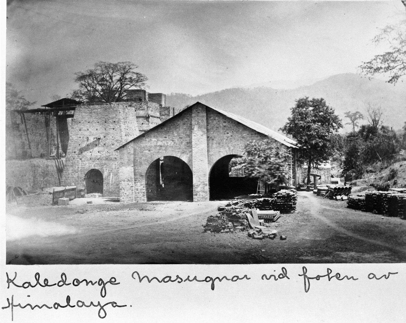
 Ironworks in Kaladhungi at the turn of 1862/1863. | |
 Kaladhungi Location in Uttarakhand, India  Kaladhungi Kaladhungi (India) | |
| Coordinates: 29.28°N 79.35°E | |
| Country | |
| State | Uttarakhand |
| District | Nainital |
| Elevation | 514 m (1,686 ft) |
| Population (2011) | |
| • Total | 6,126 |
| Languages | |
| • Official | Kumaoni, Hindi |
| Time zone | UTC+7:00 (IST) |
| PIN | 263140[1] |
| Vehicle registration | UK 04 |
| Website | uk |
The place is located just on the foothill, a good climate but summers are hot, located 26 km west of Haldwani on the Haldwani-Ramanagar road. Nainital is at distance of only 30 km to the north and Bazpur at about 19 km to south. It has a road connecting to Delhi via Bazpur, Tanda, and Moradabad.
Overview
In this route there are beautiful forests on the north side. Kaladungi has been a local commercial center for the surrounding villages in the plains, for over a century now.[2]
Kaldhungi is a Tehsil headquarters, has an Intermediate Govt. School and Hospital, with normal facilities like electricity, water, telephone, banks, post office, etc.
It is a very fertile land and a variety of fruits and vegetables like mangoes, lychee, papaya, guava, bananas, (vegetables - potato, cauliflower, tomato, cabbage, peas, beans, eggplant, gourds, calabash, pumpkin, bitter gourd, coriander, turmeric, ginger, mustard, fenugreek, spinach, etc.). The main crops are wheat, rice, mustard, sugarcane, corn, soybean, gram, pigeon pea, green gram and red lentil.
Geography
Kaladhungi is located at 29.28°N 79.35°E.[3] It has an average elevation of 393 metres (1,289 feet).
Demographics
As of 2001[update] India census,[4] Kaladhungi had a population of 6,126. Males constitute 53% of the population and females 47%. Kaladhungi has an average literacy rate of 62%, higher than the national average of 59.5%: male literacy is 70%, and female literacy is 53%. In Kaladhungi, 16% of the population is under 6 years of age.
Local attractions

Jim Corbett, the famous man-eater hunter and a great environmentalist lived at Choti Haldwani, 2 km west of Kaladhungi on Ramnagar road for most years of his life. His house has now been converted into a museum in his memory by the government, known as 'Jim Corbett Museum', a must-see for the tourist going to Nainital taking Kaladhunigi-Nainital road. There are also the graves of his two dogs in the compound of the museum. Another attraction is the Bajauniyahaldu village.
References
- "Kaladungi Pin code". pin-code.net. Retrieved 11 July 2021.
- Nainital District The Imperial Gazetteer of India 1909, v. 18, p. 324.
- Falling Rain Genomics, Inc - Kaladhungi
- "Census of India 2001: Data from the 2001 Census, including cities, villages and towns (Provisional)". Census Commission of India. Archived from the original on 16 June 2004. Retrieved 1 November 2008.
Другой контент может иметь иную лицензию. Перед использованием материалов сайта WikiSort.org внимательно изучите правила лицензирования конкретных элементов наполнения сайта.
WikiSort.org - проект по пересортировке и дополнению контента Википедии