world.wikisort.org - India
Ichhapasar is a village in Chanditala I community development block of Srirampore subdivision in Hooghly district in the Indian state of West Bengal.[1]
Ichhapasar | |
|---|---|
Village | |
 Ichhapasar Location in West Bengal, India  Ichhapasar Ichhapasar (India) | |
| Coordinates: 22.6988641°N 88.151995°E | |
| Country | |
| State | West Bengal |
| District | Hooghly |
| Government | |
| • Body | Gram panchayat |
| Population (2011) | |
| • Total | 1,442 |
| Languages | |
| • Official | Bengali, English |
| Time zone | UTC+5:30 (IST) |
| PIN | 712701 |
| ISO 3166 code | IN-WB |
| Vehicle registration | WB |
| Lok Sabha constituency | Serampore |
| Vidhan Sabha constituency | Chanditala |
| Website | wb |
Geography
Ichhapasar is located at 22.6988641°N 88.151995°E.
Gram panchayat
Villages in Haripur gram panchayat are: Anantarampur, Bade Sola, Baghati, Ban Panchbere, Chak Bangla, Chota Choughara, Dudhkomra, Haripur, Ichhapasar, Jagmohanpur, Mamudpur and Radhaballabhpur.[2]
 Map of Haripur GP
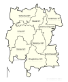 Map of Chanditala-I CD block sowing GP
 Map of Hooghly district showing CD blocks and municipal areas


Demographics
As per 2011 Census of India, Ichhapasar had a total population of 1,442 of which 722 (50%) were males and 720 (50%) were females. Population below 6 years was 141. The total number of literates in Ichhapasar was 1,059 (81.40% of the population over 6 years).[3]
Healthcare
Akuni Ichhapasar Rural Hospital at Aniya functions with 30 beds.[4][5]
Transport
Bargachia railway station and Baruipara railway station are the nearest railway stations.
References
- "banglarbhumi.gov.in". WEST BENGAL ->HUGLI(হুগলী) ->CHANDITALA-I (চণ্ডীতলা-১) Mouza Information. Government of West Bengal. Archived from the original on 22 December 2016. Retrieved 6 October 2018.
- "Haripur". Indian Village Directory. Retrieved 12 October 2018.
- "C.D. Block Wise Primary Census Abstract Data(PCA)". 2011 census: West Bengal – District-wise CD Blocks. Registrar General and Census Commissioner, India. Retrieved 7 October 2018.
- "Health & Family Welfare Department". Health Statistics. Government of West Bengal. Retrieved 4 October 2018.
- "Akuni Ichhapasar BPHC". District Administration. Retrieved 6 October 2018.
Cities, towns and locations in Srirampore subdivision | |||||||||||
|---|---|---|---|---|---|---|---|---|---|---|---|
| Cities, municipal, census towns and Villages |
| ||||||||||
Cities, towns and locations in Hooghly district | |||||||||
|---|---|---|---|---|---|---|---|---|---|
| Cities, municipalities and census towns |
| ||||||||
| Locations other than cities and towns |
| ||||||||
| Neighbourhoods |
| ||||||||
| Related topics |
| ||||||||
Другой контент может иметь иную лицензию. Перед использованием материалов сайта WikiSort.org внимательно изучите правила лицензирования конкретных элементов наполнения сайта.
WikiSort.org - проект по пересортировке и дополнению контента Википедии