world.wikisort.org - India
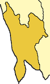
Hmawngbuchhuah is a village in Lawngtlai Block in Lawngtlai district in the state of Mizoram, India.
Hmawngbuchhuah | |
|---|---|
village | |
 Hmawngbuchhuah  Hmawngbuchhuah | |
| Coordinates: 22°08′55″N 92°46′14″E | |
| Country | India |
| State | Mizoram |
| District | Lawngtlai district |
| Population (2011) | |
| • Total | 389 |
| Languages | |
| • Official | Mizo |
| Time zone | UTC+5:30 (IST) |
| Vehicle registration | MZ |
| Website | mizoram |
Location
147 km from State capital Aizawl. It lies on the border between Myanmar and India. It is on the east bank of Sekulh Lui River which makes the border.[1] It is 10 km from the border town of Zochachhuah.
Demographics
As of the 2011 Census of India, the population in Hmawngbuchhuah village is 389, with 97 Households. There are 190 males (49%) and 199 females (51%), with 3% Scheduled Tribe and no Scheduled Cast.[1][2]
Connectivity
It is located 4 km towards South from District headquarters Lawngtlai. It is located on the India-Myanmar border where National Highway 502 (India), Kaladan Multi-Modal Transit Transport Project, enters Myanmar.[3][4]
100 km route from Indo-Myanmar border at Zorinpui to Aizawl is upgraded to two-lane in both directions (total 4 lanes). From Aizawl it connect to Aizawl-Saiha National Highway at Lawngtlai in Mizoram in India by road on National Highway 54 (India) (NH-54), which then continues further to Dabaka in Assam via 850 km long NH-54 which in turn is part of the larger East-West Corridor connecting North East India with the rest of India.[5] Almost complete (June 2017).[6] Tender has been awarded, upgrade to this national highway is under-construction and to be Completed by 2019.[7]
Survey for the Rail line from Sairang to Hmawngbuchhuah on border near Zorinpui was completed in August 2017 and it will be constructed in future phase.[8]
Economy
The mainstay of economy is agriculture and it is a border town with integrated check post being built which will be operational by April 2019.[3][4][needs update]
See also
- Sittwe Port
- Zochachhuah
References
- Hmawngbuchhuah info
- Hmawngbuchhuah village
- Hmawngbuchhuah Kaladan-project details
- Hmawngbuchhuah Kaladan-project railway survey
- "Multi-modal route map". Archived from the original on 22 August 2017. Retrieved 27 November 2018.
- India awards road contract to complete Kaladan project in Myanmar, Business Line, 9 June 2017.
- Still under construction, The Statesman, 13 May 2018.
- India's north east opened up, PowerUpConstruction.Com
External links
Другой контент может иметь иную лицензию. Перед использованием материалов сайта WikiSort.org внимательно изучите правила лицензирования конкретных элементов наполнения сайта.
WikiSort.org - проект по пересортировке и дополнению контента Википедии
