world.wikisort.org - India
Hangala is a village in the southern state of Karnataka, India.[1][2] It is located in the Gundlupet taluk of Chamarajanagar district.
Hangala | |
|---|---|
village | |
 Mariamma Temple, Hangala | |
 Hangala Location in Karnataka, India  Hangala Hangala (India) | |
| Coordinates: 11.80°N 77.69°E | |
| Country | |
| State | Karnataka |
| District | Chamarajanagar |
| Talukas | Gundlupet |
| Government | |
| • Body | Gram panchayat |
| Population (2001) | |
| • Total | 5,597 |
| Languages | |
| • Official | Kannada |
| Time zone | UTC+5:30 (IST) |
| ISO 3166 code | IN-KA |
| Vehicle registration | KA |
| Website | karnataka |
Demographics
As of 2001[update] India census, Hangala had a population of 5,597 with 2,835 males and 2,762 females.[1]
Country Code and STD Code
+91 08229
Tourist attractions
Gopalaswamy Hills is 18 km from Hangala.
Image gallery
 Varadaraja Temple
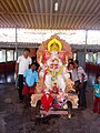 Children of Hangala


See also
- Chamarajanagar
- Districts of Karnataka
References
- Village code= 2902900 "Census of India : Villages with population 5000 & above". Registrar General & Census Commissioner, India. Retrieved 18 December 2008.
- "Yahoomaps India :". Retrieved 18 December 2008. Hangala, Chamarajanagar, Karnataka
External links
District HQ: Chamarajanagar | |
| Villages and Towns |
|
This article related to a location in Chamarajanagar district, Karnataka, India is a stub. You can help Wikipedia by expanding it. |
Текст в блоке "Читать" взят с сайта "Википедия" и доступен по лицензии Creative Commons Attribution-ShareAlike; в отдельных случаях могут действовать дополнительные условия.
Другой контент может иметь иную лицензию. Перед использованием материалов сайта WikiSort.org внимательно изучите правила лицензирования конкретных элементов наполнения сайта.
Другой контент может иметь иную лицензию. Перед использованием материалов сайта WikiSort.org внимательно изучите правила лицензирования конкретных элементов наполнения сайта.
2019-2026
WikiSort.org - проект по пересортировке и дополнению контента Википедии
WikiSort.org - проект по пересортировке и дополнению контента Википедии