world.wikisort.org - India
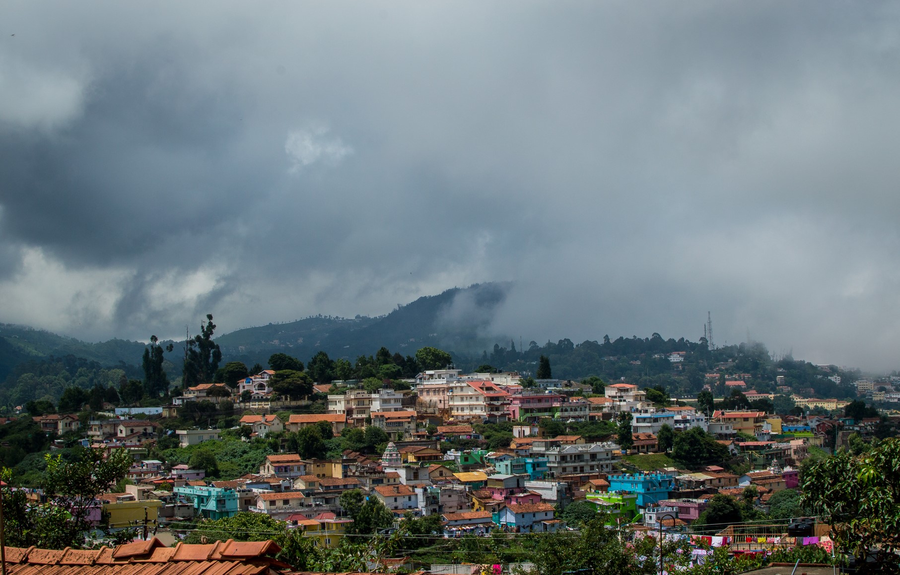
Coonoor (![]() pronunciation (help·info)) is a Taluk and a municipality of the Nilgiris district in the Indian State of Tamil Nadu. As of 2011, the town had a population of 45,494.
pronunciation (help·info)) is a Taluk and a municipality of the Nilgiris district in the Indian State of Tamil Nadu. As of 2011, the town had a population of 45,494.
Coonoor | |
|---|---|
Hill Station | |
 | |
 Coonoor Location in Tamil Nadu, India | |
| Coordinates: 11°20′42″N 76°47′42″E | |
| Country | |
| State | Tamil Nadu |
| District | Nilgiris |
| Government | |
| • Type | Selection Grade Municipality |
| • Body | Coonoor Municipality |
| Elevation | 1,850 m (6,070 ft) |
| Population (2011) | |
| • Total | 45,954 |
| Languages | |
| • Official | Tamil |
| Time zone | UTC+5:30 (IST) |
| PIN | 643 10x |
| Telephone code | 91(0)423 |
| Vehicle registration | TN 43 |
Demographics
According to 2011 census, Coonoor had a population of 45,494 with a sex-ratio of 1,058 females for every 1,000 males, much above the national average of 929.[2] A total of 3,768 were under the age of six, constituting 1,871 males and 1,897 females. Scheduled Castes and Scheduled Tribes accounted for 27.92% and 23% of the population, respectively. The average literacy of the city was 84.79%, compared to the national average of 72.99%.[2] The city had a total of 12384 households. There were a total of 17,421 workers, comprising 50 cultivators, 152 main agricultural labourers, 266 in household industries, 15,790 other workers, 1,163 marginal workers, 6 marginal cultivators, 66 marginal agricultural labourers, 31 marginal workers in household industries and 1,060 other marginal workers.[3]
The town is the second largest in the Nilgiri hills after Ooty, the district headquarters. Coonoor has 61.81% Hindus, 23.99% Christians, 13.01% Muslims, 0.04% Sikhs, 0.06% Buddhists, 0.95% Jains and 0.08% Others. 0.05% of the respondents follow no religion or did not state their religion.[1]
The town of Coonoor is broadly divided into two geographies - Lower Coonoor and Upper Coonoor. Lower Coonoor hosts the main Bus Depot, the Railway Station as also the bustling market complex. Upper Coonoor hosts locations like UPASI, Bedford, and Sim's Park.
Tourism
Spread over an area of 12 hectares, Sim's Park has a collection of over 1,000 plant species. The botanical garden is partly developed in the Japanese style and derived its name from J. D. Sim, the secretary of the Madras Club in 1874. The key attraction of the park is the annual fruit and vegetable show held in May.[4][5] Dolphin's Nose Viewpoint is 10 km from Coonoor and provides a panoramic view of the vast expanse of the Nilgiri Hills and Catherine Falls. Tourists can trek from Lady Canning's Seat to Dolphin's Nose. Lamb's Rock, about 5½ km from Coonoor, is another vantage point. Droog Fort is located a distance of 13 km from Coonoor and was once used by Tipu Sultan in the 18th century. Law's Falls is a waterfall located 5 km from Coonoor, on the way to Mettupalayam.
Pomological Station is a research center of the State Agricultural Department for persimmon, pomegranates and apricot. Pasteur Institute located near Sim's park, was started in 1907. This institute develops vaccination for rabies. Central Silk Board has its silkworm breeding station (Satellite Silkworm Breeding Station of Central Sericultural Research & Training Institute-Mysuru) besides state government silk farm at Springfield. Recently, Floriculture and strawberry cultivation have taken root.[6]
The Bollywood film, Kapoor & Sons, was shot in this town.[7]
Administration and politics
Coonoor is a Taluk headquarters, responsible for six Panchayat villages, namely, Bandishola, Bearhatty, Burliar, Hubbathalai, Melur and Yedapalli. The Coonoor block contains the revenue villages of Adigaratty, Burliar, Coonoor Town, Yedapalli, Hubbathalai, Hullickal, Ketti, Melur. Coonoor assembly constituency is part of Nilgiris (Lok Sabha constituency).[8]
Geography
Coonoor is located at 11.345°N 76.795°E.[9] It has an average elevation of 1,850 metres (6,070 feet) above sea level. It features a sub-tropical highland climate (Koppen;Cfb) due to high altitude.
| Climate data for Coonoor (1981–2010, extremes 1928–2012) | |||||||||||||
|---|---|---|---|---|---|---|---|---|---|---|---|---|---|
| Month | Jan | Feb | Mar | Apr | May | Jun | Jul | Aug | Sep | Oct | Nov | Dec | Year |
| Record high °C (°F) | 25.6 (78.1) |
27.0 (80.6) |
28.3 (82.9) |
29.6 (85.3) |
29.4 (84.9) |
28.6 (83.5) |
26.2 (79.2) |
26.2 (79.2) |
25.1 (77.2) |
25.6 (78.1) |
25.2 (77.4) |
25.6 (78.1) |
29.6 (85.3) |
| Average high °C (°F) | 20.2 (68.4) |
21.7 (71.1) |
23.6 (74.5) |
24.7 (76.5) |
25.2 (77.4) |
23.0 (73.4) |
22.2 (72.0) |
22.1 (71.8) |
22.1 (71.8) |
21.3 (70.3) |
20.0 (68.0) |
19.6 (67.3) |
22.1 (71.8) |
| Average low °C (°F) | 9.3 (48.7) |
10.4 (50.7) |
12.4 (54.3) |
14.4 (57.9) |
15.3 (59.5) |
15.3 (59.5) |
14.8 (58.6) |
14.9 (58.8) |
14.1 (57.4) |
13.4 (56.1) |
11.8 (53.2) |
10.4 (50.7) |
13.1 (55.6) |
| Record low °C (°F) | 0.7 (33.3) |
0.2 (32.4) |
3.8 (38.8) |
8.4 (47.1) |
9.0 (48.2) |
9.4 (48.9) |
8.8 (47.8) |
8.6 (47.5) |
7.2 (45.0) |
6.1 (43.0) |
3.0 (37.4) |
−0.5 (31.1) |
−0.5 (31.1) |
| Average rainfall mm (inches) | 52.4 (2.06) |
56.9 (2.24) |
111.6 (4.39) |
109.9 (4.33) |
85.7 (3.37) |
61.3 (2.41) |
79.5 (3.13) |
89.0 (3.50) |
148.9 (5.86) |
309.3 (12.18) |
296.2 (11.66) |
180.0 (7.09) |
1,590.7 (62.63) |
| Average rainy days | 2.3 | 2.4 | 3.4 | 5.9 | 7.0 | 6.0 | 7.9 | 8.2 | 9.5 | 13.7 | 10.4 | 7.5 | 84.4 |
| Average relative humidity (%) (at 8:30 IST) | 64 | 63 | 56 | 64 | 63 | 70 | 74 | 73 | 73 | 78 | 79 | 74 | 69 |
| Source: India Meteorological Department[10][11] | |||||||||||||
2021 Indian Air Force Mil Mi-17 crash
On 8 December 2021, a Mil Mi-17V-5 transport helicopter operated by the Indian Air Force (IAF) crashed between Coimbatore and Wellington in Tamil Nadu, after departing from Sulur Air Force Station. The helicopter was carrying Chief of Defence Staff General Bipin Rawat and 13 others, including his wife and staff. Thirteen people on board were killed in the immediate aftermath, and Group Captain Varun Singh died from his injuries at a hospital seven days later.
Gallery
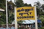 Coonoor Railway Station

See also
- Adikaratti
- Aruvankadu
- Ketti
- Kotagiri
- Nilgiris (mountains)
- Nilgiri tea
- Ooty
References
- "Population By Religious Community - Tamil Nadu" (XLS). Office of The Registrar General and Census Commissioner, Ministry of Home Affairs, Government of India. 2011. Retrieved 31 January 2016.
- "Census Info 2011 Final population totals". Office of The Registrar General and Census Commissioner, Ministry of Home Affairs, Government of India. 2013. Retrieved 26 January 2014.
- "Census Info 2011 Final population totals - Coonoor". Office of The Registrar General and Census Commissioner, Ministry of Home Affairs, Government of India. 2013. Retrieved 26 January 2014.
- Gopal, Madan (1990). K.S. Gautam (ed.). India through the ages. Publication Division, Ministry of Information and Broadcasting, Government of India. p. 177.
- "Arrangements on for fruit show in Coonoor". The Hindu: Mobile Edition. 26 April 2015.
- "Tamil Nadu Sericulture proceedings of Chief conservator of forests" (PDF). 14 November 2011. Retrieved 8 August 2013.
- Satpathy, Kriti Saraswat. "Alia Bhatt and Sidharth Malhotra capture the beauty of Coonoor in Kapoor & Sons | India.com". www.india.com. Retrieved 31 March 2022.
- "List of Parliamentary and Assembly Constituencies" (PDF). Election Commission of India. Archived from the original (PDF) on 31 October 2008. Retrieved 9 October 2008.
- "Maps, Weather, and Airports for Coonoor, India". fallingrain.com.
- "Station: Coonoor Climatological Table 1981–2010" (PDF). Climatological Normals 1981–2010. India Meteorological Department. January 2015. pp. 209–210. Archived from the original (PDF) on 5 February 2020. Retrieved 18 February 2020.
- "Extremes of Temperature & Rainfall for Indian Stations (Up to 2012)" (PDF). India Meteorological Department. December 2016. p. M193. Archived from the original (PDF) on 5 February 2020. Retrieved 18 February 2020.
External links
 Coonoor travel guide from Wikivoyage
- Conoor Official history and tourism page on www.nilgiris.tn.gov.in.
Nilgiris district | ||
|---|---|---|
| District Headquarters |  | |
| Country |
| |
| State |
| |
| Region | ||
| Divisions |
| |
| Taluks |
| |
| Revenue blocks |
| |
| Municipalities |
| |
| Rivers | ||
| History |
| |
| Cities and towns |
| |
| Villages |
| |
| Places of interest |
| |
| ||
Authority control | |
|---|---|
| General | |
| National libraries | |
Другой контент может иметь иную лицензию. Перед использованием материалов сайта WikiSort.org внимательно изучите правила лицензирования конкретных элементов наполнения сайта.
WikiSort.org - проект по пересортировке и дополнению контента Википедии