world.wikisort.org - India
Azamgarh is a city in the Indian state of Uttar Pradesh. It is the headquarters of Azamgarh division, which consists of Ballia, Mau and Azamgarh districts. Azamgarh is situated on the bank of Tamsa River (Tons). It is located 268 km (167 mi) east of the state capital Lucknow and 809 km from national capital, Delhi.
This article needs additional citations for verification. (May 2012) |
Azamgarh | |
|---|---|
City | |
 Azamgarh Railway Station | |
 Azamgarh Location in Uttar Pradesh, India  Azamgarh Azamgarh (India) | |
| Coordinates: 26.068°N 83.184°E | |
| Country | |
| State | Uttar Pradesh |
| District | Azamgarh |
| Government | |
| • MLA | Durga Prasad Yadav (SP)[1] |
| • MP | Dinesh Lal Yadav "Nirahua" (BJP) |
| Elevation | 64 m (210 ft) |
| Population (2011) | |
| • Total | 110,983 |
| Language | |
| • Official | Hindi[2] |
| • Additional official | Urdu[2] |
| • Local | Bhojpuri[3] |
| Time zone | UTC+05:30 (IST) |
| PIN | |
| Area code | 05462 |
| Vehicle registration | UP-50 |
| Airport | Azamgarh Airport |
| Website | azamgarh |
History
This section needs additional citations for verification. (July 2013) |
Azamgarh, one of the easternmost districts(a district in Purvanchal sub-region) of Uttar Pradesh, once formed a part of the ancient Kosala kingdom, except its north-eastern part. Azamgarh is also known as the land of the sage Durvasa whose ashram was located in Phulpur tehsil, near the confluence of Tamsa and Majhuee rivers, 6 kilometres (3.7 mi) north of the Phulpur.
The district is named after its headquarters town, Azamgarh, which was founded in 1665 by Azam, son of Vikramajit. Vikramajit was a descendant of Gautam Rajputs of Mehnagar in Pargana Nizamabad who like some of his predecessors had embraced the faith of Islam. He had a Muslim wife who bore him two sons Azam and Azmat. While Azam gave his name to the town of Azamgarh, and the fort, Azmat constructed the fort and settled the bazaar of Azmatgarh pargana Sagri.[4] After the attack of Chabile Ram, Azmat Khan fled northwards followed by the interior forces. He attempted to cross the Ghaghra into Gorakhpur, but the people on the other side opposed his landing, and he was either shot in mid stream or was drowned in attempting to escape by swimming.
In 1688 A.D. during Azmat's[dubious ] lifetime, his eldest son Ekram took part in the management of the state, and after Azam's[dubious ] death he was perhaps left in possession together with Mohhabat, another son. The remaining two sons were taken away and for a time detained as hostages for their brothers' 'good behaviour'.
The successor of Ikram finally confirmed the title of his family to the Jamidari. Ikram left no heirs and was succeeded by Iradat, son of Mohhabat. But the real ruler all along had been Mohhabat, and after Ikram's death, he continued to rule in his son's name.
Geography
Azamgarh has an average elevation of 64 metres (209 feet).[5] The district consists of a series of parallel ridges, whose summits are depressed into beds or hollows, along which the rivers flow; while between the ridges are low-lying rice lands, interspersed with numerous natural reservoirs.[6] The soil is fertile, and very highly cultivated, bearing good crops of rice, sugarcane, and wheat and orchards of mango and guava. Maize, gram, corn,[vague] mustard are other major crops
Climate
Azamgarh experiences a humid subtropical climate (Köppen climate classification Cwa) with large variations between summer and winter temperatures.[7][8] Summers are long, from early April to October with intervening monsoon seasons, and are also extremely hot, even by South Asian standards. The temperature ranges between 22 and 46 °C (72 and 115 °F) in the summers. Winters in Azamgarh see very large diurnal variations, with warm days and downright cold nights. Cold waves from the Himalayan region cause temperatures to dip across the city in the winter from December to February and temperatures below 5 °C (41 °F) are not uncommon. The average annual rainfall is 1,110 mm (44 in). Fog is common in the winters, while hot dry winds, called loo, blow in the summers.[9] In recent years, the water level of the Tamsa has decreased significantly.
| Climate data for Azamgarh | |||||||||||||
|---|---|---|---|---|---|---|---|---|---|---|---|---|---|
| Month | Jan | Feb | Mar | Apr | May | Jun | Jul | Aug | Sep | Oct | Nov | Dec | Year |
| Average high °C (°F) | 19 (67) |
24 (76) |
31 (87) |
37 (98) |
38 (100) |
36 (97) |
32 (90) |
31 (88) |
31 (88) |
31 (87) |
27 (81) |
22 (71) |
30 (86) |
| Average low °C (°F) | 8 (47) |
12 (54) |
17 (62) |
22 (72) |
25 (77) |
27 (80) |
26 (78) |
26 (78) |
24 (76) |
21 (70) |
15 (59) |
11 (51) |
20 (67) |
| Average precipitation mm (inches) | 19.3 (0.76) |
13.5 (0.53) |
10.4 (0.41) |
5.4 (0.21) |
9.0 (0.35) |
100.0 (3.94) |
320.6 (12.62) |
260.4 (10.25) |
231.6 (9.12) |
38.3 (1.51) |
12.9 (0.51) |
4.0 (0.16) |
1,025.4 (40.37) |
| Source: [10][11] | |||||||||||||
Demographics
As per the 2011 census, Azamgarh urban agglomeration had a population of 110,983, out of which males were 57,878, and females were 53,105.[12]
Literacy
The average literacy rate of Azamgarh town in 2011 was 70.93%, compared to 56.95% in 2001. Male and female literacy were 81.34% and 60.91% respectively. For the 2001 census, In Azamgarh district. the corresponding figures were 71.04% and 43.40%.[13]
Religion
Languages
At the time of the 2011 Census of India, 45.22% of the population recorded Hindi as their first language, while 37.46% recorded Bhojpuri and 16.99% Urdu.[14]
Transport
This section needs additional citations for verification. (April 2021) |
Road
Azamgarh is connected with Lucknow 268 km (167 mi) and Delhi 761 km (473 mi) by road. It has one of the biggest bus depots in eastern Uttar Pradesh and regular bus services to almost all district headquarters of Uttar Pradesh and also to Delhi.
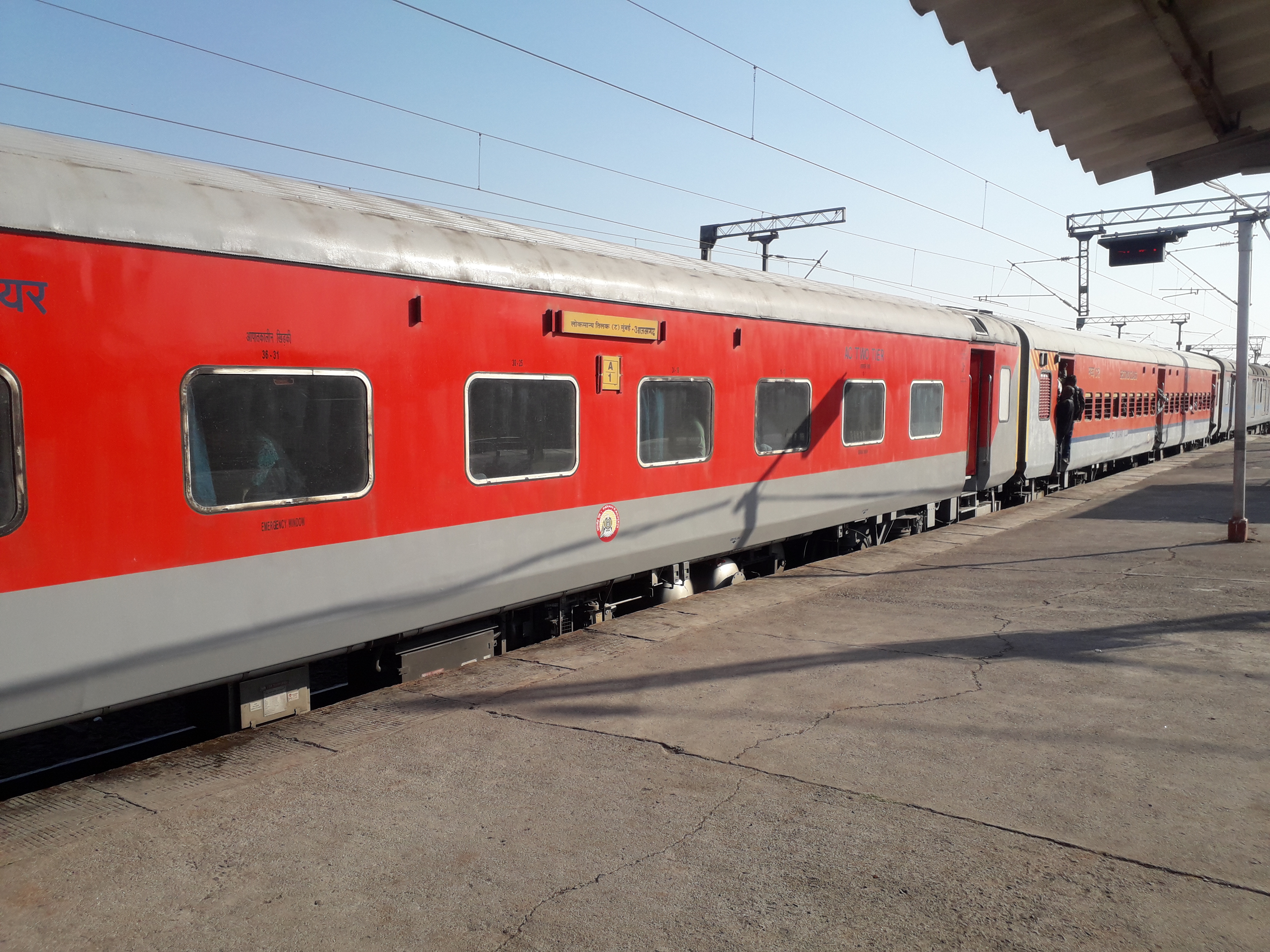
Train
Azamgarh station is one of the most important of eastern Uttar Pradesh. Azamgarh is directly connected to Delhi by Kaifiyat Express, to Mumbai by Mumbai LTT – Azamgarh Weekly Express, Godaan express, to Ahmedabad, the state capital Lucknow, Jaipur, Ajmer, and Amritsar, to Kolkata by KOAA AMH Express (13137).
Air
Azamgarh has a new airport Azamgarh Airport, 9 km (5.6 mi) away. The airport is under construction and not yet open.[when?][15]
Education
Azamgarh has a number of educational institutions ranging from basic educational institutions to the higher institution. There are a number of ITIs, Polytechnics, Nursing Schools, and medical college. Notable institutions include:
- Azamgarh State University, established in 2019
- Government Medical College and Super Facility Hospital, Azamgarh is a state medical college located at Chakrapanpur, Azamgarh.
- Rajkiya Engineering College, Azamgarh is a government engineering college and a constituent college of Dr. A.P.J. Abdul Kalam Technical University (formerly Uttar Pradesh Technical University).
- Shibli National College offers graduate and postgraduate courses in Azamgarh. Its well known institution established in 1883 by Shibli Nomani, an Islamic scholar from Indian subcontinent during British Raj.[16]
Media
FM
- Voice Of Azamgarh (90.8) Community Radio.[17]
- Air Vividh Bharti (102.2) which Broadcast from Azamgarh City & Covers Bilariaganj city too.
- Half Lemon Radio (90.4)
- Ullu TV - YouTube run by Rajiv Talvar a famous youtuber
Notable people
Azmi is a common toponymic surname among Indian Muslims from Azamgarh.[lower-alpha 1]
- Iqbal Abdulla (born 1989), Indian cricketer[18]
- Abdul Haq Azmi (1928–2016), Indian Islamic scholar, cousin-uncle of Rana Ayyub
- Abdul Lateef Azmi (1917–2002), Indian Urdu writer
- Abu Azmi (born 1955), Indian politician, MLA from Maharashtra and former Member of Rajya Sabha[19]
- Ahmad Ali Barqi Azmi (born 1954), Indian Urdu poet
- Azizullah Azmi (1929–2010), Indian politician, MP of Lok Sabha
- Baba Azmi, Indian film cinematographer, husband of Tanvi Azmi
- Habib al-Rahman al-'Azmi (1901-1992), Indian Islamic scholar of hadith and fiqh
- Iliyas Azmi (born 1934), Indian politician, MP of Lok Sabha
- Kaifi Azmi (1919–2002) was an Indian Urdu poet, husband of Shaukat Azmi and father of Shabana Azmi
- Khaleel-Ur-Rehman Azmi (1927–1978), Indian Urdu poet and literary critic
- Mohammed Badi Uzzaman Azmi (1939–2011), British-Pakistani television and film actor
- Muhammad Mustafa Azmi (1930–2017), Indian Islamic scholar of hadith
- Mushtaq Ahmed Azmi (1919–2011), Indian adult educationist and UNESCO official
- Obaidullah Khan Azmi (born 1949), Indian politician, MP of Rajya Sabha
- Seema Azmi, Indian actress of film and stage
- Shahid Azmi (1977–2010), Indian human rights lawyer
- Shakeel Azmi (born 1971), Indian Urdu lyricist and poet
- Waqar Azmi (born 1970), British-Indian civil servant
- Shaikh Shamim Ahmed Azmi (1938–2019), former MLA and Indian National Congress leader from Mumbai[20]
- Qamaruzzaman Azmi (born 1946), Indian Islamic scholar
- Mirza Aslam Beg (born 1931), former Chief of Army Staff of Pakistan
- Praveen Dubey (born 1993), Indian cricketer[21][22]
- Amin Ahsan Islahi (1904–1997), Pakistani Islamic scholar, famous for his Urdu exegeses of Quran, Tadabbur-i-Qur'an
- Frank F Islam, American entrepreneur, civic leader and writer. General Trustee of the Board of Trustees of the John F. Kennedy Center for the Performing Arts in 2013
- Kanhaiya Lal Misra (1903–1975), Indian lawyer and independence activist, Advocate General of Uttar Pradesh from 1952 to 1969
- Saeed-ur-Rahman Azmi Nadvi (born 1934), Indian Islamic scholar
- Shibli Nomani (1857–1914) Indian Islamic scholar, historian, educationist and social reformer
- Prem Chand Pandey, Indian scientist, founder-director National Centre for Antarctic and Ocean Research
- Shaukat Hussain Rizvi, filmmaker in India and Pakistan
- Ahmad Salahuddin (1937-1996), Indian biochemist, Founder Director of Interdisciplinary Biotechnology Unit at AMU in 1984.[23]
- Rahul Sankrityayan (1893–1963), Indian writer, known as the father of Hindi travelogue
- Amar Singh (1956–2020), Indian politician former MP
- Gajendra Singh, Indian television producer
- Prakash Singh, Indian Police Service officer, who rose to the highest rank of Director General of Police (DGP).[24]
- Vinod K. Singh (born 1959), Indian chemist, director Indian Institute of Science Education and Research, Bhopal, professor IIT Kanpur[25]
- Iqbal Suhail (1884–1955), Indian Urdu poet[26]
- Ayodhya Prasad Upadhyay (1865–1947), Indian writer, essayist, scholar, poet in Hindi
- Ram Naresh Yadav (1928–2016) Indian politician, Chief Minister of Uttar Pradesh from 1977 to 1979
- Ramakant Yadav (born 1957), Indian politician, MP of Lok Sabha
See also
- Azamgarh alcohol poisonings
- List of cities in Uttar Pradesh
- Dewait
- Kohanda
Notes
- Not to be confused with the similar Arabic surname meaning resolute or derived from azam (great) + -i.
References
- "Azamgarh Assembly Constituency Election Result 2022 - Candidates, MLAs, Live Updates & News". www.elections.in. Retrieved 23 November 2021.
- "52nd Report of the Commissioner for Linguistic Minorities in India" (PDF). nclm.nic.in. Ministry of Minority Affairs. Archived from the original (PDF) on 25 May 2017. Retrieved 23 February 2019.
- "LINGUISTIC SURVEY OF INDIA PART 2". new.dli.ernet.in. Rashtrapati Bhavan. Archived from the original on 31 July 2019. Retrieved 14 September 2018."Cultural regionalism and Hindi Nationalism: an analysis of identity-formation among Bhojpuri speech community" (PDF). shodhganga.inflibnet.ac.in. Shodhganga. Retrieved 10 June 2014.
- "Origin of Name of Azamgarh". Archived from the original on 27 June 2014. Retrieved 28 August 2014.
- "Falling Rain Genomics, Inc – Azamgarh". Fallingrain.com. Retrieved 30 May 2012.
- One or more of the preceding sentences incorporates text from a publication now in the public domain: Chisholm, Hugh, ed. (1911). "Azamgarh". Encyclopædia Britannica. Vol. 3 (11th ed.). Cambridge University Press. p. 79.
- Singh, Ram Bali (1975). Rajput Clan-settlements in Varanasi District. National Geographical Society of India. p. 4. OCLC 4702795.
- Pandey, K. N. (1989). Adoption of Agricultural Innovations: A Study of Small and Marginal Farmers of Varanasi, U.P. Northern Book Centre. p. 13. ISBN 978-81-85119-68-7.
- Singh, Rana P.B.; Rana, Pravin S. (2002). Banaras region: a spiritual & cultural guide. Indica Books. p. 27. ISBN 9788186569245.
- "Seasonal Weather Averages". Weather Underground. December 2010. Retrieved 22 December 2010., temperature data from Weather Underground
- "Varanasi". Indian Meteorology Department. Archived from the original on 9 July 2012. Retrieved 22 December 2010., precipitation data from Indian Meteorology Department
- "C-1 Population By Religious Community". Ministry of Home Affairs. Archived from the original on 13 September 2015. Retrieved 11 May 2016. On this page, select "Uttar Pradesh" from the download menu
- "Azamgarh District: Census 2011 data". Census 2011.co.in. Retrieved 22 May 2015.
- "2011 Census of India, Population By Mother Tongue - Uttar Pradesh (Town Level)". Government of India, Ministry of Home Affairs. Retrieved 27 June 2022.
- "Official Website of NRI Department, Government of Uttar Pradesh, India | UPNRI". nri.up.gov.in. Retrieved 15 April 2021.
- "Shibli National College, Azamgarh". shiblicollege.ac.in. Retrieved 12 November 2018.
- "Welcome to Voice of Azamgarh Website". Archived from the original on 2 April 2015. Retrieved 1 July 2013.
- "Iqbal Abdulla". Cricinfo. Retrieved 18 March 2021.
- Abu Asim Azmi - Election Commission of India Affidavit. Chief Electoral Officer.
- "ممبئی: معروف مسلم سیاست داں شیخ شمیم احمد کا انتقال، آج تدفین ہوگی" [Mumbai leading Muslim politician Sheikh Shameem Ahmed passed away burial today]. Qaumi Awaz (in Urdu). 23 September 2019. Retrieved 28 February 2020.
- "Praveen Dubey". Cricbuzz.
- "Praveen Dubey". espncricinfo.com.
- "INTERDISCIPLINARY BIOTECHNOLOGY UNIT, ALIGARH". p. About IBU.
- "Reference at mha.nic.in" (PDF).
- "Padma Shri for Indian Institute of Technology Kanpur's Prof Vinod Kumar Singh". The Times of India. 26 January 2014. Retrieved 19 September 2020.
- "The Azamgarh you don't know"; within Saikat Datta and Sharat Pradhan, "A place and its negative", Outlook, 6 October 2008, p.34. "Here". Outlook. 6 October 2008. at Google Books.
External links
Authority control | |
|---|---|
| General |
|
| National libraries | |
На других языках
[de] Azamgarh
Azamgarh (Hindi: आज़ामगढ़, Urdu: .mw-parser-output .Arab a,.mw-parser-output a bdi.Arab{text-decoration:none!important}.mw-parser-output .Arab{font-size:120%}اعظم گڑھ; Āzāmgaṛh [.mw-parser-output .IPA a{text-decoration:none}aːˈzaːmɡʌɽʱ]) ist eine Stadt im nordindischen Bundesstaat Uttar Pradesh mit rund 110.000 Einwohnern (Volkszählung 2011).- [en] Azamgarh
[ru] Азамгарх
Азамгарх (англ. Azamgarh, хинди आजमगढ़) — город на востоке центральной части штата Уттар-Прадеш, Индия. Административный центр округа Азамгарх.Другой контент может иметь иную лицензию. Перед использованием материалов сайта WikiSort.org внимательно изучите правила лицензирования конкретных элементов наполнения сайта.
WikiSort.org - проект по пересортировке и дополнению контента Википедии