world.wikisort.org - India
Amaravathi mandal is one of the 28 mandals in Palnadu district of the Indian state of Andhra Pradesh. It is under the administration of Sattenapalli revenue division and the headquarters are located at Amaravathi.[2] The mandal is located on the banks of Krishna River, at a distance 27 km from the district headquarters. It is bounded by Atchampet, Krosuru, Pedakurapadu, Tadikonda and Thullur mandals.[2]
Amaravathi mandal | |
|---|---|
Mandal | |
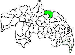 Mandal map of Guntur district showing Amaravathi mandal (in green) | |
 Amaravathi mandal Location in Andhra Pradesh, India | |
| Coordinates: 16°34′22″N 80°21′27″E | |
| Country | India |
| State | Andhra Pradesh |
| District | Palnadu |
| Headquarters | Amaravathi |
| Mandal Parishad villages | 17 |
| Government | |
| • Type | Panchayati raj (Block level) |
| • Body | Amaravathi Mandal Parishad |
| • President (MPP) | Melaka Hanumantha Rao |
| • MPDO | P.Madhuri |
| • Tehsildar | G.Vijaya |
| Area | |
| • Total | 202.79 km2 (78.30 sq mi) |
| Population (2011)[1] | |
| • Total | 66,277 |
| • Density | 330/km2 (850/sq mi) |
| Time zone | UTC+5:30 (IST) |
Demographics
As of 2011[update] census, the mandal had a population of 66,277. The total population constitute, 32,709 males and 33,568 females —a sex ratio of 1026 females per 1000 males. 6,894 children are in the age group of 0–6 years, of which 3,450 are boys and 3,444 are girls. The average literacy rate stands at 48.45% with 37,507 literates.[3]
Places adjacent to Amaravathi mandal, Andhra Pradesh | ||||||||||||||||
|---|---|---|---|---|---|---|---|---|---|---|---|---|---|---|---|---|
| ||||||||||||||||
Government and politics
Administration
The mandal forms a part of the Andhra Pradesh Capital Region, under the jurisdiction of APCRDA.[4] The present Mandal Praja Parishad (MPP) is Mekala Hanumatha Rao,[5] MPDO is P.Madhuri and the tahsildar is G.Vijaya. As of 2011[update] census, the mandal has seventeen villages.[1]
The settlements in the mandal are listed below:
- Amaravathi†
- Attalur
- Dharanikota
- Didugu
- Endroyi
- Jupudi
- Karlapudi
- Lingapuram
Muttayapalem
- Malladi
- Munugodu
- Narukullapadu
- Nemalikallu
- Pedda Madduru
- Pondugala
- Unguturu
- Vykuntapuram
- Enikapadu
†−Mandal headquarters
Politics
Amaravathi mandal is one of the 5 mandals under Pedakurapadu (Assembly constituency), which in turn represents Narasaraopet (Lok Sabha constituency) of Andhra Pradesh.[6]
See also
- List of mandals in Andhra Pradesh
- List of villages in Guntur district
References
- "District Census Hand Book : Guntur (Part B)" (PDF). Census of India. Directorate of Census Operations, Andhra Pradesh. 2011. pp. 14, 252. Retrieved 1 June 2019.
- "District Census Handbook : Guntur" (PDF). Census of India. Directorate of Census Operations, Andhra Pradesh. 2011. pp. 5, 328–329. Retrieved 3 June 2019.
- "Census 2011". The Registrar General & Census Commissioner, India. Retrieved 12 October 2014.
- "District wise mandals and villages covered in Krishna and Guntur districts" (PDF). Andhra Pradesh Capital Region Development Authority. Government of Andhra Pradesh. Archived from the original (PDF) on 23 September 2015. Retrieved 23 September 2015.
- "MPP Presidents of Guntur District".
- "Delimitation of Parliamentary and Assembly Constituencies Order, 2008" (pdf). Election Commission of India. p. 22. Retrieved 11 October 2014.
External links
Другой контент может иметь иную лицензию. Перед использованием материалов сайта WikiSort.org внимательно изучите правила лицензирования конкретных элементов наполнения сайта.
WikiSort.org - проект по пересортировке и дополнению контента Википедии