world.wikisort.org - Allemagne
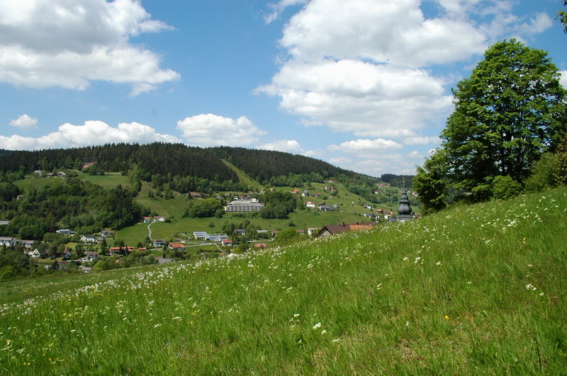
Warmensteinach est une commune de Bavière (Allemagne), située dans l'arrondissement de Bayreuth, dans le district de Haute-Franconie.
 Portail de la Bavière
Cet article est une ébauche concernant une localité allemande.
Vous pouvez partager vos connaissances en l’améliorant (comment ?) selon les recommandations des projets correspondants.
| Warmensteinach | |||
| |||
 Armoiries |
|||
| Administration | |||
|---|---|---|---|
| Pays | |||
| Land | |||
| District (Regierungsbezirk) |
Haute-Franconie | ||
| Arrondissement (Landkreis) |
Bayreuth | ||
| Code postal | 95485 | ||
| Indicatif téléphonique | 09277 | ||
| Immatriculation | BT | ||
| Démographie | |||
| Population | 2 245 hab. () | ||
| Densité | 128 hab./km2 | ||
| Géographie | |||
| Coordonnées | 49° 59′ 30″ nord, 11° 46′ 37″ est | ||
| Altitude | 628 m |
||
| Superficie | 1 753 ha = 17,53 km2 | ||
| Localisation | |||
| Géolocalisation sur la carte : Bavière
Géolocalisation sur la carte : Allemagne
| |||
| Liens | |||
| Site web | www.gemeinde.warmensteinach.de | ||
| modifier |
|||


На других языках
[de] Warmensteinach
Warmensteinach ist eine Gemeinde im oberfränkischen Landkreis Bayreuth. Der Luftkurort liegt etwa 15 Kilometer östlich von Bayreuth im Fichtelgebirge. Der gleichnamige Hauptort ist Sitz der Gemeindeverwaltung.[en] Warmensteinach
Warmensteinach is a municipality in the district of Bayreuth in Bavaria in Germany. From here there is a chairlift, the Ochsenkopf South Chairlift, to the summit of the Ochsenkopf, the second highest mountain in the Fichtelgebirge.- [fr] Warmensteinach
[ru] Варменштайнах
Варменштайнах (нем. Warmensteinach) — община в Германии, в Республике Бавария[1].Текст в блоке "Читать" взят с сайта "Википедия" и доступен по лицензии Creative Commons Attribution-ShareAlike; в отдельных случаях могут действовать дополнительные условия.
Другой контент может иметь иную лицензию. Перед использованием материалов сайта WikiSort.org внимательно изучите правила лицензирования конкретных элементов наполнения сайта.
Другой контент может иметь иную лицензию. Перед использованием материалов сайта WikiSort.org внимательно изучите правила лицензирования конкретных элементов наполнения сайта.
2019-2026
WikiSort.org - проект по пересортировке и дополнению контента Википедии
WikiSort.org - проект по пересортировке и дополнению контента Википедии