world.wikisort.org - Germany
Woltersdorf is a municipality in the district Lüchow-Dannenberg, in Lower Saxony, Germany.
This article needs additional citations for verification. (June 2007) |
Woltersdorf | |
|---|---|
Municipality | |
 Coat of arms | |
Location of Woltersdorf within Lüchow-Dannenberg district 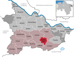 | |
 Woltersdorf  Woltersdorf | |
| Coordinates: 52°57′N 11°13′E | |
| Country | Germany |
| State | Lower Saxony |
| District | Lüchow-Dannenberg |
| Municipal assoc. | Lüchow (Wendland) |
| Subdivisions | 4 Ortsteile |
| Government | |
| • Mayor | Claudia Hennings (CDU) |
| Area | |
| • Total | 27.97 km2 (10.80 sq mi) |
| Elevation | 31 m (102 ft) |
| Population (2020-12-31)[1] | |
| • Total | 899 |
| • Density | 32/km2 (83/sq mi) |
| Time zone | UTC+01:00 (CET) |
| • Summer (DST) | UTC+02:00 (CEST) |
| Postal codes | 29497 |
| Dialling codes | 05841 |
| Vehicle registration | DAN |
The municipality Woltersdorf includes the villages Woltersdorf, Klein Breese, Lichtenberg and Thurau.
Famous sites around Woltersdorf are the Brautstein ("stone of the bride") and the Feldkirche ("church on the field"). Both of them can be seen in the coat of arms of Woltersdorf. Former is a formation of ancient boulders left there by glaciers in the ice-age and has a legend to it, latter has a little stone in its walls which was taken from the Slavic population and was built into the church. The stone shows a face that the Slavic population obviously prayed to. The Christians built it into their church to show their superiority.
References
Towns and municipalities in Lüchow-Dannenberg (district) | ||
|---|---|---|
 | ||
| Unincorporated areas |
| |
Authority control | |
|---|---|
| General |
|
| National libraries | |
This Lüchow-Dannenberg location article is a stub. You can help Wikipedia by expanding it. |
На других языках
- [en] Woltersdorf, Lower Saxony
[ru] Вольтерсдорф (Вендланд)
Вольтерсдорф (нем. Woltersdorf) — коммуна в Германии, в земле Нижняя Саксония.Другой контент может иметь иную лицензию. Перед использованием материалов сайта WikiSort.org внимательно изучите правила лицензирования конкретных элементов наполнения сайта.
WikiSort.org - проект по пересортировке и дополнению контента Википедии