world.wikisort.org - Germany
Töpen is a municipality in Upper Franconia in the district of Hof in Bavaria in Germany.
Töpen | |
|---|---|
Municipality | |
 Kupferbach in Töpen | |
 Coat of arms | |
Location of Töpen within Hof district 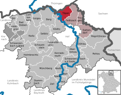 | |
 Töpen  Töpen | |
| Coordinates: 50°23′25″N 11°52′19″E | |
| Country | Germany |
| State | Bavaria |
| Admin. region | Oberfranken |
| District | Hof |
| Municipal assoc. | Feilitzsch |
| Subdivisions | 6 Ortsteile |
| Government | |
| • Mayor (2020–26) | Alexander Kätzel[1] (CSU) |
| Area | |
| • Total | 20.80 km2 (8.03 sq mi) |
| Elevation | 516 m (1,693 ft) |
| Population (2020-12-31)[2] | |
| • Total | 1,023 |
| • Density | 49/km2 (130/sq mi) |
| Time zone | UTC+01:00 (CET) |
| • Summer (DST) | UTC+02:00 (CEST) |
| Postal codes | 95183 |
| Dialling codes | 09295 |
| Vehicle registration | HO |
| Website | Official website |
History
Between 1945 and 1966 Töpen served as West German inner German border crossing for cars travelling between the Soviet Zone of occupation in Germany (till 1949, thereafter the East German Democratic Republic), or West Berlin and the American zone of occupation (till 1949) and thereafter the West German Federal Republic of Germany. The traffic was subject to the Interzonal traffic regulations, that between West Germany and West Berlin followed the special regulations of the Transit Agreement (1972). In 1966 the border crossing was closed in favour of a new crossing in Rudolphstein, a component of Berg in Upper Franconia.
See also
References
- Liste der ersten Bürgermeister/Oberbürgermeister in kreisangehörigen Gemeinden, Bayerisches Landesamt für Statistik, 15 July 2021.
- "Tabellenblatt "Daten 2", Statistischer Bericht A1200C 202041 Einwohnerzahlen der Gemeinden, Kreise und Regierungsbezirke". Bayerisches Landesamt für Statistik (in German). June 2021.
External links
![]() Media related to Töpen at Wikimedia Commons
Media related to Töpen at Wikimedia Commons
Towns and municipalities in Hof (district) | ||
|---|---|---|
|  | |
Authority control | |
|---|---|
| General |
|
| National libraries | |
This Hof district location article is a stub. You can help Wikipedia by expanding it. |
На других языках
- [en] Töpen
[ru] Тёпен
Тёпен (нем. Töpen) — коммуна в Германии, в земле Бавария.Другой контент может иметь иную лицензию. Перед использованием материалов сайта WikiSort.org внимательно изучите правила лицензирования конкретных элементов наполнения сайта.
WikiSort.org - проект по пересортировке и дополнению контента Википедии