world.wikisort.org - Germany
Stepenitztal is a municipality in the Nordwestmecklenburg district, in Mecklenburg-Vorpommern, Germany. It takes its name from the river Stepenitz. It was formed on 25 May 2014 by the merger of the former municipalities Börzow, Mallentin and Papenhusen.
Stepenitztal | |
|---|---|
Municipality | |
Location of Stepenitztal within Nordwestmecklenburg district 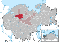 | |
 Stepenitztal  Stepenitztal | |
| Coordinates: 53°52′N 11°05′E | |
| Country | Germany |
| State | Mecklenburg-Vorpommern |
| District | Nordwestmecklenburg |
| Municipal assoc. | Grevesmühlen-Land |
| Area | |
| • Total | 45.03 km2 (17.39 sq mi) |
| Elevation | 29 m (95 ft) |
| Population (2020-12-31)[1] | |
| • Total | 1,707 |
| • Density | 38/km2 (98/sq mi) |
| Time zone | UTC+01:00 (CET) |
| • Summer (DST) | UTC+02:00 (CEST) |
| Postal codes | 23936, 23923 |
| Dialling codes | 038824, 03881 |
| Vehicle registration | NWM |
| Website | www.grevesmuehlen.de |
References
- "Statistisches Amt M-V – Bevölkerungsstand der Kreise, Ämter und Gemeinden 2020". Statistisches Amt Mecklenburg-Vorpommern (in German). July 2021.

This Nordwestmecklenburg location article is a stub. You can help Wikipedia by expanding it. |
Текст в блоке "Читать" взят с сайта "Википедия" и доступен по лицензии Creative Commons Attribution-ShareAlike; в отдельных случаях могут действовать дополнительные условия.
Другой контент может иметь иную лицензию. Перед использованием материалов сайта WikiSort.org внимательно изучите правила лицензирования конкретных элементов наполнения сайта.
Другой контент может иметь иную лицензию. Перед использованием материалов сайта WikiSort.org внимательно изучите правила лицензирования конкретных элементов наполнения сайта.
2019-2026
WikiSort.org - проект по пересортировке и дополнению контента Википедии
WikiSort.org - проект по пересортировке и дополнению контента Википедии