world.wikisort.org - Germany
Staufenberg is the southernmost municipality of the district of Göttingen, and of Lower Saxony, Germany. It is situated east of the river Fulda, approx. 6 km south of Hannoversch Münden, and 12 km northeast of Kassel. Its seat is in the village Landwehrhagen.
Staufenberg | |
|---|---|
Municipality | |
 | |
 Coat of arms | |
Location of Staufenberg within Göttingen district 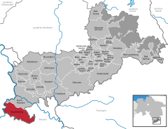 | |
 Staufenberg  Staufenberg | |
| Coordinates: 51°21′00″N 09°35′59″E | |
| Country | Germany |
| State | Lower Saxony |
| District | Göttingen |
| Government | |
| • Mayor (2021–26) | Bernd Grebenstein[1] |
| Area | |
| • Total | 77.55 km2 (29.94 sq mi) |
| Elevation | 288 m (945 ft) |
| Population (2020-12-31)[2] | |
| • Total | 7,724 |
| • Density | 100/km2 (260/sq mi) |
| Time zone | UTC+01:00 (CET) |
| • Summer (DST) | UTC+02:00 (CEST) |
| Postal codes | 34355 |
| Dialling codes | 05543 |
| Vehicle registration | GÖ |
| Website | www.staufenberg-nds.de |
Points of interest
- Arboretum Habichtsborn
References
- "Direktwahlen in Niedersachsen vom 12. September 2021" (PDF). Landesamt für Statistik Niedersachsen. 13 October 2021.
- Landesamt für Statistik Niedersachsen, LSN-Online Regionaldatenbank, Tabelle A100001G: Fortschreibung des Bevölkerungsstandes, Stand 31. Dezember 2020.

This Göttingen district location article is a stub. You can help Wikipedia by expanding it. |
На других языках
[de] Staufenberg (Niedersachsen)
Staufenberg ist eine Gemeinde im Landkreis Göttingen. Sie ist die südlichste Gemeinde in Niedersachsen.- [en] Staufenberg, Lower Saxony
[ru] Штауфенберг (Нижняя Саксония)
Штауфенберг (нем. Staufenberg) — коммуна в Германии, в земле Нижняя Саксония.Текст в блоке "Читать" взят с сайта "Википедия" и доступен по лицензии Creative Commons Attribution-ShareAlike; в отдельных случаях могут действовать дополнительные условия.
Другой контент может иметь иную лицензию. Перед использованием материалов сайта WikiSort.org внимательно изучите правила лицензирования конкретных элементов наполнения сайта.
Другой контент может иметь иную лицензию. Перед использованием материалов сайта WikiSort.org внимательно изучите правила лицензирования конкретных элементов наполнения сайта.
2019-2026
WikiSort.org - проект по пересортировке и дополнению контента Википедии
WikiSort.org - проект по пересортировке и дополнению контента Википедии