world.wikisort.org - Germany
Schladt is an Ortsgemeinde – a municipality belonging to a Verbandsgemeinde, a kind of collective municipality – in the Bernkastel-Wittlich district in Rhineland-Palatinate, Germany.
Schladt | |
|---|---|
Municipality | |
 Coat of arms | |
Location of Schladt within Bernkastel-Wittlich district 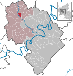 | |
 Schladt  Schladt | |
| Coordinates: 50°01′56″N 6°50′30″E | |
| Country | Germany |
| State | Rhineland-Palatinate |
| District | Bernkastel-Wittlich |
| Municipal assoc. | Wittlich-Land |
| Government | |
| • Mayor (2019–24) | Rainer Ernst[1] |
| Area | |
| • Total | 4.96 km2 (1.92 sq mi) |
| Elevation | 330 m (1,080 ft) |
| Population (2020-12-31)[2] | |
| • Total | 143 |
| • Density | 29/km2 (75/sq mi) |
| Time zone | UTC+01:00 (CET) |
| • Summer (DST) | UTC+02:00 (CEST) |
| Postal codes | 54534 |
| Dialling codes | 06575 |
| Vehicle registration | WIL |
Geography
Location
The municipality lies in the Eifel east of the river Lieser in a stretch of countryside known as the “Schladt Switzerland” (Schladter Schweiz). The nearest major town is Wittlich, some 6 km away. Schladt belongs to the Verbandsgemeinde Wittlich-Land.
Neighbouring municipalities
Schladt's neighbours are Gipperath, Plein, Minderlittgen, Großlittgen and Karl.
History
Beginning in 1794, Schladt lay under French rule. In 1814 it was assigned to the Kingdom of Prussia at the Congress of Vienna. Since 1947, it has been part of the then newly founded state of Rhineland-Palatinate.
Politics
Municipal council
The council is made up of 6 council members, who were elected by majority vote at the municipal election held on 7 June 2009, and the honorary mayor as chairman.[3]
Coat of arms
The German blazon reads: Gespalten von Gold und Silber durch eine eingebogene blaue Spitze, darin zwei gekreuzte goldene Kerzen, rechts ein roter Sparrenbalken, links eine schwarze Lilie.
The municipality's arms might in English heraldic language be described thus: Tierced in mantle, dexter Or a fess dancetty gules, sinister argent a fleur-de-lis sable, and in base azure two candles in saltire of the first, lit with fire of the third.
The crossed candles are one of Saint Blaise’s attributes and thus represent him, the church’s and the village’s longtime patron saint. The zigzag stripe (“fess dancetty”) seen on the dexter (armsbearer's right, viewer's left) side is the armorial charge once borne by the Lords of Manderscheid, who were Schladt's landholders until feudalism finally ended in the region. Before them came the Abbey of Echternach, which held Schladt until the mid 14th century, and whose armorial bearing was the black lily now seen on the sinister (armsbearer's left, viewer's right) side of the municipality's arms.[4]
Culture and sightseeing
- 600-year-old village oak with girth of 5.20 m
- Chapel in the village centre
Economy and infrastructure
To the south runs the Autobahn A 60, and to the east the A 1. In Wittlich is a railway station on the Koblenz-Trier railway line.
References
- Direktwahlen 2019, Landkreis Bernkastel-Wittlich, Landeswahlleiter Rheinland-Pfalz, accessed 6 August 2021.
- "Bevölkerungsstand 2020, Kreise, Gemeinden, Verbandsgemeinden". Statistisches Landesamt Rheinland-Pfalz (in German). 2021.
- Kommunalwahl Rheinland-Pfalz 2009, Gemeinderat
- Description and explanation of Schladt’s arms
External links
- Verbandsgemeinde of Manderscheid (in German)

| Authority control |
|
|---|
This Bernkastel-Wittlich location article is a stub. You can help Wikipedia by expanding it. |
На других языках
- [en] Schladt
[ru] Шладт
Шладт (нем. Schladt) — коммуна в Германии, в земле Рейнланд-Пфальц.Другой контент может иметь иную лицензию. Перед использованием материалов сайта WikiSort.org внимательно изучите правила лицензирования конкретных элементов наполнения сайта.
WikiSort.org - проект по пересортировке и дополнению контента Википедии