world.wikisort.org - Germany
Rohr is a municipality in the Schmalkalden-Meiningen district in Thuringia.
Rohr | |
|---|---|
Municipality | |
 | |
 Coat of arms | |
Location of Rohr within Schmalkalden-Meiningen district 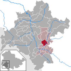 | |
 Rohr  Rohr | |
| Coordinates: 50°35′N 10°30′E | |
| Country | Germany |
| State | Thuringia |
| District | Schmalkalden-Meiningen |
| Municipal assoc. | Dolmar-Salzbrücke |
| Government | |
| • Mayor (2022–28) | Siegmar Kleffel[1] (CDU) |
| Area | |
| • Total | 13.96 km2 (5.39 sq mi) |
| Elevation | 340 m (1,120 ft) |
| Population (2020-12-31)[2] | |
| • Total | 921 |
| • Density | 66/km2 (170/sq mi) |
| Time zone | UTC+01:00 (CET) |
| • Summer (DST) | UTC+02:00 (CEST) |
| Postal codes | 98530 |
| Dialling codes | 036844 |
| Vehicle registration | SM |
| Website | www.vg-dolmar.de |
History
Rohr was first mentioned in 815. A Benedictine monastery was established in the 9th century and a Carolingian church, St. Michaels, was built. The monastery lasted for about 100 years but the church survives today. In 1206 a Benedictine convent was established outside of town. The convent was closely associated with the House of Henneberg and to a lesser degree with the Bibra family especially in the 14th century. Kloster Rohr was abandoned after reformation and is now a technical school. The shell of the former church was renovated into a modern building in the 2000s.
Population history
| Year | Population | Year | Population | Year | Population |
|---|---|---|---|---|---|
| 1994 | 986 | 1998 | 1,085 | 2002 | 1,062 |
| 1995 | 1,032 | 1999 | 1,084 | 2003 | 1,062 |
| 1996 | 1,050 | 2000 | 1,089 | 2004 | 1046 |
| 1997 | 1,080 | 2001 | 1,077 |
References
- Gewählte Bürgermeister - aktuelle Landesübersicht, Freistaat Thüringen, accessed 10 November 2022.
- "Bevölkerung der Gemeinden, erfüllenden Gemeinden und Verwaltungsgemeinschaften in Thüringen Gebietsstand: 31.12.2020". Thüringer Landesamt für Statistik (in German). June 2021.
- WERNER WAGENHÖFER, Grablegen des Niederadels im Spätmittelalterlichen Franken - das Beispiel der Bibra, Wirtschaft - Gesellschaft - Mentalitäten im Mittelalter, Festschrift zum 75. Geburtstag von Rolf Sprandel, Franz Steiner Verlag, Stuttgart, 2006 ISBN 3-515-08882-2, ISBN 978-3-515-08882-4, Pages.335-359.
External links
- History of Rohr (in German)
- Kirchenburg Rohr
- Michaeliskirche in Rohr
- "Haselbrücke (historic stone arch bridge)". brueckenweb.de (in German).
- Kloster History (in German)
- BTZ Technical School at former Kloster Rohr
| Authority control: National libraries |
|---|
This Schmalkalden-Meiningen location article is a stub. You can help Wikipedia by expanding it. |
На других языках
[de] Rohr (Thüringen)
Rohr ist eine Gemeinde im Landkreis Schmalkalden-Meiningen in Thüringen. Die Gemeinde gehört zur Verwaltungsgemeinschaft Dolmar-Salzbrücke.- [en] Rohr, Thuringia
[ru] Рор (Тюрингия)
Рор (нем. Rohr) — коммуна в Германии, в земле Тюрингия.Текст в блоке "Читать" взят с сайта "Википедия" и доступен по лицензии Creative Commons Attribution-ShareAlike; в отдельных случаях могут действовать дополнительные условия.
Другой контент может иметь иную лицензию. Перед использованием материалов сайта WikiSort.org внимательно изучите правила лицензирования конкретных элементов наполнения сайта.
Другой контент может иметь иную лицензию. Перед использованием материалов сайта WikiSort.org внимательно изучите правила лицензирования конкретных элементов наполнения сайта.
2019-2026
WikiSort.org - проект по пересортировке и дополнению контента Википедии
WikiSort.org - проект по пересортировке и дополнению контента Википедии