world.wikisort.org - Germany
Grabfeld is a municipality in the district Schmalkalden-Meiningen, in Thuringia, Germany.
Grabfeld | |
|---|---|
Municipality | |
 Coat of arms | |
Location of Grabfeld within Schmalkalden-Meiningen district 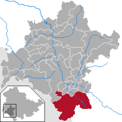 | |
 Grabfeld  Grabfeld | |
| Coordinates: 50°27′N 10°26′E | |
| Country | Germany |
| State | Thuringia |
| District | Schmalkalden-Meiningen |
| Subdivisions | 13 |
| Area | |
| • Total | 121.08 km2 (46.75 sq mi) |
| Elevation | 360 m (1,180 ft) |
| Population (2020-12-31)[1] | |
| • Total | 5,618 |
| • Density | 46/km2 (120/sq mi) |
| Time zone | UTC+01:00 (CET) |
| • Summer (DST) | UTC+02:00 (CEST) |
| Postal codes | 98631 |
| Dialling codes | 036944, 036947 |
| Vehicle registration | SM |
| Website | www |

Grabfeld was established as a municipality on December 1, 2007 by combining the former municipalities of Behrungen, Berkach, Bibra, Exdorf, Jüchsen, Nordheim, Queienfeld, Rentwertshausen, Schwickershausen and Wolfmannshausen, replacing the former Verwaltungsgemeinschaft of the same name. It was joined by the former municipality Bauerbach in January 2012, and by Wölfershausen in January 2019.
History
Within the German Empire (1871–1918), the territory of the present-day municipality of Grabfeld was part of the Duchy of Saxe-Meiningen.
References
- "Bevölkerung der Gemeinden, erfüllenden Gemeinden und Verwaltungsgemeinschaften in Thüringen Gebietsstand: 31.12.2020". Thüringer Landesamt für Statistik (in German). June 2021.
Towns and municipalities in Schmalkalden-Meiningen | ||
|---|---|---|
| ||
This Schmalkalden-Meiningen location article is a stub. You can help Wikipedia by expanding it. |
Текст в блоке "Читать" взят с сайта "Википедия" и доступен по лицензии Creative Commons Attribution-ShareAlike; в отдельных случаях могут действовать дополнительные условия.
Другой контент может иметь иную лицензию. Перед использованием материалов сайта WikiSort.org внимательно изучите правила лицензирования конкретных элементов наполнения сайта.
Другой контент может иметь иную лицензию. Перед использованием материалов сайта WikiSort.org внимательно изучите правила лицензирования конкретных элементов наполнения сайта.
2019-2026
WikiSort.org - проект по пересортировке и дополнению контента Википедии
WikiSort.org - проект по пересортировке и дополнению контента Википедии