world.wikisort.org - Germany
Lich is a town in the district of Gießen, in Hesse, Germany. It is situated 12 km southeast of Gießen. Lich has a population of around 13,000.
Lich | |
|---|---|
Town | |
 Late medieval framework buildinga in Oberstadt road | |
 Coat of arms | |
Location of Lich within Gießen district  | |
 Lich  Lich | |
| Coordinates: 50°31′18″N 8°49′15″E | |
| Country | Germany |
| State | Hesse |
| Admin. region | Gießen |
| District | Gießen |
| Subdivisions | 9 Stadtbezirke |
| Government | |
| • Mayor (2019–25) | Julien Neubert[1] |
| Area | |
| • Total | 77.64 km2 (29.98 sq mi) |
| Elevation | 177 m (581 ft) |
| Population (2020-12-31)[2] | |
| • Total | 13,880 |
| • Density | 180/km2 (460/sq mi) |
| Time zone | UTC+01:00 (CET) |
| • Summer (DST) | UTC+02:00 (CEST) |
| Postal codes | 35423 |
| Dialling codes | 06404, 06004 |
| Vehicle registration | GI |
| Website | www.lich.de |
Geography
Location
The town is located on the river Wetter halfway between Taunus and Vogelsberg; the northern and eastern parts of the town reside within the natural area of the Vogelsberg, the southern and western in the Wetterau.
Constituent communities
Besides the main town, which bears the same name as the whole municipality, the following surrounding communities belong to Lich since the Gebietsreformen (administrative reorganization) of the 1970s:
|
|
History


The region is known to have been settled for more than 100,000 years. Tools found in several places in and around Lich were dated to the Neanderthal period, others to the Aurignacian culture, Linear Pottery culture, the Bronze Age, the Hallstatt culture and the La Tène culture.
When building the Upper Germanic limes during the reign of the Roman Emperor Domitian the Romans built the Castrum Arnsburg, located near what is now Arnsburg Abbey. It is the most northeastern known full-sized castrum along the limes.
The first known mentioning of Lich dates back to 790 in the Lorsch codex. In 1300 the town was awarded market rights by Emperor Albert I of Germany. Originally belonging to the County of Hagen-Münzenberg it became the property of the Counts of Falkenstein following the marriage of Isengard of Münzenberg to Philip IV of Bolanden-Falkenstein. As an inheritance Lich was given to the House of Solms in the middle of the 14th century. The House of Solms split into several branches over the centuries – one of them the branch Solms-Hohensolms-Lich, which retains its seat in Lich.
There was no significant destruction in Lich during several wars from Thirty Years' War up to World War II. In 1993, the town hosted the 33rd Hessentag state festival.
Governance
Town twinning
Lich is twinned with the following communities:
- Dieulefit in France
- Tangermünde in Saxony-Anhalt, Germany
- Budakeszi in Hungary
- Vänersborg in Sweden
It is also associated with:
- Tata in Morocco
Landmarks
- Town centre, made up largely of half-timbered buildings. The most notable is the Textorhaus with its richly carved façade, today hosting the town museum.
- Late Gothic Marienstiftskirche (St Mary's collegiate church) with grave plates and a Baroque pulpit.
- Some parts of the town wall remain. Of the former fortifications the Town Tower (height 48 meters) and the Town Gate are still extant, built at the beginning of the 14th century.
- Castle Lich of the Fürsten (Princes) of Solms-Hohensolms-Lich in late Renaissance and Baroque style, surrounded by a public park.
- Former Cistercian Arnsburg Abbey, about five kilometers southwest of Lich.
- Ober-Bessingen has one of the few remaining Gatehouses.
- Kino Traumstern (cinema) is one of the leading arthouse cinemas of Hesse; it has received several Hessian and German cultural prices over the years.
Education
There are three elementary schools, a comprehensive school, a special school for children with learning disabilities and a nursing school associated to the Asklepios Klinik Lich. The Gießen district Volkshochschule is also located in Lich.
Economy
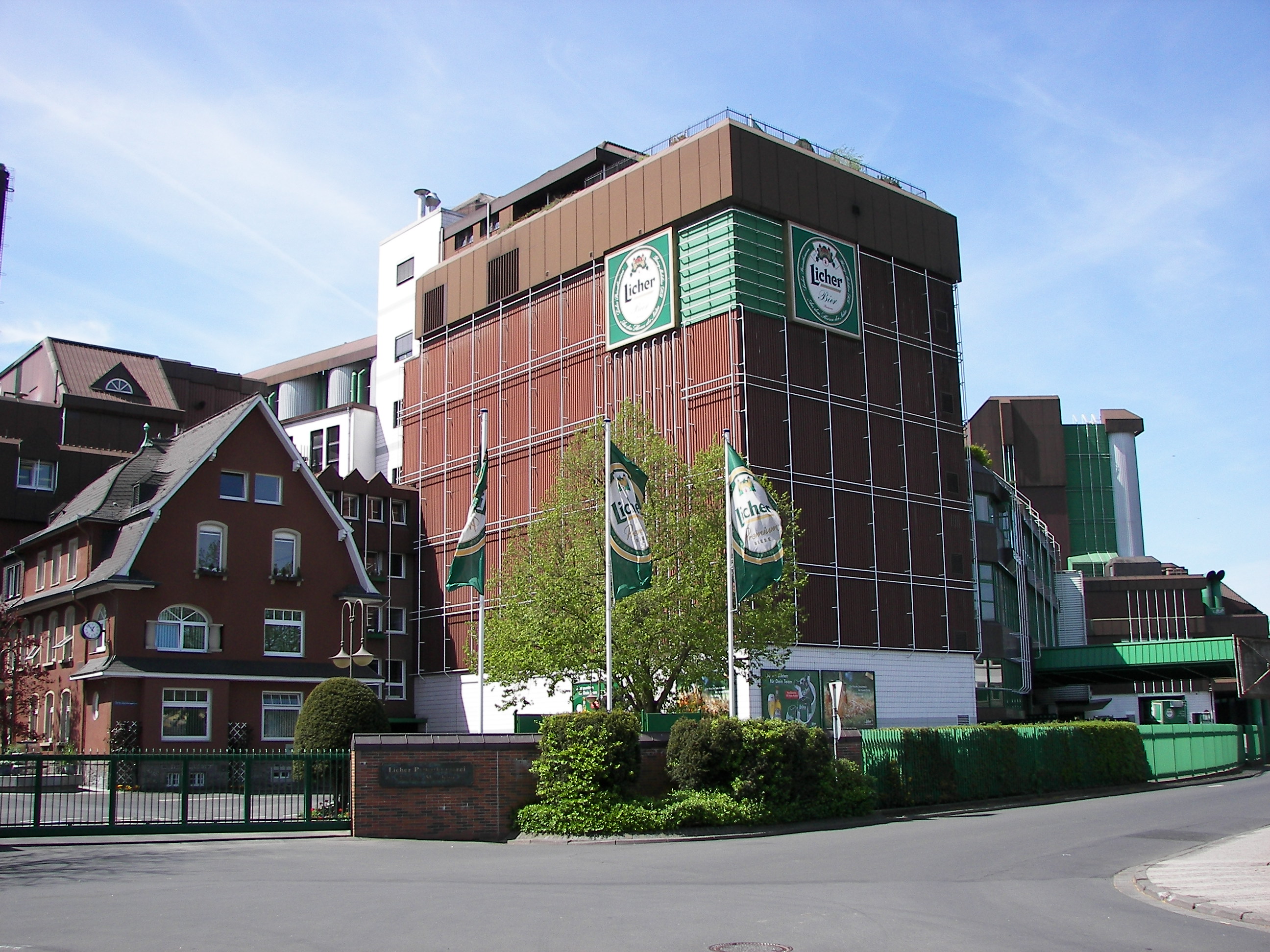
Lich is the home of the brewery and leading regional brand Licher (part of Bitburger Holding). The town also has more than 400 years of tradition in organ building, today represented by the Förster & Nicolaus Orgelbauanstalt and the Otto Heuss GmbH. The Hofapotheke (Court Pharmacy) was founded in 1703.
Gallery
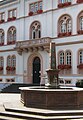 Town hall and market fountain
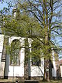 The Marienstiftskirche
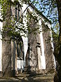 The Marienstiftskirche
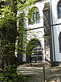 Main portal of the Marienstiftskirche
 The town tower.
 Inner court of Lich Castle and Ludwig Fürst zu Solms-Hohensolms-Lich monument
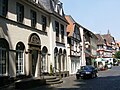 The Court pharmacy
 Birklar, former school building
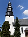 Eberstadt, Lutheran church
 Eberstadt, Roman Catholic church St Maria Immaculata
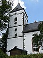 Nieder-Bessingen, Lutheran church
 Ober-Bessingen, gate house
 Ober-Bessingen in winter


Notable people
Notable people born in Lich
- Ludwig zu Solms-Hohensolms-Lich (1805–1880), politician, President of the First Chamber of the Grand Duchy of Hesse and Deputy of the North German Confederation
- Heinrich Adam Neeb (1805–1878), composer
- Charles of Solms-Hohensolms-Lich (1866–1920), politician, president of the First Chamber of the Estates of the Grand Duchy of Hesse
- Princess Eleonore of Solms-Hohensolms-Lich (1871–1937), wife of Ernest Ludwig, Grand Duke of Hesse and mother-in-law to the Duke of Edinburgh's sister Princess Cecilie of Greece and Denmark
- Dorothea Gräfin Razumovsky (1935–2014), publicist
- Wilhelm Solms (b. 1937), Germanist, professor of communication studies
- Hermann Otto Solms (b. 1940), politician (FDP), up to 22 October 2013 Vice President of the Deutscher Bundestag.
- Alexandra Keil (b. 1978), former member of the German Women's National Basketball Team
- Stefan Koch (b. 1964), Germany's 2000 and 2005 Basketball Bundesliga Coach of the Year
- Benjamin Lense (b. 1978), footballer in the German Bundesliga
- Aylin Aslım (b. 1975), rock singer and actor
Notable people connected to Lich
- Daniel Hisgen (1733–1812), painter of the Rococo period
- Hermann of Solms-Hohensolms-Lich (1838–1899), politician
- Ernst Moritz Engert (1892–1986), silhouette artist and co-founder of the Darmstädter Sezession
- Anne-Eva Brauneck (1910–2007), first female German criminal law professor
- Joachim Dudeck (1932–2010), professor of health informatics and founder of the German Cancer Registry
- Karl Starzacher (b. 1945), politician of the SPD, 1991–1995 President of the Landtag of Hesse and Finance Minister from 1995 to 1999
- Thorsten Schäfer-Gümbel (b. 1969), politician (SPD), current leader of the opposition SPD party bloc in the Landtag of Hesse
- Markus Wach, musician.
References
- Direkt gewählte (Ober-) Bürgermeister/-innen der hessischen Städte und Gemeinden, accessed 6 July 2021.
- "Bevölkerung in Hessen am 31.12.2020 nach Gemeinden". Hessisches Statistisches Landesamt (in German). June 2021.
External links
- Municipal website
- Lich at Curlie
Towns and municipalities in Giessen district | ||
|---|---|---|
 | ||
На других языках
[de] Lich
Lich ist eine Stadt im mittelhessischen Landkreis Gießen, 15 Kilometer südöstlich der Universitätsstadt Gießen.- [en] Lich, Hesse
[ru] Лих
Лих (нем. Lich) — город в Германии, расположен на реке Веттер в земле Гессен в 15 километрах юго-восточнее университетского города Гиссен. Подчинён административному округу Гиссен. Входит в состав района Гиссен. Население составляет 13 349[1] человек (на 30 июня 2009 года). Занимает площадь 77,64 км². Официальный код — 06 5 31 011.Другой контент может иметь иную лицензию. Перед использованием материалов сайта WikiSort.org внимательно изучите правила лицензирования конкретных элементов наполнения сайта.
WikiSort.org - проект по пересортировке и дополнению контента Википедии