world.wikisort.org - Germany
Lehesten is a town in the Thuringian Forest, 20 km southeast of Saalfeld.
Lehesten | |
|---|---|
Town | |
 Coat of arms | |
Location of Lehesten within Saalfeld-Rudolstadt district 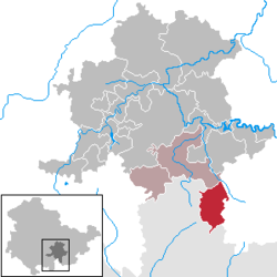 | |
 Lehesten  Lehesten | |
| Coordinates: 50°28′32″N 11°26′53″E | |
| Country | Germany |
| State | Thuringia |
| District | Saalfeld-Rudolstadt |
| Municipal assoc. | Schiefergebirge |
| Subdivisions | 3 |
| Government | |
| • Mayor (2016–22) | René Bredow[1] |
| Area | |
| • Total | 35.96 km2 (13.88 sq mi) |
| Elevation | 640 m (2,100 ft) |
| Population (2020-12-31)[2] | |
| • Total | 1,643 |
| • Density | 46/km2 (120/sq mi) |
| Time zone | UTC+01:00 (CET) |
| • Summer (DST) | UTC+02:00 (CEST) |
| Postal codes | 07349 |
| Dialling codes | 036653 |
| Vehicle registration | SLF |
| Website | www.lehesten.de |
World War II V-2 facility
After an August 1944 explosion at the Redl-Zipf V-2 liquid oxygen plant at Schlier stopped production, the third V-2 liquid oxygen plant (5000 tons/month)[3] was built at a slate quarry at Lehesten at the Thuringia-Bavarian border[4] near Nordhausen (acceptance testing of combustion chamber was also performed at the Lehesten plant).[3] Dr Martin Schilling (the head of testing at Peenemünde)[5] located the Lehesten site,[3] and 400 engineers were moved from Peenemünde to Lehesten, which eventually had 16 liquid oxygen production plants.[6]
References
- Gewählte Bürgermeister - aktuelle Landesübersicht, Freistaat Thüringen, accessed 13 July 2021.
- "Bevölkerung der Gemeinden, erfüllenden Gemeinden und Verwaltungsgemeinschaften in Thüringen Gebietsstand: 31.12.2020". Thüringer Landesamt für Statistik (in German). June 2021.
- Ordway, Frederick I, III; Sharpe, Mitchell R (1979). The Rocket Team. Apogee Books Space Series 36. New York: Thomas Y. Crowell. p. 99. ISBN 1-894959-00-0.
- Neufeld, Michael J (1995). The Rocket and the Reich: Peenemünde and the Coming of the Ballistic Missile Era. New York: The Free Press. p. 207. ISBN 9780029228951.
- McGovern, J (1964). Crossbow and Overcast. New York: W. Morrow. p. 198.
- Heike, Hasenaur (October 2008). "Space Pioneers" (pdf). United States Army. p. 6. Retrieved 2008-10-22.
Towns and municipalities in Saalfeld-Rudolstadt | ||
|---|---|---|
 | ||
| Authority control: National libraries |
|---|
This Saalfeld-Rudolstadt location article is a stub. You can help Wikipedia by expanding it. |
На других языках
- [en] Lehesten
[ru] Леэстен
Леэстен (нем. Lehesten) — город в Германии, в земле Тюрингия.Текст в блоке "Читать" взят с сайта "Википедия" и доступен по лицензии Creative Commons Attribution-ShareAlike; в отдельных случаях могут действовать дополнительные условия.
Другой контент может иметь иную лицензию. Перед использованием материалов сайта WikiSort.org внимательно изучите правила лицензирования конкретных элементов наполнения сайта.
Другой контент может иметь иную лицензию. Перед использованием материалов сайта WikiSort.org внимательно изучите правила лицензирования конкретных элементов наполнения сайта.
2019-2026
WikiSort.org - проект по пересортировке и дополнению контента Википедии
WikiSort.org - проект по пересортировке и дополнению контента Википедии