world.wikisort.org - Germany
Kreuzau is a municipality in the district of Düren in the state of North Rhine-Westphalia, Germany. It is located on the river Rur, approx. 5 km south of Düren.
Kreuzau | |
|---|---|
Municipality | |
 Kreuzau Castle | |
 Flag  Coat of arms | |
Location of Kreuzau within Düren district 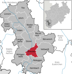 | |
 Kreuzau  Kreuzau | |
| Coordinates: 50°45′00″N 06°28′59″E | |
| Country | Germany |
| State | North Rhine-Westphalia |
| Admin. region | Köln |
| District | Düren |
| Government | |
| • Mayor (2020–25) | Ingo Eßer[1] (CDU) |
| Area | |
| • Total | 41.77 km2 (16.13 sq mi) |
| Highest elevation | 360 m (1,180 ft) |
| Lowest elevation | 142 m (466 ft) |
| Population (2020-12-31)[2] | |
| • Total | 17,422 |
| • Density | 420/km2 (1,100/sq mi) |
| Time zone | UTC+01:00 (CET) |
| • Summer (DST) | UTC+02:00 (CEST) |
| Postal codes | 52372 |
| Dialling codes | 02422, 02427, 02421 |
| Vehicle registration | DN |
| Website | www.kreuzau.de |
Geography
Neighbouring communities
Kreuzau is surrounded by the following settlements, listed clockwise beginning in the north: the county town of Düren and the municipalities of Nörvenich, Vettweiß, Nideggen and Hürtgenwald, all in the county of Düren.
Municipal subdivisions
The municipality Kreuzau includes the following civil parishes (Ortsteil):
- Bogheim
- Boich
- Drove
- Kreuzau (incl. Schneidhausen) with 5,150 inhabitants on 31 October 2015
- Leversbach
- Obermaubach (incl. Schlagstein)
- Stockheim
- Thum
- Üdingen
- Untermaubach (incl. Bilstein)
- Winden (incl. Bergheim and Langenbroich)
In addition there was the now extinct village of Hemgenberg.
Twin towns
Kreuzau is twinned with:
 Obervellach, Austria
 Plancoët, France
References
- Wahlergebnisse in NRW Kommunalwahlen 2020, Land Nordrhein-Westfalen, accessed 19 June 2021.
- "Bevölkerung der Gemeinden Nordrhein-Westfalens am 31. Dezember 2020" (in German). Landesbetrieb Information und Technik NRW. Retrieved 21 June 2021.
Wikimedia Commons has media related to Kreuzau.
Towns and municipalities in Düren (district) | ||
|---|---|---|
 | ||
This Düren district location article is a stub. You can help Wikipedia by expanding it. |
На других языках
[de] Kreuzau
Kreuzau (Dürener Platt Krötzau) liegt im Erholungsgebiet Rureifel und ist mit etwa 18.000 Einwohnern in gut 7.000 Haushalten die drittgrößte Gemeinde im Kreis Düren in Nordrhein-Westfalen.- [en] Kreuzau
[ru] Кройцау
Кройцау (нем. Kreuzau) — коммуна в Германии, в земле Северный Рейн-Вестфалия.Текст в блоке "Читать" взят с сайта "Википедия" и доступен по лицензии Creative Commons Attribution-ShareAlike; в отдельных случаях могут действовать дополнительные условия.
Другой контент может иметь иную лицензию. Перед использованием материалов сайта WikiSort.org внимательно изучите правила лицензирования конкретных элементов наполнения сайта.
Другой контент может иметь иную лицензию. Перед использованием материалов сайта WikiSort.org внимательно изучите правила лицензирования конкретных элементов наполнения сайта.
2019-2026
WikiSort.org - проект по пересортировке и дополнению контента Википедии
WikiSort.org - проект по пересортировке и дополнению контента Википедии