world.wikisort.org - Germany
Höpfingen, sometimes spelled Hoepfingen, is a municipality in the district of Neckar-Odenwald-Kreis, in Baden-Württemberg, Germany.
 | This article may be expanded with text translated from the corresponding article in German. (February 2009) Click [show] for important translation instructions.
|
Höpfingen | |
|---|---|
Municipality | |
 Aerial view of St. Ägidius Church and surrounding area in the Höpfingen subdivision | |
 Coat of arms | |
Location of Höpfingen within Neckar-Odenwald-Kreis district  | |
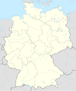  Höpfingen 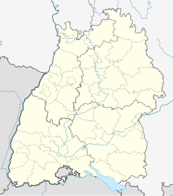 Höpfingen | |
| Coordinates: 49°36′5″N 9°25′51″E | |
| Country | Germany |
| State | Baden-Württemberg |
| Admin. region | Karlsruhe |
| District | Neckar-Odenwald-Kreis |
| Subdivisions | 2 |
| Government | |
| • Mayor (2021–29) | Christian Hauck[1] |
| Area | |
| • Total | 30.49 km2 (11.77 sq mi) |
| Elevation | 377 m (1,237 ft) |
| Population (2020-12-31)[2] | |
| • Total | 2,968 |
| • Density | 97/km2 (250/sq mi) |
| Time zone | UTC+01:00 (CET) |
| • Summer (DST) | UTC+02:00 (CEST) |
| Postal codes | 74746 |
| Dialling codes | 06283 |
| Vehicle registration | MOS, BCH |
| Website | www.hoepfingen.de |
Administration
The municipality consists of two subdivisions:
- Höpfingen
- Waldstetten
Geography
The district lies on the southeastern slope of the Odenwald mountain range. Part is included with the Neckartal-Odenwald Nature Park, one of the largest national parks in Baden-Württemberg.
Höpfingen, in the northern part of the municipality, has forests, fields and meadows. To the south, the town of Waldstetten sits in a valley with several streams running through.[3]
References
- Aktuelle Wahlergebnisse, Staatsanzeiger, accessed 13 September 2021.
- "Bevölkerung nach Nationalität und Geschlecht am 31. Dezember 2020" [Population by nationality and sex as of December 31, 2020] (CSV). Statistisches Landesamt Baden-Württemberg (in German). June 2021. Retrieved 17 October 2021.
- "Unsere Ortsteile". Retrieved 2 February 2016.
Towns and municipalities in Neckar-Odenwald (district) | ||
|---|---|---|
 | ||
Authority control | |
|---|---|
| General | |
| National libraries | |

 | This Neckar-Odenwald location article is a stub. You can help Wikipedia by expanding it. |
На других языках
[de] Höpfingen
Höpfingen ist eine Gemeinde im Neckar-Odenwald-Kreis in Baden-Württemberg. Sie gehört zur europäischen Metropolregion Rhein-Neckar (bis 20. Mai 2003 Region Unterer Neckar und bis 31. Dezember 2005 Region Rhein-Neckar-Odenwald). Die Gemeinde bildet mit den Nachbargemeinden Walldürn und Hardheim einen Gemeindeverwaltungsverband.- [en] Höpfingen
[ru] Хёпфинген
Хёпфинген (нем. Höpfingen) — коммуна в Германии, в земле Баден-Вюртемберг.Текст в блоке "Читать" взят с сайта "Википедия" и доступен по лицензии Creative Commons Attribution-ShareAlike; в отдельных случаях могут действовать дополнительные условия.
Другой контент может иметь иную лицензию. Перед использованием материалов сайта WikiSort.org внимательно изучите правила лицензирования конкретных элементов наполнения сайта.
Другой контент может иметь иную лицензию. Перед использованием материалов сайта WikiSort.org внимательно изучите правила лицензирования конкретных элементов наполнения сайта.
2019-2026
WikiSort.org - проект по пересортировке и дополнению контента Википедии
WikiSort.org - проект по пересортировке и дополнению контента Википедии