world.wikisort.org - Germany
Fehrbellin is a municipality in Germany, located 60 km NW of Berlin. It had 9,310 inhabitants as of 2005, but has since declined to 8,606 inhabitants in 2012.
Fehrbellin | |
|---|---|
Municipality | |
 | |
 Coat of arms | |
Location of Fehrbellin within Ostprignitz-Ruppin district  | |
 Fehrbellin  Fehrbellin | |
| Coordinates: 52°47′59″N 12°46′00″E | |
| Country | Germany |
| State | Brandenburg |
| District | Ostprignitz-Ruppin |
| Government | |
| • Mayor (2019–27) | Mathias Perschall[1] (SPD) |
| Area | |
| • Total | 269.06 km2 (103.88 sq mi) |
| Elevation | 40 m (130 ft) |
| Population (2021-12-31)[2] | |
| • Total | 8,951 |
| • Density | 33/km2 (86/sq mi) |
| Time zone | UTC+01:00 (CET) |
| • Summer (DST) | UTC+02:00 (CEST) |
| Postal codes | 16833 |
| Dialling codes | 033932 |
| Vehicle registration | OPR |
| Website | www.fehrbellin.de |
History
In 1675, the Battle of Fehrbellin was fought there, in which the troops of Brandenburg-Prussia defeated those of the occupying Swedish Empire. In 1758 during the Seven Years' War Prussian and Swedish forces clashed at the Battle of Fehrbellin (1758).
One of the most important skydiving dropzones of Germany is located at the local airport.
Municipal divisions


- Fehrbellin
- Betzin
- Brunne
- Dechtow
- Deutschhof
- Hakenberg
- Karwesee
- Königshorst
- Langen
- Lentzke
- Linum
- Manker
- Protzen
- Tarmow
- Walchow
- Wall
- Wustrau-Altfriesack
Wustrau and Altfriesack were amalgamated in 1970. With 1221 residents, the combined municipal division is the largest in the municipality. Altfriesack lies between the Ruppiner See and the Bützsee and belonged to Alt Ruppin until 1872. By area, Fehrbellin is the second-largest rural municipality ("Gemeinde") in Germany, trailing only Nuthe-Urstromtal.
Demography
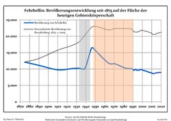 Development of population since 1875 within the current Boundaries (Blue Line: Population; Dotted Line: Comparison to Population development in Brandenburg state; Grey Background: Time of Nazi Germany; Red Background: Time of communist East Germany)
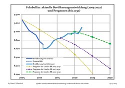 Recent Population Development and Projections — Population Development before Census 2011 (blue line); Recent Population Development according to the Census in Germany in 2011 (blue bordered line); Official projections for 2005-2030 (yellow line); for 2017-2030 (scarlet line); for 2020-2030 (green line)


|
|
|
Sights
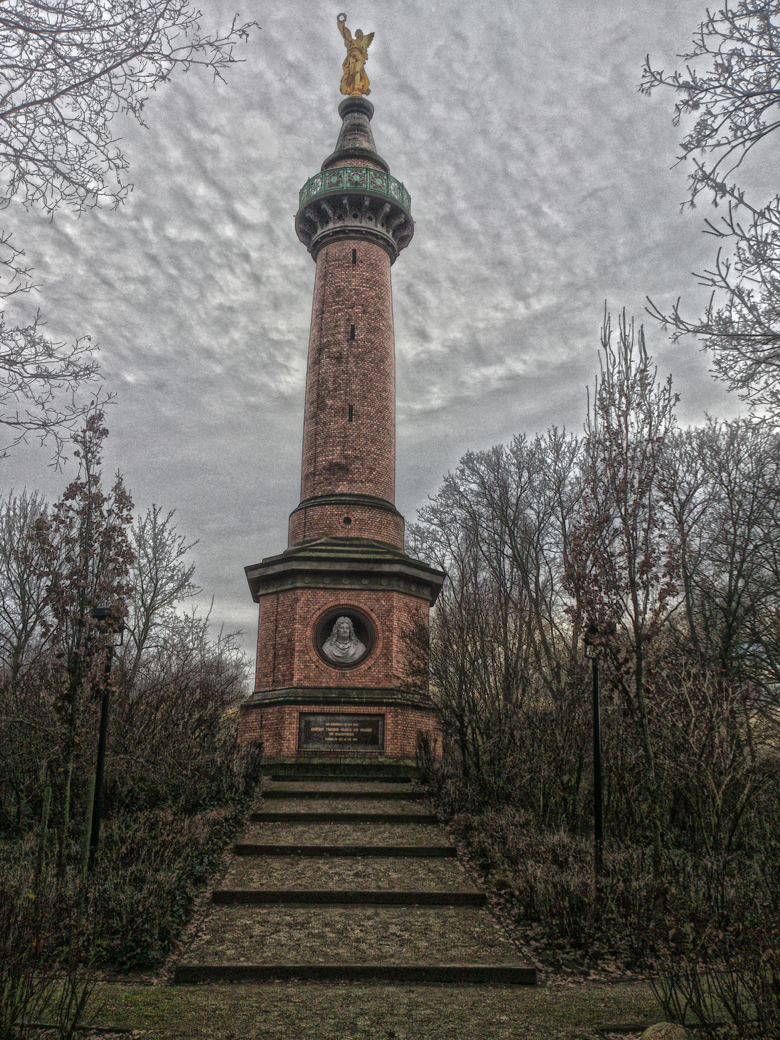
- Hakenberg Victory Column
- Zietenschloß in Wustrau
- Brandenburg-Preußen Museum
 Hakenberg Victory Column
 Church in Linum
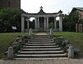 War memorial in Linum
 Former textile factory in Fehrbellin
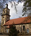 Church in Wustrau


Personalities
- Hans Joachim von Zieten (1699–1786), Prussian cavalry general, born and buried in Wustrau.
- Hans Ernst Karl, Graf von Zieten (1770–1848), Prussian general field marshal
References
- Landkreis Ostprignitz-Ruppin Wahl der Bürgermeisterin / des Bürgermeisters, retrieved 2 July 2021.
- "Bevölkerungsentwicklung und Flächen der kreisfreien Städte, Landkreise und Gemeinden im Land Brandenburg 2021" (PDF). Amt für Statistik Berlin-Brandenburg (in German). June 2022.
- Detailed data sources are to be found in the Wikimedia Commons.Population Projection Brandenburg at Wikimedia Commons
External links
- Brandenburg Prussia Museum in Fehrbellin-Wustrau
- . Encyclopædia Britannica (11th ed.). 1911.
Towns and municipalities in Ostprignitz-Ruppin | ||
|---|---|---|
 | ||
Authority control | |
|---|---|
| General | |
| National libraries | |
| Other |
|
This Brandenburg location article is a stub. You can help Wikipedia by expanding it. |
На других языках
[de] Fehrbellin
Fehrbellin (mit Betonung auf der letzten Silbe) ist eine amtsfreie Gemeinde im Landkreis Ostprignitz-Ruppin in Brandenburg.- [en] Fehrbellin
[ru] Фербеллин
Фербеллин (нем. Fehrbellin) — община в Германии, в земле Бранденбург.Другой контент может иметь иную лицензию. Перед использованием материалов сайта WikiSort.org внимательно изучите правила лицензирования конкретных элементов наполнения сайта.
WikiSort.org - проект по пересортировке и дополнению контента Википедии