world.wikisort.org - Germany
Drachselsried is a municipality in the district of Regen, in Bavaria, Germany. Drachselsried is in the Zeller Valley (German: Zellertal), and is part of the Glass Road (Glasstrasse) The area is part of the Bavarian Forest National Park. The village is a small, highly organised, friendly place to live. Bayern Eins, the German radio station, gave some history details of the village, which was first noted in 1184. The village continues to grow with the addition in 2017 of a retirement home with private apartments, close to the village centre. A number of new homes have been built on land available for purchase from the local council.
This article may be expanded with text translated from the corresponding article in German. (March 2009) Click [show] for important translation instructions.
|
Drachselsried | |
|---|---|
Municipality | |
 Drachselsried | |
 Coat of arms | |
Location of Drachselsried within Regen district 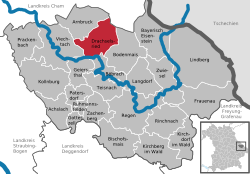 | |
 Drachselsried  Drachselsried | |
| Coordinates: 49°6′N 13°1′E | |
| Country | Germany |
| State | Bavaria |
| Admin. region | Niederbayern |
| District | Regen |
| Government | |
| • Mayor (2020–26) | Johannes Vogl[1] (CSU) |
| Area | |
| • Total | 41.73 km2 (16.11 sq mi) |
| Highest elevation | 1,284 m (4,213 ft) |
| Lowest elevation | 435 m (1,427 ft) |
| Population (2020-12-31)[2] | |
| • Total | 2,434 |
| • Density | 58/km2 (150/sq mi) |
| Time zone | UTC+01:00 (CET) |
| • Summer (DST) | UTC+02:00 (CEST) |
| Postal codes | 94256 |
| Dialling codes | 09945 |
| Vehicle registration | REG |
| Website | www |
References
- Liste der ersten Bürgermeister/Oberbürgermeister in kreisangehörigen Gemeinden, Bayerisches Landesamt für Statistik, 15 July 2021.
- "Tabellenblatt "Daten 2", Statistischer Bericht A1200C 202041 Einwohnerzahlen der Gemeinden, Kreise und Regierungsbezirke". Bayerisches Landesamt für Statistik (in German). June 2021.
External links
Towns and municipalities in Regen (district) | ||
|---|---|---|
 | ||
This Regen district location article is a stub. You can help Wikipedia by expanding it. |
На других языках
- [en] Drachselsried
[ru] Драксельсрид
Драксельсрид (нем. Drachselsried) — община в Германии, в Республике Бавария.Текст в блоке "Читать" взят с сайта "Википедия" и доступен по лицензии Creative Commons Attribution-ShareAlike; в отдельных случаях могут действовать дополнительные условия.
Другой контент может иметь иную лицензию. Перед использованием материалов сайта WikiSort.org внимательно изучите правила лицензирования конкретных элементов наполнения сайта.
Другой контент может иметь иную лицензию. Перед использованием материалов сайта WikiSort.org внимательно изучите правила лицензирования конкретных элементов наполнения сайта.
2019-2026
WikiSort.org - проект по пересортировке и дополнению контента Википедии
WikiSort.org - проект по пересортировке и дополнению контента Википедии