world.wikisort.org - Germany
Borrentin is a municipality in the Mecklenburgische Seenplatte district, in Mecklenburg-Western Pomerania, Germany. Seat of the Amt Borrentin until 2004, it is now part of the Amt Demmin-Land. The highway B194 goes through the municipality. The main economical activity in Borrentin is agriculture. Other businesses are small in size.[2]
Borrentin | |
|---|---|
Municipality | |
Location of Borrentin within Mecklenburgische Seenplatte district 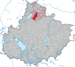 | |
 Borrentin  Borrentin | |
| Coordinates: 53°49′N 12°58′E | |
| Country | Germany |
| State | Mecklenburg-Vorpommern |
| District | Mecklenburgische Seenplatte |
| Municipal assoc. | Demmin-Land |
| Subdivisions | 8 |
| Government | |
| • Mayor | Eckhard Wach |
| Area | |
| • Total | 48.09 km2 (18.57 sq mi) |
| Elevation | 39 m (128 ft) |
| Population (2020-12-31)[1] | |
| • Total | 784 |
| • Density | 16/km2 (42/sq mi) |
| Time zone | UTC+01:00 (CET) |
| • Summer (DST) | UTC+02:00 (CEST) |
| Postal codes | 17111 |
| Dialling codes | 039994 |
| Vehicle registration | DM |
References
- "Statistisches Amt M-V – Bevölkerungsstand der Kreise, Ämter und Gemeinden 2020". Statistisches Amt Mecklenburg-Vorpommern (in German). July 2021.
- 1232.726.1 Amt Demmin-Land[permanent dead link]
Authority control | |
|---|---|
| General |
|
| National libraries | |
This Mecklenburgische Seenplatte (district) location article is a stub. You can help Wikipedia by expanding it. |
На других языках
- [en] Borrentin
[ru] Боррентин
Боррентин (нем. Borrentin) — коммуна в Германии, в земле Мекленбург-Передняя Померания.Текст в блоке "Читать" взят с сайта "Википедия" и доступен по лицензии Creative Commons Attribution-ShareAlike; в отдельных случаях могут действовать дополнительные условия.
Другой контент может иметь иную лицензию. Перед использованием материалов сайта WikiSort.org внимательно изучите правила лицензирования конкретных элементов наполнения сайта.
Другой контент может иметь иную лицензию. Перед использованием материалов сайта WikiSort.org внимательно изучите правила лицензирования конкретных элементов наполнения сайта.
2019-2026
WikiSort.org - проект по пересортировке и дополнению контента Википедии
WikiSort.org - проект по пересортировке и дополнению контента Википедии