world.wikisort.org - Germany
Ainring is a municipality in the district of Berchtesgadener Land, Upper Bavaria, Germany, near the border to Austria.
Ainring | |
|---|---|
Municipality | |
 Ainring | |
 Coat of arms | |
Location of Ainring within Berchtesgadener Land district 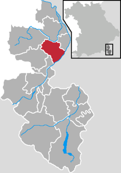 | |
 Ainring  Ainring | |
| Coordinates: 47°48′49″N 12°56′34″E | |
| Country | Germany |
| State | Bavaria |
| Admin. region | Oberbayern |
| District | Berchtesgadener Land |
| Government | |
| • Mayor (2020–26) | Martin Öttl[1] |
| Area | |
| • Total | 32.97 km2 (12.73 sq mi) |
| Elevation | 459 m (1,506 ft) |
| Population (2020-12-31)[2] | |
| • Total | 9,847 |
| • Density | 300/km2 (770/sq mi) |
| Time zone | UTC+01:00 (CET) |
| • Summer (DST) | UTC+02:00 (CEST) |
| Postal codes | 83404 |
| Dialling codes | 08654 & 08656 |
| Vehicle registration | BGL |
| Website | www.ainring.de |
After World War II it was the site of a displaced persons camp.[3]

Personalities
Sons and daughters Ainrings
- Manuela Kraller (born 1981), singer
Connected to Ainring
- Eugen Sänger (1905-1964), engineer and pioneer in the field of aerospace
- Hans Söllner (born 1955), Bavarian singer-songwriter; lives in Ainring
References
- Liste der ersten Bürgermeister/Oberbürgermeister in kreisangehörigen Gemeinden, Bayerisches Landesamt für Statistik, accessed 19 July 2021.
- "Tabellenblatt "Daten 2", Statistischer Bericht A1200C 202041 Einwohnerzahlen der Gemeinden, Kreise und Regierungsbezirke". Bayerisches Landesamt für Statistik (in German). June 2021.
- Wyman, Mark (1998). Dps: Europe's Displaced Persons, 1945-1951. Cornell paperbacks. p. 116. ISBN 9780801485428. Retrieved December 27, 2012.
Towns and municipalities in Berchtesgadener Land | ||
|---|---|---|
 | ||
Wikimedia Commons has media related to Ainring.
This Berchtesgadener Land location article is a stub. You can help Wikipedia by expanding it. |
На других языках
- [en] Ainring
[ru] Айнринг
Айнринг (нем. Ainring)— община в Германии, в Республике Бавария[1].Текст в блоке "Читать" взят с сайта "Википедия" и доступен по лицензии Creative Commons Attribution-ShareAlike; в отдельных случаях могут действовать дополнительные условия.
Другой контент может иметь иную лицензию. Перед использованием материалов сайта WikiSort.org внимательно изучите правила лицензирования конкретных элементов наполнения сайта.
Другой контент может иметь иную лицензию. Перед использованием материалов сайта WikiSort.org внимательно изучите правила лицензирования конкретных элементов наполнения сайта.
2019-2026
WikiSort.org - проект по пересортировке и дополнению контента Википедии
WikiSort.org - проект по пересортировке и дополнению контента Википедии