world.wikisort.org - France
Montriond (French pronunciation: [mɔ̃tʁijɔ̃]; Arpitan: Meûryan) is a commune in the Haute-Savoie department in the Auvergne-Rhône-Alpes region in south-eastern France.
Montriond | |
|---|---|
Commune | |
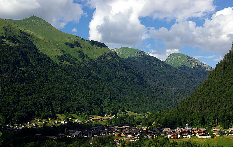 Montriond village | |
 Coat of arms | |
Location of Montriond  | |
 Montriond  Montriond | |
| Coordinates: 46°11′53″N 6°41′42″E | |
| Country | France |
| Region | Auvergne-Rhône-Alpes |
| Department | Haute-Savoie |
| Arrondissement | Thonon-les-Bains |
| Canton | Évian-les-Bains |
| Intercommunality | Haut-Chablais |
| Government | |
| • Mayor (2020–2026) | Jean-Claude Denne |
| Area 1 | 24.71 km2 (9.54 sq mi) |
| Population | 939 |
| • Density | 38/km2 (98/sq mi) |
| Time zone | UTC+01:00 (CET) |
| • Summer (DST) | UTC+02:00 (CEST) |
| INSEE/Postal code | 74188 /74110 |
| Elevation | 877–2,340 m (2,877–7,677 ft) |
| 1 French Land Register data, which excludes lakes, ponds, glaciers > 1 km2 (0.386 sq mi or 247 acres) and river estuaries. | |
It is just north of the ski resorts of Morzine and Avoriaz in the Portes du Soleil ski resorts area. Just east lies Lac de Montriond, a small lake. Montriond's village centre features a small supermarket, ski/outdoors retailer and several restaurants as well as a tourist information office and a Mairie.
See also
References
- "Populations légales 2019". The National Institute of Statistics and Economic Studies. 29 December 2021.
| Wikimedia Commons has media related to Montriond. |
Communes of the Haute-Savoie department | |
|---|---|
|
This Haute-Savoie geographical article is a stub. You can help Wikipedia by expanding it. |
Текст в блоке "Читать" взят с сайта "Википедия" и доступен по лицензии Creative Commons Attribution-ShareAlike; в отдельных случаях могут действовать дополнительные условия.
Другой контент может иметь иную лицензию. Перед использованием материалов сайта WikiSort.org внимательно изучите правила лицензирования конкретных элементов наполнения сайта.
Другой контент может иметь иную лицензию. Перед использованием материалов сайта WikiSort.org внимательно изучите правила лицензирования конкретных элементов наполнения сайта.
2019-2026
WikiSort.org - проект по пересортировке и дополнению контента Википедии
WikiSort.org - проект по пересортировке и дополнению контента Википедии