world.wikisort.org - France
Langeais (French pronunciation: [lɑ̃ʒɛ] (![]() listen)) is a commune in the Indre-et-Loire department in central France. On 1 January 2017, the former commune of Les Essards was merged into Langeais.[2]
listen)) is a commune in the Indre-et-Loire department in central France. On 1 January 2017, the former commune of Les Essards was merged into Langeais.[2]
Langeais | |
|---|---|
Commune | |
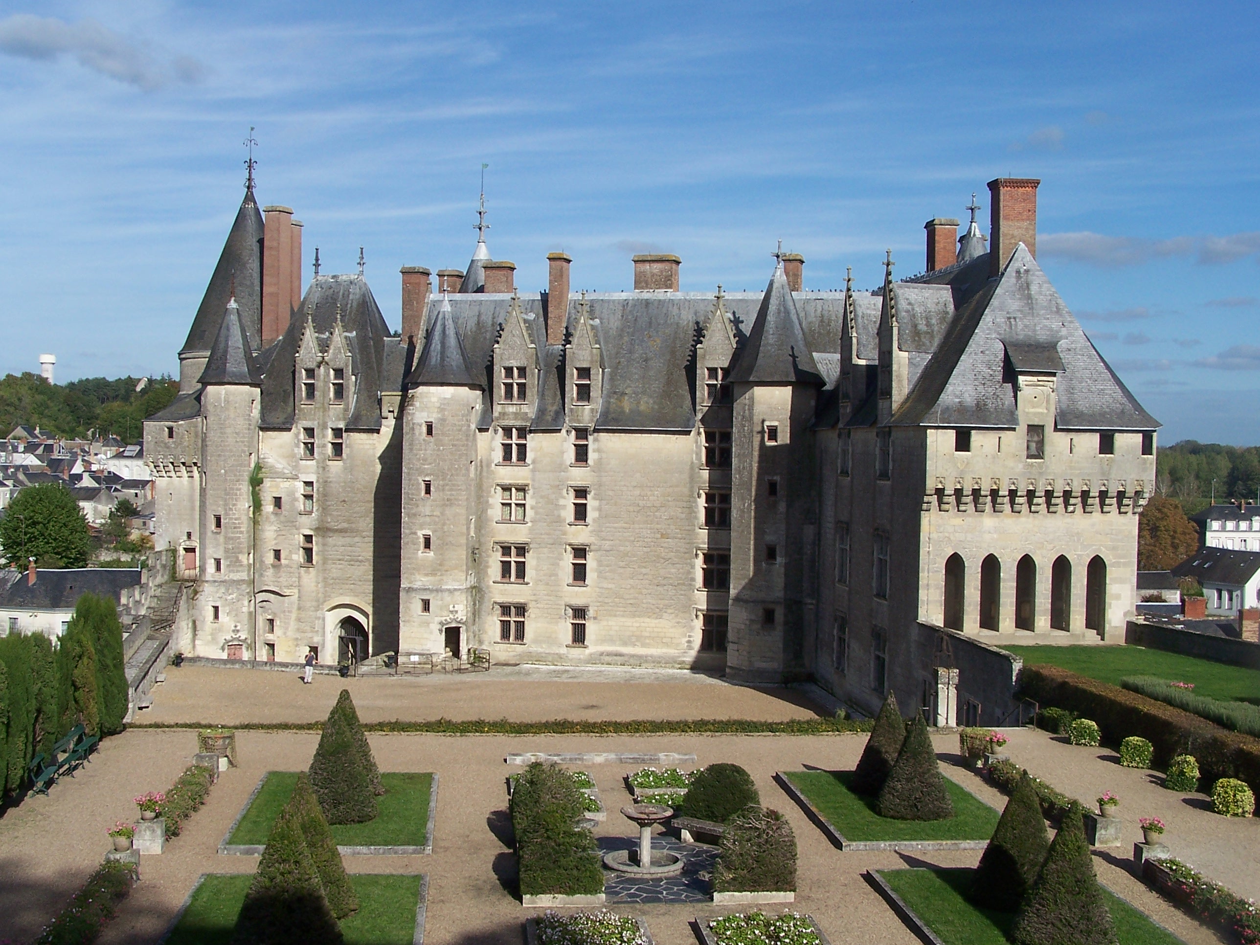 Château de Langeais | |
 Coat of arms | |
Location of Langeais  | |
 Langeais  Langeais | |
| Coordinates: 47°19′36″N 0°24′25″E | |
| Country | France |
| Region | Centre-Val de Loire |
| Department | Indre-et-Loire |
| Arrondissement | Chinon |
| Canton | Langeais |
| Government | |
| • Mayor (2020–2026) | Pierre-Alain Roiron |
| Area 1 | 64.55 km2 (24.92 sq mi) |
| Population | 4,455 |
| • Density | 69/km2 (180/sq mi) |
| Time zone | UTC+01:00 (CET) |
| • Summer (DST) | UTC+02:00 (CEST) |
| INSEE/Postal code | 37123 /37130 |
| Elevation | 36–109 m (118–358 ft) |
| 1 French Land Register data, which excludes lakes, ponds, glaciers > 1 km2 (0.386 sq mi or 247 acres) and river estuaries. | |
Population
|
|
Sights
Langeais has a church of the 11th, 12th and 15th centuries, but is chiefly interesting for its large and historic château built soon after the middle of the 15th century by Jean Bourré, minister of Louis XI. Here the marriage of Charles VIII and Anne of Brittany took place in 1491. In the park, are the ruins of a keep of late 10th century architecture, built by Fulk Nerra (Black Hawk in old French), count of Anjou.[3]
Transportation
Langeais is served by the A85 autoroute.
International relations
Langeais is twinned with:
- Eppstein, Germany
- Gondar, Portugal
Notes
- "Populations légales 2019". The National Institute of Statistics and Economic Studies. 29 December 2021.
- Arrêté préfectoral 30 September 2016 (in French)
- Chisholm 1911, p. 173.
References
- Attribution
- Chisholm, Hugh, ed. (1911). . Encyclopædia Britannica. Vol. 16 (11th ed.). Cambridge University Press. p. 173.
| Authority control |
|
|---|
This Indre-et-Loire geographical article is a stub. You can help Wikipedia by expanding it. |
На других языках
- [en] Langeais
[ru] Ланже (Эндр и Луара)
Ланже́ (фр. Langeais) — муниципалитет (коммуна) во Франции, в регионе Центр, департамент Эндр и Луара.Другой контент может иметь иную лицензию. Перед использованием материалов сайта WikiSort.org внимательно изучите правила лицензирования конкретных элементов наполнения сайта.
WikiSort.org - проект по пересортировке и дополнению контента Википедии