world.wikisort.org - France
La Bazouge-de-Chemeré (French pronunciation: [la bazuʒ də ʃəmʁe]) is a commune in the Mayenne department in northwestern France.
La Bazouge-de-Chemeré | |
|---|---|
Commune | |
Location of La Bazouge-de-Chemeré  | |
 La Bazouge-de-Chemeré  La Bazouge-de-Chemeré | |
| Coordinates: 48°00′06″N 0°29′10″W | |
| Country | France |
| Region | Pays de la Loire |
| Department | Mayenne |
| Arrondissement | Château-Gontier |
| Canton | Meslay-du-Maine |
| Government | |
| • Mayor (2020–2026) | Franck Legeay[1] |
| Area 1 | 24.84 km2 (9.59 sq mi) |
| Population | 516 |
| • Density | 21/km2 (54/sq mi) |
| Time zone | UTC+01:00 (CET) |
| • Summer (DST) | UTC+02:00 (CEST) |
| INSEE/Postal code | 53022 /53170 |
| Elevation | 58–112 m (190–367 ft) (avg. 98 m or 322 ft) |
| 1 French Land Register data, which excludes lakes, ponds, glaciers > 1 km2 (0.386 sq mi or 247 acres) and river estuaries. | |
Geography
The village stands on a promontory above the Vaige river. On the opposite side there are limestone quarries and old lime kilns.
The village stands at the far east of the Armorican Massif so the geology presents various facies : limestone, coal, rhyolite, slate, slate shale. Luckily there were anthracite mines dedicated to the lime kiln. The lime was used for liming (soil) until 1896 when chemical fertilizers have been available, so the lime kilns has stopped and also the mining because coal layers are not regular but spraid in distant columns.
History
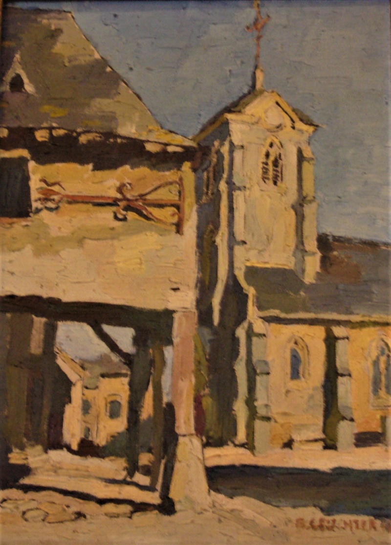
In 1926 the lightning torched the bell tower then the church. The steeple cover has been built again shorter and the bells were cast again then baptized in 1930. But the fire has brought up covered frescoes of the 16th century showing the dictation of the three dead and the three alive (three skeletons tell three young men the life is short...)
Economy
After being an industrial town in the 19th century with lime kilns, quarries and mining, La Bazouge-de-Chemeré returns mainly to agriculture in 20th century. Tourism starts 40 years ago with bed and breakfast and rural lodging in cottages. Nowadays a well-known Ultralight aviation aerodrome stands at the old mine.
La Bazouge-de-Chemeré through artists
Some painters passed in the village :
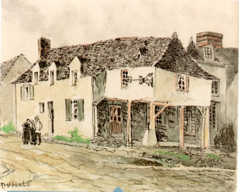
- Felix Desille has painted a watercolor of the 'Hôtel du Porche'(Porch hotel) in 1914 and already wished its restoration.
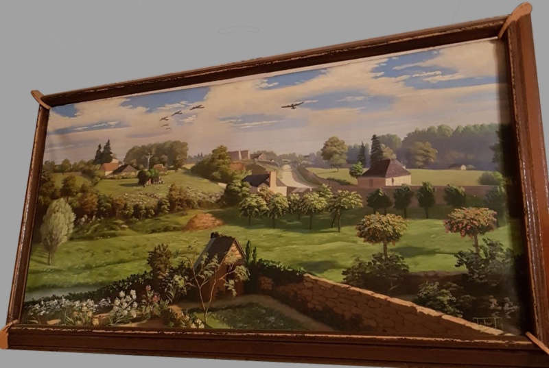
- Giuseppe Tribus an Italian painter who had fled fascism in Italy and had taken refuge in the village has immortalized the roaring flyover of German bombers on 17 June 1940.
- Édouard Cortès, from a photography and by his invention, has depicted the church street, once 'a snowy evening' and once 'sunshine after rain' (circa 1945) as he used to paint Paris streets.
In 1950 Tribus has painted the porch of the hotel (demolished in 1960) and the church steeple.
| Paintings | |
|---|---|
- Sold painting : Edouard Cortes - La Bazouge-de-Chemere, a snowy evening (circa 1945)
- Sold painting : Edouard Cortes - La Bazouge-de-Chemere, sunshine after rain (circa 1945) strangely named 'south of France'
Population
| Year | Pop. | ±% |
|---|---|---|
| 1962 | 528 | — |
| 1968 | 592 | +12.1% |
| 1975 | 494 | −16.6% |
| 1982 | 447 | −9.5% |
| 1990 | 406 | −9.2% |
| 1999 | 443 | +9.1% |
| 2006 | 504 | +13.8% |
| 2009 | 522 | +3.6% |
| 2016 | 514 | −1.5% |
Gallery
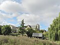 The village at the top of the promontory above the mere and the river
 The village above the mere that the Vaige river has crossed until 2016 and now bypasses it
 The Vaige river
 The dried Vaige river
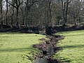 The Chemerette stream pass through an old path then flows in the Vaige river
 The church : known 12th c., frescos 16th c., extension and steeple 19th c., cover 20th c.
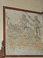 The dictation of the 3 dead and the 3 alive : the 3 dead (1585 fresco)
 The dictation of the 3 dead and the 3 alive : the 3 alive (1585 fresco)
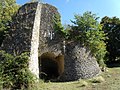 The Fortinière lime kiln
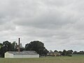 Ultralight aviation aerodrome at the old coal mine
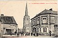 Old postcard showing the Porche hotel and the high church steeple before the 1926 fire and mostly the Édouard Cortès point of view


See also
- Communes of Mayenne
References
- "Répertoire national des élus: les maires". data.gouv.fr, Plateforme ouverte des données publiques françaises (in French). 2 December 2020.
- "Populations légales 2019". The National Institute of Statistics and Economic Studies. 29 December 2021.
На других языках
[de] La Bazouge-de-Chemeré
La Bazouge-de-Chemeré ist eine französische Gemeinde mit 516 Einwohnern (Stand: 1. Januar 2019) im Département Mayenne in der Region Pays de la Loire in Frankreich. Einwohner der Gemeinde werden Bazougéens genannt. Die Gemeinde gehört zum Arrondissement Château-Gontier und zum Kanton Meslay-du-Maine.- [en] La Bazouge-de-Chemeré
Другой контент может иметь иную лицензию. Перед использованием материалов сайта WikiSort.org внимательно изучите правила лицензирования конкретных элементов наполнения сайта.
WikiSort.org - проект по пересортировке и дополнению контента Википедии