world.wikisort.org - France
Entrammes (French pronunciation: [ɑ̃tʁam]) is a commune in the Mayenne department in north-western France. It is located about 3.7 kilometres (2.3 mi) west of Parné-sur-Roc and about 3.7 kilometres (2.3 mi) south of Laval Entrammes Airport in Laval.[2]
Entrammes | |
|---|---|
Commune | |
 The new Town Hall in Entrammes | |
 Coat of arms | |
Location of Entrammes  | |
 Entrammes  Entrammes | |
| Coordinates: 47°59′48″N 0°42′45″W | |
| Country | France |
| Region | Pays de la Loire |
| Department | Mayenne |
| Arrondissement | Laval |
| Canton | L'Huisserie |
| Intercommunality | Laval Agglomération |
| Government | |
| • Mayor (2020–2026) | Jérôme Allaire |
| Area 1 | 26.16 km2 (10.10 sq mi) |
| Population | 2,255 |
| • Density | 86/km2 (220/sq mi) |
| Time zone | UTC+01:00 (CET) |
| • Summer (DST) | UTC+02:00 (CEST) |
| INSEE/Postal code | 53094 /53260 |
| Elevation | 33–108 m (108–354 ft) (avg. 50 m or 160 ft) |
| 1 French Land Register data, which excludes lakes, ponds, glaciers > 1 km2 (0.386 sq mi or 247 acres) and river estuaries. | |
History
Entrammes owes its location to a major ford across the rivers Mayenne and Jouanne: the road connecting Le Mans to Rennes traditionally crossed the river here. Consequently, a substantial town covering approximately 55 hectares existed here already two thousand years ago, and was already settled during the first century BC.
Gallery
 The old Town Hall
 The Port-du-Salut Abbey
 The Roman-Gaul Baths
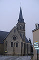 The parish church


See also
- Communes of the Mayenne department
- Roman-Gaul Baths of Entrammes
References
- "Populations légales 2019". The National Institute of Statistics and Economic Studies. 29 December 2021.
- Maps, Weather, and Airports for Entrammes, France, retrieved 5 April 2010
Wikimedia Commons has media related to Entrammes.
Communes of the Mayenne department | |
|---|---|
|
Authority control | |
|---|---|
| General |
|
| National libraries | |
This Mayenne geographical article is a stub. You can help Wikipedia by expanding it. |
Текст в блоке "Читать" взят с сайта "Википедия" и доступен по лицензии Creative Commons Attribution-ShareAlike; в отдельных случаях могут действовать дополнительные условия.
Другой контент может иметь иную лицензию. Перед использованием материалов сайта WikiSort.org внимательно изучите правила лицензирования конкретных элементов наполнения сайта.
Другой контент может иметь иную лицензию. Перед использованием материалов сайта WikiSort.org внимательно изучите правила лицензирования конкретных элементов наполнения сайта.
2019-2026
WikiSort.org - проект по пересортировке и дополнению контента Википедии
WikiSort.org - проект по пересортировке и дополнению контента Википедии