world.wikisort.org - France
The arrondissement of Cholet is an arrondissement of France in the Maine-et-Loire department in the Pays de la Loire region. It has 32 communes.[2] Its population is 224,581 (2016), and its area is 2,102.5 km2 (811.8 sq mi).[3]
Cholet | |
|---|---|
Arrondissement | |
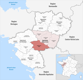 Location within the region Pays de la Loire | |
| Country | France |
| Region | Pays de la Loire |
| Department | Maine-et-Loire |
| No. of communes | 32 |
| Subprefecture | Cholet |
| Area | 2,102.5 km2 (811.8 sq mi) |
| Population | 223,828 |
| • Density | 106/km2 (270/sq mi) |
| INSEE code | 492 |
Composition
The communes of the arrondissement of Cholet, and their INSEE codes, are:[2]
- Beaupréau-en-Mauges (49023)
- Bégrolles-en-Mauges (49027)
- Cernusson (49057)
- Les Cerqueux (49058)
- Chanteloup-les-Bois (49070)
- Chemillé-en-Anjou (49092)
- Cholet (49099)
- Cléré-sur-Layon (49102)
- Coron (49109)
- Lys-Haut-Layon (49373)
- Mauges-sur-Loire (49244)
- Maulévrier (49192)
- Le May-sur-Èvre (49193)
- Mazières-en-Mauges (49195)
- Montilliers (49211)
- Montrevault-sur-Èvre (49218)
- Nuaillé (49231)
- Orée-d'Anjou (49069)
- Passavant-sur-Layon (49236)
- La Plaine (49240)
- La Romagne (49260)
- Saint-Christophe-du-Bois (49269)
- Saint-Léger-sous-Cholet (49299)
- Saint-Paul-du-Bois (49310)
- La Séguinière (49332)
- Sèvremoine (49301)
- Somloire (49336)
- La Tessoualle (49343)
- Toutlemonde (49352)
- Trémentines (49355)
- Vezins (49371)
- Yzernay (49381)
History
The arrondissement of Beaupréau was created in 1800. The subprefecture was moved to Cholet in 1857.[4] At the January 2017 reorganisation of the arrondissements of Maine-et-Loire, it gained nine communes from the arrondissement of Saumur.[5]
As a result of the reorganisation of the cantons of France which came into effect in 2015, the borders of the cantons are no longer related to the borders of the arrondissements. The cantons of the arrondissement of Cholet were, as of January 2015:[6]
- Beaupréau
- Champtoceaux
- Chemillé
- Cholet-1
- Cholet-2
- Cholet-3
- Montfaucon-Montigné
- Montrevault
- Saint-Florent-le-Vieil
References
- "Téléchargement du fichier d'ensemble des populations légales en 2019". The National Institute of Statistics and Economic Studies. 29 December 2021.
- "Arrondissement de Cholet (492)". INSEE. Retrieved 2019-10-01.
- "Comparateur de territoire, géographie au 01/01/2019". INSEE. Retrieved 2019-10-01.
- Historique de Maine-et-Loire
- "Arrêté préfectoral, 27 December 2016" (PDF). Retrieved 2019-10-22.
- Populations légales 2012: 49 Maine-et-Loire, INSEE
На других языках
- [en] Arrondissement of Cholet
[ru] Шоле (округ)
Шоле (фр. Cholet) — округ (фр. Arrondissement) во Франции, один из округов в регионе Страна Луары. Департамент округа — Мен и Луара. Супрефектура — Шоле. Население округа на 2006 год составляло 193 112 человек. Плотность населения составляет 117 чел./км². Площадь округа составляет всего 1646 км².Другой контент может иметь иную лицензию. Перед использованием материалов сайта WikiSort.org внимательно изучите правила лицензирования конкретных элементов наполнения сайта.
WikiSort.org - проект по пересортировке и дополнению контента Википедии