world.wikisort.org - France
Érize-la-Brûlée (French pronunciation: [eʁiz la bʁyle]) is a commune in the Meuse department in Grand Est in north-eastern France.
Érize-la-Brûlée | |
|---|---|
Commune | |
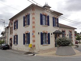
 The town hall in Érize-la-Brûlée | |
 Coat of arms | |
Location of Érize-la-Brûlée  | |
 Érize-la-Brûlée  Érize-la-Brûlée | |
| Coordinates: 48°51′02″N 5°17′03″E | |
| Country | France |
| Region | Grand Est |
| Department | Meuse |
| Arrondissement | Bar-le-Duc |
| Canton | Bar-le-Duc-1 |
| Government | |
| • Mayor (2020–2026) | Jean-Louis Adrian[1] |
| Area 1 | 10.82 km2 (4.18 sq mi) |
| Population | 189 |
| • Density | 17/km2 (45/sq mi) |
| Time zone | UTC+01:00 (CET) |
| • Summer (DST) | UTC+02:00 (CEST) |
| INSEE/Postal code | 55175 /55260 |
| Elevation | 278–363 m (912–1,191 ft) (avg. 282 m or 925 ft) |
| 1 French Land Register data, which excludes lakes, ponds, glaciers > 1 km2 (0.386 sq mi or 247 acres) and river estuaries. | |
It is located 80 km south-west of Metz and north-west of Nancy. Nearby settlements include Érize-Saint-Dizier, Rumont, Raival, Érize-la-Petite, and Chaumont-sur-Aire.
Its name derives from the name of the local river L'Ezrule (in Latin, Ericia). The suffix 'la-Brûlée', meaning 'burnt', may date back to 1247 when the village was destroyed by invaders.[3]
See also
References
Wikimedia Commons has media related to Érize-la-Brûlée.
- "Répertoire national des élus: les maires". data.gouv.fr, Plateforme ouverte des données publiques françaises (in French). 9 August 2021.
- "Populations légales 2019". The National Institute of Statistics and Economic Studies. 29 December 2021.
- Communal website http://www.cc-entreaireetmeuse.fr/intercommunalite/erize_la_brulee.htm
Текст в блоке "Читать" взят с сайта "Википедия" и доступен по лицензии Creative Commons Attribution-ShareAlike; в отдельных случаях могут действовать дополнительные условия.
Другой контент может иметь иную лицензию. Перед использованием материалов сайта WikiSort.org внимательно изучите правила лицензирования конкретных элементов наполнения сайта.
Другой контент может иметь иную лицензию. Перед использованием материалов сайта WikiSort.org внимательно изучите правила лицензирования конкретных элементов наполнения сайта.
2019-2025
WikiSort.org - проект по пересортировке и дополнению контента Википедии
WikiSort.org - проект по пересортировке и дополнению контента Википедии