world.wikisort.org - Finland
Toholampi is a municipality of Finland.
Toholampi | |
|---|---|
Municipality | |
| Toholammin kunta Toholampi kommun | |
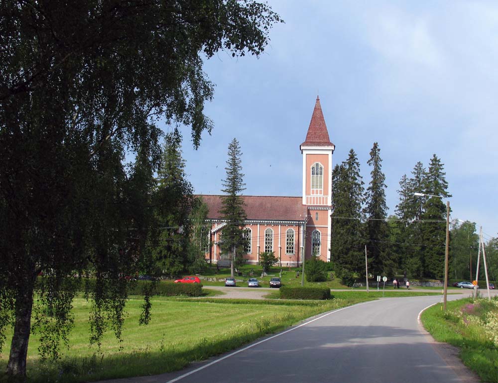 Toholampi church | |
|
Coat of arms | |
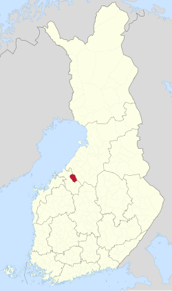 Location of Toholampi in Finland | |
| Coordinates: 63°46.5′N 024°15′E | |
| Country | |
| Region | Central Ostrobothnia |
| Sub-region | Kaustinen sub-region |
| Charter | 1865 |
| Government | |
| • Municipal manager | Jukka Hillukkala |
| Area (2018-01-01)[1] | |
| • Total | 616.89 km2 (238.18 sq mi) |
| • Land | 608.43 km2 (234.92 sq mi) |
| • Water | 8.45 km2 (3.26 sq mi) |
| • Rank | 139th largest in Finland |
| Population (2021-12-31)[2] | |
| • Total | 2,937 |
| • Rank | 220th largest in Finland |
| • Density | 4.83/km2 (12.5/sq mi) |
| Population by native language | |
| • Finnish | 99.7% (official) |
| • Swedish | 0.1% |
| • Others | 0.3% |
| Population by age | |
| • 0 to 14 | 18.3% |
| • 15 to 64 | 53.7% |
| • 65 or older | 28.1% |
| Time zone | UTC+02:00 (EET) |
| • Summer (DST) | UTC+03:00 (EEST) |
| Municipal tax rate[5] | 21.75% |
| Website | www |
It is located in the Central Ostrobothnia region. The municipality has a population of 2,937 (31 December 2021)[6] and covers an area of 616.89 square kilometres (238.18 sq mi) of which 8.45 km2 (3.26 sq mi) is water.[1] The population density is 4.83 inhabitants per square kilometre (12.5/sq mi). Neighbouring municipalities are Kannus, Kokkola, Lestijärvi and Sievi.
The municipality is unilingually Finnish.
Notable people
- Mika Lintilä, politician
- Hannu Hirvikoski, writer
- Pekka Jylhä, sculptor
- Mauri Leppänen, volleyballer
- Virve Nuotio, soloist
- Samsa Tuikka, runner
- Teemu Wirkkala, javelin thrower
- Albert Gebhard, painter
References
- "Area of Finnish Municipalities 1.1.2018" (PDF). National Land Survey of Finland. Retrieved 30 January 2018.
- "Preliminary population structure by area, 2021M01*-2021M12*". StatFin (in Finnish). Statistics Finland. Retrieved 2 February 2022.
- "Population according to language and the number of foreigners and land area km2 by area as of 31 December 2008". Statistics Finland's PX-Web databases. Statistics Finland. Retrieved 29 March 2009.
- "Population according to age (1-year) and sex by area and the regional division of each statistical reference year, 2003–2020". StatFin. Statistics Finland. Retrieved 2 May 2021.
- "List of municipal and parish tax rates in 2021" (PDF). Tax Administration of Finland. 1 December 2020. Retrieved 10 April 2021.
- "Population by municipality as of 31 December 2009". Population Information System (in Finnish and Swedish). Population Register Center of Finland. Archived from the original on 2010-12-02. Retrieved 13 January 2010.
External links
 Media related to Toholampi at Wikimedia Commons
- Municipality of Toholampi – Official website
Places adjacent to Toholampi | ||||||||||||||||
|---|---|---|---|---|---|---|---|---|---|---|---|---|---|---|---|---|
| ||||||||||||||||
Municipalities of Central Ostrobothnia | ||
|---|---|---|
| Municipalities |  | |
| Former municipalities |
| |
| ||
| Authority control |
|
|---|
This Western Finland location article is a stub. You can help Wikipedia by expanding it. |
На других языках
- [en] Toholampi
[ru] Тохолампи
Тохолампи (фин. Toholampi) — община в провинции Центральная Остроботния, Финляндия. Общая площадь территории — 616,88 км², из которых 8,45 км² — вода.Текст в блоке "Читать" взят с сайта "Википедия" и доступен по лицензии Creative Commons Attribution-ShareAlike; в отдельных случаях могут действовать дополнительные условия.
Другой контент может иметь иную лицензию. Перед использованием материалов сайта WikiSort.org внимательно изучите правила лицензирования конкретных элементов наполнения сайта.
Другой контент может иметь иную лицензию. Перед использованием материалов сайта WikiSort.org внимательно изучите правила лицензирования конкретных элементов наполнения сайта.
2019-2026
WikiSort.org - проект по пересортировке и дополнению контента Википедии
WikiSort.org - проект по пересортировке и дополнению контента Википедии