world.wikisort.org - Finland
Keitele is a municipality of Finland.
Keitele | |
|---|---|
Municipality | |
| Keiteleen kunta Keitele kommun | |
 | |
|
Coat of arms | |
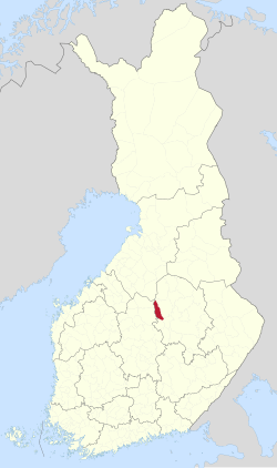 Location of Keitele in Finland | |
| Coordinates: 63°10.7′N 026°21′E | |
| Country | |
| Region | Northern Savonia |
| Sub-region | Upper Savonia |
| Charter | 1879 |
| Government | |
| • Municipal manager | Hanna Helaste |
| Area (2018-01-01)[1] | |
| • Total | 578.30 km2 (223.28 sq mi) |
| • Land | 481.80 km2 (186.02 sq mi) |
| • Water | 96.59 km2 (37.29 sq mi) |
| • Rank | 179th largest in Finland |
| Population (2021-12-31)[2] | |
| • Total | 2,099 |
| • Rank | 254th largest in Finland |
| • Density | 4.36/km2 (11.3/sq mi) |
| Population by native language | |
| • Finnish | 99.2% (official) |
| • Swedish | 0.1% |
| • Others | 0.7% |
| Population by age | |
| • 0 to 14 | 11% |
| • 15 to 64 | 50.6% |
| • 65 or older | 38.3% |
| Time zone | UTC+02:00 (EET) |
| • Summer (DST) | UTC+03:00 (EEST) |
| Postal code | 72600 |
| Area code(s) | 017 |
| Municipal tax rate[5] | 20.5% |
| Website | www.keitele.fi (in Finnish) |
It is part of the Northern Savonia region. The municipality has a population of 2,099 (31 December 2021)[2] and covers an area of 578.30 square kilometres (223.28 sq mi) of which 96.59 km2 (37.29 sq mi) is water.[1] The population density is 4.36 inhabitants per square kilometre (11.3/sq mi).
Neighbour municipalities are Pielavesi, Pihtipudas, Tervo, Vesanto and Viitasaari.
Despite its name, the municipality is not located by the lake Keitele. The shortest distance between the municipality and the lake is roughly ten kilometers.
The municipality is unilingually Finnish.
Notable people born in Keitele
- Ilmari Tossavainen (1887–1978)
- Kalle Matilainen (1903–1973)
- Rakel Hiltunen (1940–)
- Mikko Härkin (1979–)
References
- "Area of Finnish Municipalities 1.1.2018" (PDF). National Land Survey of Finland. Retrieved 30 January 2018.
- "Preliminary population structure by area, 2021M01*-2021M12*". StatFin (in Finnish). Statistics Finland. Retrieved 2 February 2022.
- "Population according to language and the number of foreigners and land area km2 by area as of 31 December 2008". Statistics Finland's PX-Web databases. Statistics Finland. Retrieved 29 March 2009.
- "Population according to age (1-year) and sex by area and the regional division of each statistical reference year, 2003–2020". StatFin. Statistics Finland. Retrieved 2 May 2021.
- "List of municipal and parish tax rates in 2021" (PDF). Tax Administration of Finland. 1 December 2020. Retrieved 10 April 2021.
External links
![]() Media related to Keitele at Wikimedia Commons
Media related to Keitele at Wikimedia Commons
- Municipality of Keitele – Official website
Places adjacent to Keitele | ||||||||||||||||
|---|---|---|---|---|---|---|---|---|---|---|---|---|---|---|---|---|
| ||||||||||||||||
Municipalities of North Savo | ||
|---|---|---|
| Municipalities |
|  |
| Former municipalities |
| |
| ||
Authority control | |
|---|---|
| General |
|
| National libraries | |
| Other |
|
This Eastern Finland location article is a stub. You can help Wikipedia by expanding it. |
На других языках
- [en] Keitele
[ru] Кейтеле
Кейтеле (фин. Keitele) — община в провинции Северное Саво, губерния Восточная Финляндия, Финляндия. Общая площадь территории — 578,39 км², из которых 96,59 км² — вода.Текст в блоке "Читать" взят с сайта "Википедия" и доступен по лицензии Creative Commons Attribution-ShareAlike; в отдельных случаях могут действовать дополнительные условия.
Другой контент может иметь иную лицензию. Перед использованием материалов сайта WikiSort.org внимательно изучите правила лицензирования конкретных элементов наполнения сайта.
Другой контент может иметь иную лицензию. Перед использованием материалов сайта WikiSort.org внимательно изучите правила лицензирования конкретных элементов наполнения сайта.
2019-2026
WikiSort.org - проект по пересортировке и дополнению контента Википедии
WikiSort.org - проект по пересортировке и дополнению контента Википедии