world.wikisort.org - Finland
Herttoniemen teollisuusalue (Finnish, Swedish: Hertonäs industriområde) is a southeastern neighborhood of Helsinki, Finland.
The official major districts of Helsinki and their subdivision in neighbourhoods (and quarters) | ||
|---|---|---|
| Southern Eteläinen Södra |
|  |
| Western Läntinen Västra |
| |
| Central Keskinen Mellersta |
| |
| Northern Pohjoinen Norra |
| |
| Northeastern Koillinen Nordöstra |
| |
| Southeastern Kaakkoinen Sydöstra | ||
| Eastern Itäinen Östra |
| |
| Östersundom Östersundomin Östersundoms |
| |
This article does not cite any sources. (October 2021) |
This article may be expanded with text translated from the corresponding article in Finnish. (December 2009) Click [show] for important translation instructions.
|
Herttoniemen teollisuusalue
Hertonäs industriområde | |
|---|---|
Helsinki Subdivision | |
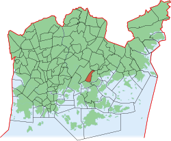 Position of Herttoniemen teollisuusalue within Helsinki | |
| Coordinates: 60.198242°N 25.040962°E | |
| Country | |
| Region | Uusimaa |
| Sub-region | Greater Helsinki |
| Municipality | Helsinki |
| District | Southeastern |
| Subdivision regions | is a quarter of the Herttoniemi neighbourhood |
| Area | 0.91 km2 (0.35 sq mi) |
| Population (2005) | 55 |
| • Density | 60/km2 (200/sq mi) |
| Postal codes | 00810, 00811 |
| Subdivision number | 434 |
| Neighbouring subdivisions | Herttoniemenranta Länsi-Herttoniemi Roihuvuori Roihupellon teollisuusalue |
This Southern Finland location article is a stub. You can help Wikipedia by expanding it. |
Текст в блоке "Читать" взят с сайта "Википедия" и доступен по лицензии Creative Commons Attribution-ShareAlike; в отдельных случаях могут действовать дополнительные условия.
Другой контент может иметь иную лицензию. Перед использованием материалов сайта WikiSort.org внимательно изучите правила лицензирования конкретных элементов наполнения сайта.
Другой контент может иметь иную лицензию. Перед использованием материалов сайта WikiSort.org внимательно изучите правила лицензирования конкретных элементов наполнения сайта.
2019-2025
WikiSort.org - проект по пересортировке и дополнению контента Википедии
WikiSort.org - проект по пересортировке и дополнению контента Википедии