world.wikisort.org - Estonia
Kunda is a town in the Viru-Nigula Parish of Estonia, located on the coast of the Gulf of Finland. Kunda is most famous for its cement factory, port and archaeological heritage.[2]
Kunda | |
|---|---|
Town | |
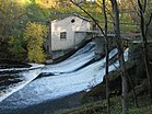
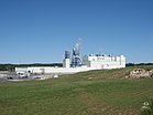
From left to right, clockwise: A cement factory, apartment buildings, the ruins of an old cement factory, a pulp mill, a hydroelectric power plant | |
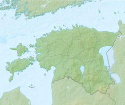
| Coordinates: 59°30′N 26°32′E | |
| Country | Estonia |
| County | Lääne-Viru County |
| Municipality | Viru-Nigula Parish |
| City status | May 1, 1938 |
| Area | |
| • Total | 9.85 km2 (3.80 sq mi) |
| Population (2021)[1] | |
| • Total | 2,865 |
| • Rank | 29th |
| • Density | 290/km2 (750/sq mi) |
| Time zone | UTC+2 (EET) |
| • Summer (DST) | UTC+3 (EEST) |
History
Evidence of some of the oldest prehistoric communities in Estonia, hunting and fishing communities that existed around 6500 BC, were found near Kunda. This settlement gave the name to the Kunda culture.
The first written record of Kunda dates back to 1241 - it was mentioned as a village. In 1443 it was mentioned as a manor.[3]
Kunda was granted official borough rights on May 1, 1938.
International relations
Twin towns — Sister cities
The former municipality of Kunda was twinned with:
 Gdynia, Poland[4]
Climate
| Climate data for Kunda, Estonia (normals 1991–2020, extremes 1849–present) | |||||||||||||
|---|---|---|---|---|---|---|---|---|---|---|---|---|---|
| Month | Jan | Feb | Mar | Apr | May | Jun | Jul | Aug | Sep | Oct | Nov | Dec | Year |
| Record high °C (°F) | 9.6 (49.3) |
11.1 (52.0) |
15.8 (60.4) |
27.6 (81.7) |
33.1 (91.6) |
30.9 (87.6) |
33.4 (92.1) |
34.4 (93.9) |
29.0 (84.2) |
21.2 (70.2) |
13.7 (56.7) |
11.8 (53.2) |
34.4 (93.9) |
| Average high °C (°F) | −1 (30) |
−1.2 (29.8) |
2.6 (36.7) |
8.8 (47.8) |
14.7 (58.5) |
18.9 (66.0) |
21.8 (71.2) |
20.9 (69.6) |
16.1 (61.0) |
9.5 (49.1) |
4.0 (39.2) |
0.9 (33.6) |
9.7 (49.5) |
| Daily mean °C (°F) | −3.3 (26.1) |
−4.0 (24.8) |
−0.8 (30.6) |
4.4 (39.9) |
9.8 (49.6) |
14.4 (57.9) |
17.5 (63.5) |
16.5 (61.7) |
12.2 (54.0) |
6.7 (44.1) |
1.9 (35.4) |
−1.1 (30.0) |
6.2 (43.2) |
| Average low °C (°F) | −5.7 (21.7) |
−6.7 (19.9) |
−4 (25) |
0.8 (33.4) |
5.3 (41.5) |
10.1 (50.2) |
13.2 (55.8) |
12.4 (54.3) |
8.6 (47.5) |
4.0 (39.2) |
−0.2 (31.6) |
−3.2 (26.2) |
2.9 (37.2) |
| Record low °C (°F) | −33.1 (−27.6) |
−34.9 (−30.8) |
−27.7 (−17.9) |
−19 (−2) |
−5.3 (22.5) |
−0.2 (31.6) |
2.9 (37.2) |
2.7 (36.9) |
−3.4 (25.9) |
−10.6 (12.9) |
−19.7 (−3.5) |
−34.9 (−30.8) |
−34.9 (−30.8) |
| Average precipitation mm (inches) | 38 (1.5) |
29 (1.1) |
27 (1.1) |
29 (1.1) |
41 (1.6) |
68 (2.7) |
61 (2.4) |
76 (3.0) |
54 (2.1) |
61 (2.4) |
52 (2.0) |
38 (1.5) |
573 (22.6) |
| Average precipitation days (≥ 1.0 mm) | 9 | 6 | 7 | 7 | 6 | 8 | 9 | 11 | 11 | 11 | 11 | 10 | 105 |
| Average relative humidity (%) | 87 | 85 | 80 | 75 | 72 | 76 | 78 | 80 | 81 | 83 | 86 | 86 | 81 |
| Source: Estonian Weather Service (precipitation days, 1971–2000)[5][6][7][8][9] | |||||||||||||
Notable people
- Argo Aadli (born 1980), theatre and film actor
- Armin Öpik (1898–1983), paleontologist
- Ernst Öpik (1893–1985), astronomer and astrophysicist
- Jüri Parijõgi (1892–1941), writer and scholar
- Knudåge Riisager (1897–1974), composer, son of expatriate Danish parents (his father running the cement factory), spent his first 3 years in Kunda.
References
- "Population by sex, age group and place of residence after the 2017 administrative reform, 1 January". Statistics Estonia. Retrieved 2021-12-26.
- Kirss, Odette (1980). Kunda (in Estonian). Tallinn: Eesti Raamat. p. 5.
- "Kunda". Eesti Entsüklopeedia. Retrieved 28 January 2022.
- "International co-operation of Gdynia". Gdynia.pl. Archived from the original on 2016-10-19.
- "Climate normals-Temperature". Estonian Weather Service. Retrieved 24 February 2021.
- "Climate normals-Precipitation". Estonian Weather Service. Retrieved 24 February 2021.
- "Climate normals-Humidity". Estonian Weather Service. Retrieved 24 February 2021.
- "Rekordid" (in Estonian). Estonian Weather Service. Retrieved 19 March 2021.
- "Kliimanormid-Sademed, õhuniiskus" (in Estonian). Estonian Weather Service. Archived from the original on 22 February 2012. Retrieved 24 February 2021.
External links
| Wikimedia Commons has media related to Kunda. |
На других языках
[de] Kunda (Viru-Nigula)
Kunda ist eine Stadt in der Landgemeinde Viru-Nigula an der Nordküste von Estland an dem gleichnamigen Fluss. Im Westen befindet sich ein Sandsteinplateau (Maageranna).- [en] Kunda, Estonia
[ru] Кунда
Ку́нда (эст. Kunda) — город в уезде Ляэне-Вирумаа. В результате административно-территориальной реформы в 2017 году стал административным центром волости Виру-Нигула.Текст в блоке "Читать" взят с сайта "Википедия" и доступен по лицензии Creative Commons Attribution-ShareAlike; в отдельных случаях могут действовать дополнительные условия.
Другой контент может иметь иную лицензию. Перед использованием материалов сайта WikiSort.org внимательно изучите правила лицензирования конкретных элементов наполнения сайта.
Другой контент может иметь иную лицензию. Перед использованием материалов сайта WikiSort.org внимательно изучите правила лицензирования конкретных элементов наполнения сайта.
2019-2025
WikiSort.org - проект по пересортировке и дополнению контента Википедии
WikiSort.org - проект по пересортировке и дополнению контента Википедии


