world.wikisort.org - Denmark
Sørvágur Municipality (Faroese: Sørvágs kommuna), is the westernmost municipality in the Faroe Islands.
Sørvágur Municipality
Sørvágs kommuna | |
|---|---|
Municipality | |
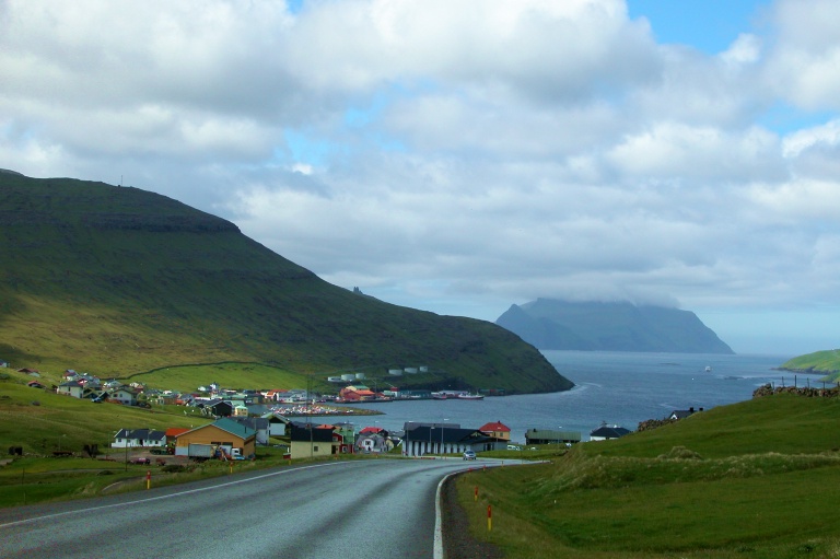 Sørvágur, view on Mykines | |
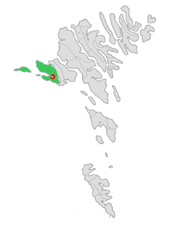 Location of Sørvágur within Sørvágur municipality in the Faroe Islands | |
| Coordinates: 62°06′N 7°24′W | |
| State | |
| Constituent country | |
| Island | Vágar |
| Municipality | Sørvágur |
| Area | |
| • Total | 32.46 sq mi (84.08 km2) |
| Population (August 2022)[1] | |
| • Total | 1,249 |
| • Density | 38/sq mi (15/km2) |
| Time zone | GMT |
| • Summer (DST) | UTC+1 (WEST) |
| Postal code | FO 380 |
| Website | http://www.sorvag.fo/ |
It consists of the villages of Sørvágur, Bøur, Gásadalur and Mykines. Originally the municipality only included the village of Sørvágur, but in January 2005 the municipality of Sørvágur agreed to merge with the smaller municipalities of Bøur/Gásadal and Mykines.
The new municipality had a population of 1,236 in 2020.[2]
Logo
The logo of the municipality is two white birds on a white/blue background with an orange sundisk. The two birds are made in the image of the letters S and K which are the initials for Sørvágs Kommuna.
Gallery
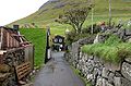 Village idyll in Bøur
 Bøur as seen from above, October 2005


References
- Population, municipalities and villages Statistics Faroe Islands
- "Fólkatal". Archived from the original on 21 September 2013.
External links
Municipalities of the Faroe Islands | ||
|---|---|---|
 | ||
This Faroe Islands location article is a stub. You can help Wikipedia by expanding it. |
Текст в блоке "Читать" взят с сайта "Википедия" и доступен по лицензии Creative Commons Attribution-ShareAlike; в отдельных случаях могут действовать дополнительные условия.
Другой контент может иметь иную лицензию. Перед использованием материалов сайта WikiSort.org внимательно изучите правила лицензирования конкретных элементов наполнения сайта.
Другой контент может иметь иную лицензию. Перед использованием материалов сайта WikiSort.org внимательно изучите правила лицензирования конкретных элементов наполнения сайта.
2019-2026
WikiSort.org - проект по пересортировке и дополнению контента Википедии
WikiSort.org - проект по пересортировке и дополнению контента Википедии