world.wikisort.org - Denmark
Lundtofte is a neighbourhood in Lyngby-Taarbæk Municipality, located north of Kongens Lyngby. The town is bordered by Nærumbanen, the Mølleåen river, the Technical University of Denmark and the Helsingørmotorvejen. DTU is situated on the location of the former Lundtofte Flyveplads.
Lundtofte | |
|---|---|
Neighbourhood | |
 Lundtofte Church | |
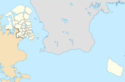 Lundtofte Location in the Capital Region of Denmark | |
| Coordinates: 55°47′55″N 12°31′27″E | |
| Country | Denmark |
| Region | Capital Region |
| Municipality | Lyngby-Taarbæk |
| Time zone | UTC+1 (CET) |
| • Summer (DST) | UTC+2 (CEST) |
Major company Haldor Topsøe is located in Lundtofte. Catalysts by Haldor Topsøe are used in production of around 50% of the world's fertilizer.[1][2]
Lundtofte Church originates from 1921.[3]
References
- "Om DADES". Dades.dk. Retrieved 6 June 2021.
- "History". Topsoe.com. Retrieved 6 June 2021.
- "Lundtofte Kirke". Danske-kirker.dk. Retrieved 4 August 2021.
Wikimedia Commons has media related to Lundtofte.
Lyngby-Taarbæk Municipality | ||
|---|---|---|
| Populated places |  | |
| Landmarks |
| |
| Museums |
| |
| Churches |
| |
| Manors and castles |
| |
| Education |
| |
| Transport |
| |
| Geographical features |
| |
| Sports | ||
| Media |
| |
| Culture |
| |
| Lists |
| |
This article about a location in the Capital Region of Denmark is a stub. You can help Wikipedia by expanding it. |
Текст в блоке "Читать" взят с сайта "Википедия" и доступен по лицензии Creative Commons Attribution-ShareAlike; в отдельных случаях могут действовать дополнительные условия.
Другой контент может иметь иную лицензию. Перед использованием материалов сайта WikiSort.org внимательно изучите правила лицензирования конкретных элементов наполнения сайта.
Другой контент может иметь иную лицензию. Перед использованием материалов сайта WikiSort.org внимательно изучите правила лицензирования конкретных элементов наполнения сайта.
2019-2026
WikiSort.org - проект по пересортировке и дополнению контента Википедии
WikiSort.org - проект по пересортировке и дополнению контента Википедии