world.wikisort.org - Denmark
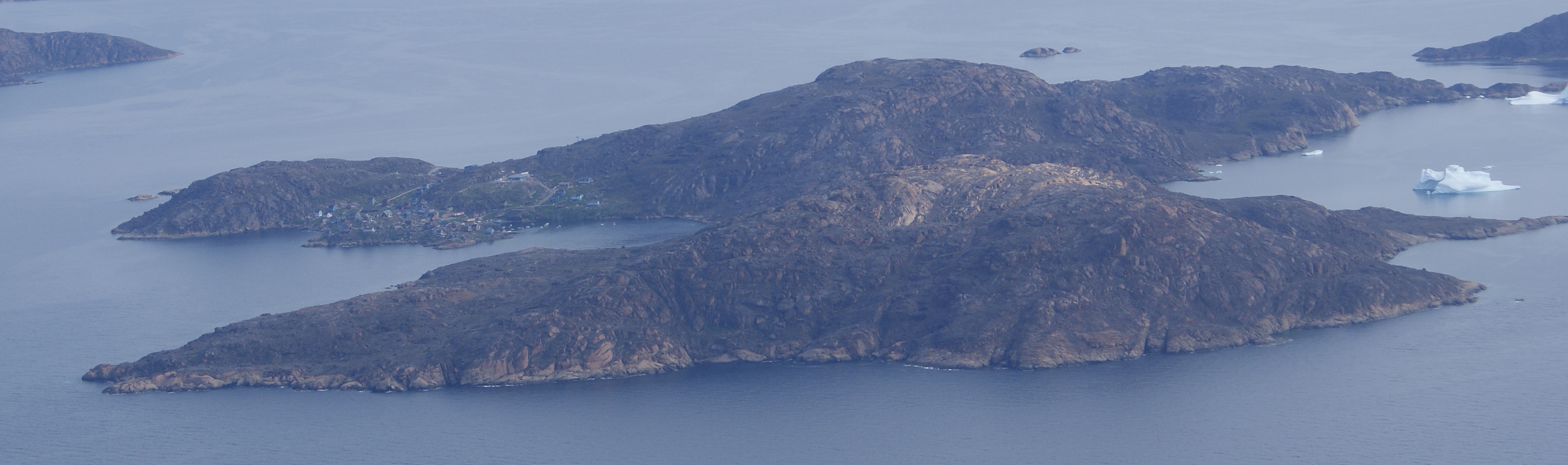
Kangersuatsiaq (old spelling: Kangerssuatsiaq), formerly Prøven, is an island settlement in the Avannaata municipality in northwestern Greenland. It had 130 inhabitants in 2020.[1]
Kangersuatsiaq
Prøven | |
|---|---|
 Kangersuatsiaq | |
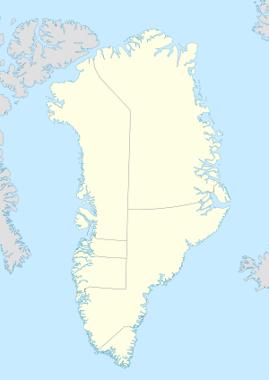 Kangersuatsiaq Location within Greenland | |
| Coordinates: 72°22′47″N 55°33′00″W | |
| State | |
| Constituent country | |
| Municipality | Avannaata |
| Population (2020) | |
| • Total | 130 |
| Time zone | UTC-03 |
Upernavik Archipelago

Kangersuatsiaq is located within Upernavik Archipelago, a vast archipelago of small islands on the coast of northeastern Baffin Bay. The archipelago extends from the northwestern coast of Sigguup Nunaa peninsula in the south at approximately 71°50′N 56°00′W[2] to the southern end of Melville Bay (Greenlandic: Qimusseriarsuaq) in the north at approximately 74°50′N 57°30′W.[3]
Transport
Air Greenland serves the village as part of government contract, with flights between Kangersuatsiaq Heliport and Upernavik Airport.[4]
Population
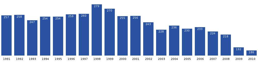
The population of Kangersuatsiaq has decreased by over a quarter relative to the 2000 levels, and is still decreasing.[5]
References
- "Population by Localities". Statistical Greenland.
- Nunavik, Saga Map, 1:250.000, Tage Schjøtt, 1992
- Upernavik Avannarleq, Saga Map, 1:250.000, Tage Schjøtt, 1992
- Air Greenland, Departures and Arrivals Archived 2010-03-09 at the Wayback Machine
- Statistics Greenland Archived 2011-08-12 at the Wayback Machine
Cities, towns, and villages in Greenland | ||
|---|---|---|
| Avannaata |
|  |
| Kujalleq |
| |
| Qeqertalik |
| |
| Qeqqata |
| |
| Sermersooq |
| |
| Authority control |
|
|---|
Другой контент может иметь иную лицензию. Перед использованием материалов сайта WikiSort.org внимательно изучите правила лицензирования конкретных элементов наполнения сайта.
WikiSort.org - проект по пересортировке и дополнению контента Википедии