world.wikisort.org - Czech
Žulová (until 1948 Frýdberk; German: Friedeberg) is a town in Jeseník District in the Olomouc Region of the Czech Republic. It has about 1,200 inhabitants.
Žulová | |
|---|---|
Town | |
 View of Žulová from Boží hora | |
 Flag 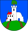 Coat of arms | |
 Žulová Location in the Czech Republic | |
| Coordinates: 50°18′34″N 17°5′56″E | |
| Country | |
| Region | Olomouc |
| District | Jeseník |
| First mentioned | 1266 |
| Area | |
| • Total | 14.76 km2 (5.70 sq mi) |
| Elevation | 357 m (1,171 ft) |
| Population (2022-01-01)[1] | |
| • Total | 1,155 |
| • Density | 78/km2 (200/sq mi) |
| Time zone | UTC+1 (CET) |
| • Summer (DST) | UTC+2 (CEST) |
| Postal code | 790 65 |
| Website | www |
Administrative parts

The village of Tomíkovice is an administrative part of Žulová.
Geography
Žulová lies approximately 12 kilometres (7 mi) north-west of Jeseník, 81 km (50 mi) north of Olomouc, and 193 km (120 mi) east of Prague. The Vidnavka stream flows through the town.
Velký Pond, located in the eastern part of the municipal territory, is a fish pond with an area of 11 ha (27 acres). It is the largest pond in the area.[2]
History
The first written mention of Frýdberk is from the 13th century, when the Frýdberk Castle was built. The settlement was first referred to as a town in 1358. It was part of the Duchy of Nysa under Bohemian suzerainty. In the 15th century, silver was mined here and two glassworks were in operation. The castle was renaissance reconstructed in 1594.[3]
The development of the town ended with the Thirty Years' War. In 1639, the castle was conquered and demolished by the Swedish and Polish troops. The town was looted in 1642 and destroyed by a fire in 1657. In the second half of the 17th century, Frýdberk recovered and began to expand. In 1793, the town privileges were restored.[3]
Following the duchy's dissolution in 1850, it was incorporated directly into Bohemia. In the 19th century, the town of became a centre of stone mining and processing, especially granite.[3]
From 1938 to 1945 it was occupied by Germany within which it was one of the municipalities in Sudetenland. During World War II, the Germans operated the E167 forced labour subcamp of the Stalag VIII-B/344 prisoner-of-war camp at a quarry in Žulová, and the E120 subcamp of Stalag VIII-B/344 at a quarry in Tomíkovice.[4]
Transport
Žulová lies on a railway line of local importance from Javorník to Lipová-lázně.
Gallery
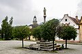 Mariánské Square
 Church of Saint Joseph
 Church of Our Lady of Sorrows


References
- "Population of Municipalities – 1 January 2022". Czech Statistical Office. 2022-04-29.
- "Velký rybník u Žulové na Jesenicku" (in Czech). CzechTourism. Retrieved 2022-05-07.
- "Územní plán Žulová: Odůvodnění územního plánu" (in Czech). Město Žulová. May 2017. p. 64 (68). Retrieved 2022-01-26.
- "Working Parties". Lamsdorf.com. Archived from the original on 29 October 2020. Retrieved 13 November 2021.
External links
Authority control | |
|---|---|
| General |
|
| National libraries | |
Другой контент может иметь иную лицензию. Перед использованием материалов сайта WikiSort.org внимательно изучите правила лицензирования конкретных элементов наполнения сайта.
WikiSort.org - проект по пересортировке и дополнению контента Википедии