world.wikisort.org - Czech
Trhová Kamenice is a market town in Chrudim District in the Pardubice Region of the Czech Republic. It has about 1,000 inhabitants.
Trhová Kamenice | |
|---|---|
Market town | |
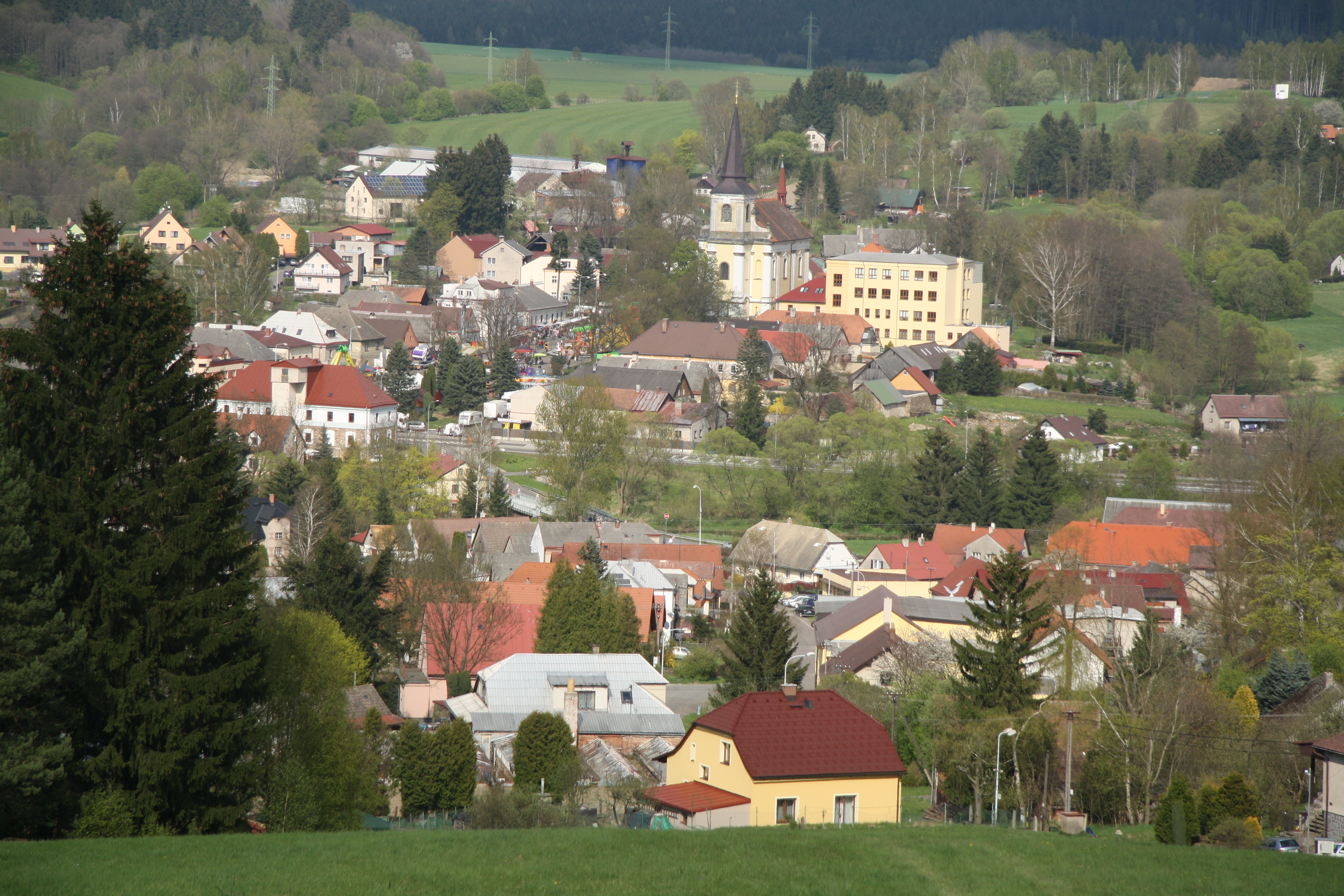 General view | |
 Flag  Coat of arms | |
 Trhová Kamenice Location in the Czech Republic | |
| Coordinates: 49°47′19″N 15°49′1″E | |
| Country | |
| Region | Pardubice |
| District | Chrudim |
| First mentioned | 1439 |
| Government | |
| • Mayor | Iva Dostálová |
| Area | |
| • Total | 20.40 km2 (7.88 sq mi) |
| Elevation | 535 m (1,755 ft) |
| Population (2022-01-01)[1] | |
| • Total | 956 |
| • Density | 47/km2 (120/sq mi) |
| Time zone | UTC+1 (CET) |
| • Summer (DST) | UTC+2 (CEST) |
| Postal codes | 538 25, 539 01, 539 52 |
| Website | www |
Administrative parts
Villages and hamlets of Hluboká, Kameničky, Petrkov 3.díl, Polom, Rohozná and Zubří are administrative parts of Trhová Kamenice.
Geography

Trhová Kamenice is located about 18 kilometres (11 mi) south of Chrudim and 27 km (17 mi) south of Pardubice. It lies in the Iron Mountains and in the eponymous protected landscape area. The highest point is the hill Zuberský vrch at 651 metres (2,136 ft) above sea level.
Trhová Kamenice is situated on the Chrudimka River. The territory is rich in ponds. The largest pond in Trhová Kamenice and in the entire Iron Mountains is Rohozenský velký, which forms half of the 46-hectare (110-acre) large Strádovka Nature Reserve.[2]
History
The first written mention of this area is in a donation deed from 1242. A settlement was founded here probably by the monastery in Vilémov. At the end of the 14th century, the ironworks were founded and the production of charcoal started. In the 15th century, the economical development occurred and in 1499, Trhová Kamenice became a market town[3]
On 8 May 1945, when Trhová Kamenice was under Nazi occupation, several Nazi troops were passing through the market town from Chrudim back to Nazi Germany and massacred 14 people while finding resistance partisans.
Notable people
- František Šmahel (born 1934), historian
Twin towns – sister cities
Trhová Kamenice is twinned with:[4]
 Oberembrach, Switzerland
References
- "Population of Municipalities – 1 January 2022". Czech Statistical Office. 2022-04-29.
- "Přírodní rezervace Strádovka" (in Czech). AOPK ČR. Retrieved 2022-07-12.
- "Historie" (in Czech). Městys Trhová Kamenice. Retrieved 2021-10-20.
- "Partnerská obec" (in Czech). Městys Trhová Kamenice. Retrieved 2020-08-25.
External links
| Authority control: National libraries |
|---|
Другой контент может иметь иную лицензию. Перед использованием материалов сайта WikiSort.org внимательно изучите правила лицензирования конкретных элементов наполнения сайта.
WikiSort.org - проект по пересортировке и дополнению контента Википедии