world.wikisort.org - Czech
Rožďalovice is a town in Nymburk District in the Central Bohemian Region of the Czech Republic. It has about 1,600 inhabitants.
Rožďalovice | |
|---|---|
Town | |
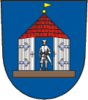
 Rožďalovice Castle | |
 Coat of arms | |
 Rožďalovice Location in the Czech Republic | |
| Coordinates: 50°18′17″N 15°10′11″E | |
| Country | |
| Region | Central Bohemian |
| District | Nymburk |
| First mentioned | 1223 |
| Area | |
| • Total | 23.91 km2 (9.23 sq mi) |
| Elevation | 198 m (650 ft) |
| Population (2022-01-01)[1] | |
| • Total | 1,619 |
| • Density | 68/km2 (180/sq mi) |
| Time zone | UTC+1 (CET) |
| • Summer (DST) | UTC+2 (CEST) |
| Postal code | 289 34 |
| Website | www |
Administrative parts
Villages of Hasina, Ledečky, Podlužany, Podolí, Viničná Lhota and Zámostí are administrative parts of Rožďalovice.
Geography
Rožďalovice is located about 16 kilometres (10 mi) northeast of Nymburk and 49 km (30 mi) northeast of Prague. It lies in the Central Elbe Table. The highest point is a place called Kostelíček with an altitude of 241 metres (791 ft). The Štítarský Stream flows through the municipal territory.
History
The first written mention of Rožďalovice is from 1223. Around 1340, the village was promoted to a town by John of Bohemia. The most important owners of Rožďalovice, during whose rule the town flourished, were the Křinecký of Ronov family (end of the 15th century – 1622), the Waldstein family (1622–1760) and the Lobkowicz family (1815–1930)[2]
Transport
The main railroad Nymburk–Jičín crosses here.
Notable people
- Jiří Melantrich of Aventino (c. 1511–1580), printer and publisher
- Oskar Hekš (1908–1944), long-distance runner
Gallery
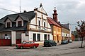 Old town hall
 Husova street


References
- "Population of Municipalities – 1 January 2022". Czech Statistical Office. 2022-04-29.
- "Z historie města" (in Czech). Město Rožďalovice. Retrieved 2022-08-25.
External links
Authority control | |
|---|---|
| General |
|
| National libraries | |
На других языках
[de] Rožďalovice
Rožďalovice (deutsch Rozdalowitz) ist eine Stadt mit 1.556 Einwohnern in der Region Středočeský kraj (Tschechien).- [en] Rožďalovice
Другой контент может иметь иную лицензию. Перед использованием материалов сайта WikiSort.org внимательно изучите правила лицензирования конкретных элементов наполнения сайта.
WikiSort.org - проект по пересортировке и дополнению контента Википедии