world.wikisort.org - Czech
Přibyslav (German: Primislau) is a town in Havlíčkův Brod District in the Vysočina Region of the Czech Republic. It has about 4,000 people. The historic town centre is well preserved and is protected by law as an urban monument zone.
Přibyslav | |
|---|---|
Town | |
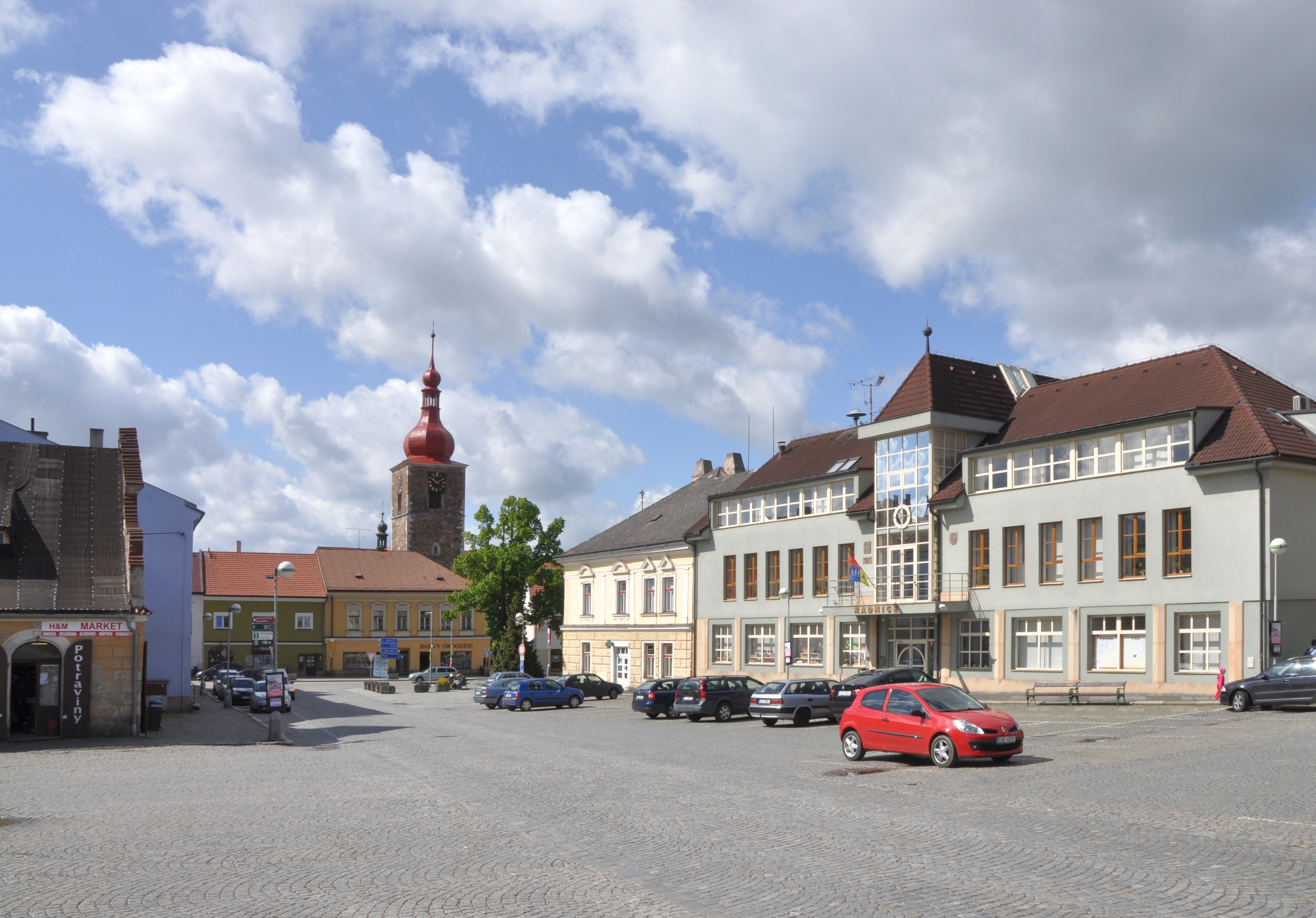 Town square | |
 Flag  Coat of arms | |
 Přibyslav Location in the Czech Republic | |
| Coordinates: 49°34′37″N 15°44′19″E | |
| Country | |
| Region | Vysočina |
| District | Havlíčkův Brod |
| First mentioned | 1257 |
| Government | |
| • Mayor | Martin Kamarád (ODS) |
| Area | |
| • Total | 35.32 km2 (13.64 sq mi) |
| Elevation | 475 m (1,558 ft) |
| Population (2022-01-01)[1] | |
| • Total | 3,957 |
| • Density | 110/km2 (290/sq mi) |
| Time zone | UTC+1 (CET) |
| • Summer (DST) | UTC+2 (CEST) |
| Postal code | 582 22 |
| Website | www |
Administrative parts
Villages Česká Jablonná, Dobrá, Dolní Jablonná, Hřiště, Poříčí, Ronov nad Sázavou and Utín are administrative parts of Přibyslav.
Geography
Přibyslav is located about 11 kilometres (7 mi) east of Havlíčkův Brod and 21 km (13 mi) northeast of Jihlava. It lies in the Upper Sázava Hills. The town is situated on the right bank of the Sázava River. There are several fish ponds in the municipal territory.
History
The first written mention of Přibyslav is from 1257. Until the Hussite Wars, it was a small mining town known for silver mining. After the wars, the mining was never successfully renewed. During the Hussite Wars, Přibyslav was a military base of the Hussites. The town was often severely affected by wars and by frequent fires, which destroyed many historically valuable buildings. The most devastating fire occurred in 1767.[2]
Climate
| Climate data for Přibyslav (1991−2020 normals, extremes 1980−present) | |||||||||||||
|---|---|---|---|---|---|---|---|---|---|---|---|---|---|
| Month | Jan | Feb | Mar | Apr | May | Jun | Jul | Aug | Sep | Oct | Nov | Dec | Year |
| Record high °C (°F) | 15.4 (59.7) |
17.6 (63.7) |
23.0 (73.4) |
25.8 (78.4) |
30.5 (86.9) |
33.0 (91.4) |
36.0 (96.8) |
35.8 (96.4) |
31.9 (89.4) |
24.7 (76.5) |
16.1 (61.0) |
13.2 (55.8) |
36.0 (96.8) |
| Average high °C (°F) | 0.3 (32.5) |
2.3 (36.1) |
6.9 (44.4) |
13.1 (55.6) |
17.6 (63.7) |
21.1 (70.0) |
23.5 (74.3) |
23.6 (74.5) |
17.8 (64.0) |
11.7 (53.1) |
5.4 (41.7) |
0.9 (33.6) |
12.0 (53.6) |
| Daily mean °C (°F) | −2.0 (28.4) |
−0.9 (30.4) |
3.0 (37.4) |
7.9 (46.2) |
12.3 (54.1) |
15.7 (60.3) |
17.7 (63.9) |
17.7 (63.9) |
13.1 (55.6) |
8.2 (46.8) |
3.2 (37.8) |
−1.1 (30.0) |
7.9 (46.2) |
| Average low °C (°F) | −4.1 (24.6) |
−3.8 (25.2) |
−0.8 (30.6) |
2.8 (37.0) |
7.1 (44.8) |
10.3 (50.5) |
11.9 (53.4) |
11.8 (53.2) |
8.4 (47.1) |
4.8 (40.6) |
1.2 (34.2) |
−2.8 (27.0) |
3.9 (39.0) |
| Record low °C (°F) | −28.2 (−18.8) |
−27.0 (−16.6) |
−19.6 (−3.3) |
−9.6 (14.7) |
−10.1 (13.8) |
−1.5 (29.3) |
2.4 (36.3) |
0.0 (32.0) |
−2.7 (27.1) |
−8.6 (16.5) |
−16.2 (2.8) |
−25.3 (−13.5) |
−28.2 (−18.8) |
| Average precipitation mm (inches) | 42.3 (1.67) |
35.7 (1.41) |
42.2 (1.66) |
35.0 (1.38) |
76.3 (3.00) |
73.2 (2.88) |
92.0 (3.62) |
79.3 (3.12) |
75.0 (2.95) |
45.0 (1.77) |
45.2 (1.78) |
41.8 (1.65) |
682.8 (26.88) |
| Average precipitation days (≥ 1 mm) | 9.7 | 8.5 | 10.0 | 7.4 | 10.6 | 10.5 | 11.4 | 9.6 | 8.5 | 9.0 | 9.4 | 10.5 | 115.1 |
| Source: infoclimat.fr[3][better source needed] | |||||||||||||
Sights

The oldest building in the town is a Gothic tower from 1497. The adjacent baroque Church of the Nativity of Saint John the Baptist is from 1753.[4]
Přibyslav Castle was built in 1560 by Zachariáš of Hradec. There are two courtyards in the castle. The older one is valuable by columns in the Tuscan style. Today the castle houses the Fireman Museum.[4]
An equestrian statue of Jan Žižka by Bohumil Kafka from 1935 is located in the town park. It is a smaller model of the larger statue, which is part of the National Monument at Vítkov in Prague.[4]
Notable people
- Jan Otto (1841–1916), publisher and bookseller
- Jan Filip (1911–1971), priest, writer and Esperantist
- Jan Bechyně (1920–1973), entomologist
- Hana Orgoníková (1946–2014), politician
Twin towns – sister cities
Přibyslav is twinned with:[5]
 Mook en Middelaar, Netherlands
 Sliač, Slovakia
References
- "Population of Municipalities – 1 January 2022". Czech Statistical Office. 29 April 2022.
- "Historie města" (in Czech). Město Přibyslav. Retrieved 29 October 2021.
- "Normales et records pour la période 1991-2020 à Pribyslav". infoclimat.fr. Retrieved 15 March 2022.
- "Historické památky" (in Czech). Město Přibyslav. Retrieved 29 October 2021.
- "Partnerská města" (in Czech). Přibyslav. Retrieved 24 September 2020.
External links
Authority control | |
|---|---|
| General | |
| National libraries | |
Другой контент может иметь иную лицензию. Перед использованием материалов сайта WikiSort.org внимательно изучите правила лицензирования конкретных элементов наполнения сайта.
WikiSort.org - проект по пересортировке и дополнению контента Википедии