world.wikisort.org - Czech
Loučná nad Desnou (until 1948 Vízmberk; German: Wiesenberg) is a municipality and village in Šumperk District in the Olomouc Region of the Czech Republic. It has about 1,500 inhabitants.
Loučná nad Desnou | |
|---|---|
Municipality | |
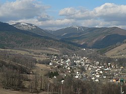
 Upper part of Loučná nad Desnou | |
 Loučná nad Desnou Location in the Czech Republic | |
| Coordinates: 50°4′18″N 17°5′28″E | |
| Country | |
| Region | Olomouc |
| District | Šumperk |
| First mentioned | 1494 |
| Area | |
| • Total | 94.34 km2 (36.42 sq mi) |
| Elevation | 450 m (1,480 ft) |
| Population (2022-01-01)[1] | |
| • Total | 1,472 |
| • Density | 16/km2 (40/sq mi) |
| Time zone | UTC+1 (CET) |
| • Summer (DST) | UTC+2 (CEST) |
| Postal code | 788 11 |
| Website | www |
Administrative parts
Villages of Filipová, Kociánov, Kouty nad Desnou, Přemyslov and Rejhotice are administrative parts of Loučná nad Desnou.
Geography
Loučná nad Desnou is located about 14 km (9 mi) northeast of Šumperk and 54 km (34 mi) north of Olomouc. It lies in the Hrubý Jeseník mountain range in the Desná river valley. The highest point of Loučná nad Desnou is the highest mountain of the entire Moravia, which is Praděd at 1,491 m (4,892 ft) above sea level.
Notable people
- Alfred Brendel (born 1931), Austrian pianist
References
- "Population of Municipalities – 1 January 2022". Czech Statistical Office. 2022-04-29.
Wikimedia Commons has media related to Loučná nad Desnou.
На других языках
[de] Loučná nad Desnou
Loučná nad Desnou, bis 1948 Vízmberk (deutsch Wiesenberg) ist eine Gemeinde in Tschechien. Sie liegt 15 Kilometer nördlich von Šumperk und gehört zum Okres Šumperk. Die Gemeinde ist Mitglied im Gemeindeverband Svazek obcí údolí Desné.- [en] Loučná nad Desnou
Текст в блоке "Читать" взят с сайта "Википедия" и доступен по лицензии Creative Commons Attribution-ShareAlike; в отдельных случаях могут действовать дополнительные условия.
Другой контент может иметь иную лицензию. Перед использованием материалов сайта WikiSort.org внимательно изучите правила лицензирования конкретных элементов наполнения сайта.
Другой контент может иметь иную лицензию. Перед использованием материалов сайта WikiSort.org внимательно изучите правила лицензирования конкретных элементов наполнения сайта.
2019-2025
WikiSort.org - проект по пересортировке и дополнению контента Википедии
WikiSort.org - проект по пересортировке и дополнению контента Википедии

